Mountains & hills · West Midlands
Haresfield Beacon
Haresfield Beacon — Named summit at 217 m.
Wikimedia Commons contributors — see linked file page for photographer and licence licence
Plan your visit
- Typical visit
- 3 h–8 h
- Best time of year
- Late spring – early autumn (May–Oct)
- Nearest railway station
- Stonehouse · 3.8 km
- Free entry
- Dog-friendly
About
Haresfield Beacon is a named summit in the United Kingdom. Wikidata describes it as: "Named summit at 217 m.". Coordinates: 51.7783°, -2.2618°.
Photo gallery
Protected designations
- Site of Special Scientific Interest: Haresfield Beacon SSSI
- Area of Outstanding Natural Beauty: Cotswolds
Designations sourced from Natural England open data under OGL v3.
From the Wikipedia article
Haresfield Beacon (grid reference SO819088) is a 0.73-hectare (1.8-acre) geological Site of Special Scientific Interest in Gloucestershire, notified in 1985. The site is listed in the ‘Stroud District’ Local Plan, adopted November 2005, Appendix 6 (online for download) as an SSSI and a Regionally Important Geological Site (RIGS).
Excerpt from Wikipedia under CC BY-SA 4.0. See the source article linked in Sources below.
- Coordinates
- 51.7783, -2.2618
- County
- Gloucestershire
- District
- Stroud
- Parish
- Haresfield
- Postcode
- GL10 3ES
- Parliamentary constituency
- North Cotswolds
- Nearest railway station
- Stonehouse — 3.8 km
Sources
- osm: n326346334 (ODbL)
- wikipedia: Haresfield Beacon (CC BY-SA 4.0)
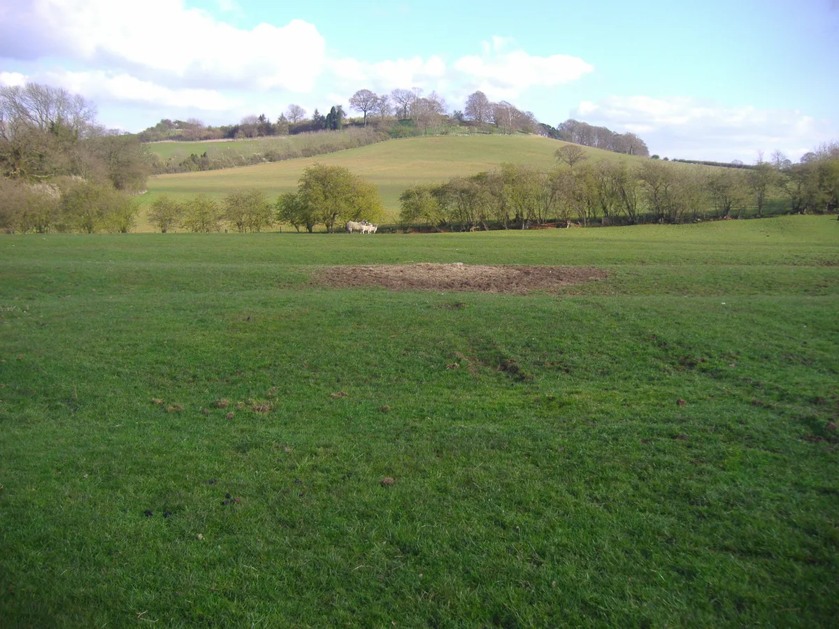
- commons: View from Haresfield Beacon - geograph.org.uk - 1120282.jpg (CC BY-SA 4.0)
Other places nearby
Loading nearby places…
Nearby
Vineyards · West Midlands
Haresfield Hill camp and Ring Hill earthworks
Haresfield Hill camp and Ring Hill earthworks — a UK vineyard in england west midlands, producing English or Welsh wine from cool-climate grape varieties.
Vineyards · West Midlands
The Bulwarks, Haresfield
The Bulwarks, Haresfield — a UK vineyard in england west midlands, producing English or Welsh wine from cool-climate grape varieties.
 📷 3
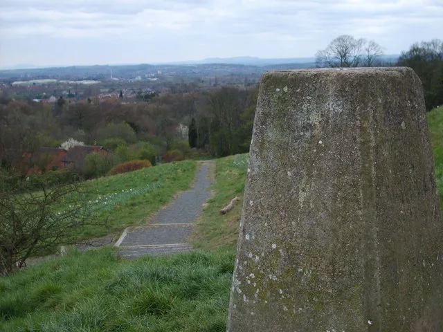
📷 3Viewpoints · West Midlands
Haresfield Topograph
Haresfield Topograph is a viewpoint in the United Kingdom.
 📷 3
📷 3Memorials & monuments · West Midlands
Cromwell's Stone
Cromwell's Stone is a memorial in the United Kingdom.
 📷 3
📷 3Manor houses · West Midlands
Standish Park
Standish Park — a manor in england-west-midlands, United Kingdom.
 📷 3
📷 3Memorials & monuments · West Midlands
Two Warner Or Warnar Monuments, About 3M South Of Priest's Door In Churchyard Of Church Of St Peter
Two Warner Or Warnar Monuments, About 3M South Of Priest's Door In Churchyard Of Church Of St Peter — Grade II listed building-listed memorial in england-west-midlands, United Kingdom.
More mountains in this region
 📷 5
📷 5Mountains & hills · West Midlands
Arbury Hill
Arbury Hill — Named summit at 224.3 m.
Mountains & hills · West Midlands
Barr Beacon
Barr Beacon — Named summit at 227 m.
 📷 3
📷 3Mountains & hills · West Midlands
Barrow Hill
Barrow Hill — Named summit at 179 m.
Mountains & hills · West Midlands
Beacon Hill
Beacon Hill — Named summit at 237 m.
Frequently asked questions
- Where is Haresfield Beacon?
- Haresfield Beacon is in Gloucestershire, the West Midlands, United Kingdom (postcode GL10 3ES), in the parish of Haresfield.
- Is Haresfield Beacon a protected site?
- Yes — Haresfield Beacon is part of the Haresfield Beacon SSSI Site of Special Scientific Interest and the Cotswolds National Landscape (AONB).
- Is Haresfield Beacon free to visit?
- Yes, Haresfield Beacon is free to enter.
- How do I get to Haresfield Beacon?
- The nearest railway station is Stonehouse, about 3.8 km away. Drivers can navigate to postcode GL10 3ES.