Mountains & hills · North West England
Hail Storm Hill
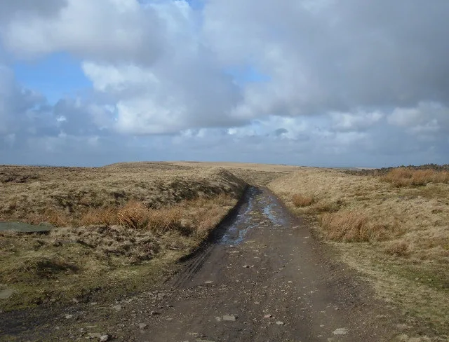
Hail Storm Hill — Named summit at 477 m.

Wikimedia Commons contributors — see linked file page for photographer and licence licence
Plan your visit
- Typical visit
- 3 h–8 h
- Best time of year
- Late spring – early autumn (May–Oct)
- Nearest railway station
- Rawtenstall · 4.1 km
- Free entry
- Dog-friendly
About
Hail Storm Hill is a named summit in the United Kingdom. Wikidata describes it as: "Named summit at 477 m.". Coordinates: 53.6704°, -2.2513°.
Photo gallery
From the Wikipedia article
Hail Storm Hill, also known as Cowpe Moss, is the highest point of the Rossendale Valley, England, an area of moorland and hill country situated between the West Pennine Moors and the South Pennines. It is wholly within Lancashire, although the administrative county boundary with the Metropolitan Borough of Rochdale passes just a kilometre to the south-east of the summit. Scout Moor Wind Farm now spans Hail Storm Hill. The Forest of Rossendale also contains the Marilyn of Freeholds Top and the summit of Great Hameldon.
Excerpt from Wikipedia under CC BY-SA 4.0. See the source article linked in Sources below.
- Coordinates
- 53.6704, -2.2513
- County
- Lancashire
- District
- Rossendale
- Parish
- Rossendale, unparished area
- Postcode
- BB4 7AE
- Parliamentary constituency
- Rossendale and Darwen
- Nearest railway station
- Rawtenstall — 4.1 km
Sources
- osm: n30844599 (ODbL)
- wikipedia: Hail Storm Hill (CC BY-SA 4.0)
- commons: Cowpe Moss.jpg (CC BY-SA 4.0)
Other places nearby
Loading nearby places…
Nearby
 📷 5
📷 5Natural landmarks · North West England
Hail Storm Hill
Hail Storm Hill — mountain in United Kingdom.
 📷 3
📷 3Memorials & monuments · North West England
Waugh's Well
Waugh's Well — a memorial in england-north-west, United Kingdom.
 📷 3
📷 3Mountains & hills · North West England
Higher Hill
Higher Hill — a mountain in england-north-west, United Kingdom.
 📷 3
📷 3Mountains & hills · North West England
Whittle Pike
Whittle Pike — a mountain in england-north-west, United Kingdom.
 📷 5
📷 5Museums · North West England
Borough of Rossendale
Rossendale () is a local government district with borough status in Lancashire, England. Its council is based in Bacup and its largest town is Rawtenstall. It also includes the towns of Haslingden and
 📷 3
📷 3Mountains & hills · North West England
Cowpe Lowe
Cowpe Lowe — a mountain in england-north-west, United Kingdom, 440 m.
More mountains in this region
 📷 3
📷 3Mountains & hills · North West England
Allen Crags
Allen Crags — Named summit at 785 m.
 📷 3
📷 3Mountains & hills · North West England
Alum Pot
Alum Pot — Open shaft pothole in North Yorkshire.
 📷 3
📷 3Mountains & hills · North West England
Arnside Knott
Arnside Knott — Named summit at 159 m.
 📷 3
📷 3Mountains & hills · North West England
Aye Gill Pike
Aye Gill Pike — Named summit at 556.3 m.
Frequently asked questions
- Where is Hail Storm Hill?
- Hail Storm Hill is in Lancashire, North-West England, United Kingdom (postcode BB4 7AE), in the parish of Rossendale, unparished area.
- Is Hail Storm Hill free to visit?
- Yes, Hail Storm Hill is free to enter.
- How do I get to Hail Storm Hill?
- The nearest railway station is Rawtenstall, about 4.1 km away. Drivers can navigate to postcode BB4 7AE.