Museums · North West England
Borough of Rossendale
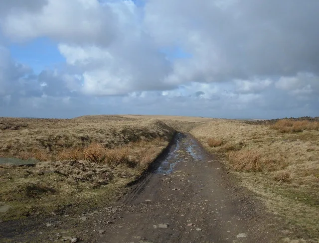
Rossendale () is a local government district with borough status in Lancashire, England. Its council is based in Bacup and its largest town is Rawtenstall. It also includes the towns of Haslingden and

David Dixon — CC BY-SA 2.0 via Wikimedia Commons licence
Plan your visit
- Typical visit
- 1.5 h–3 h
- Best time of year
- Year-round
- Family-friendly
- Limited wheelchair access
About
Rossendale () is a local government district with borough status in Lancashire, England. Its council is based in Bacup and its largest town is Rawtenstall. It also includes the towns of Haslingden and Whitworth. The borough is named after the Rossendale Valley, the upper part of the valley of the River Irwell. The neighbouring districts are Burnley, Hyndburn, Blackburn with Darwen, Bury, Bolton, Calderdale and Rochdale.
Photo gallery
From the Wikipedia article
Rossendale () is a local government district with borough status in Lancashire, England. Its council is based in Bacup and its largest town is Rawtenstall. It also includes the towns of Haslingden and Whitworth. The borough is named after the Rossendale Valley, the upper part of the valley of the River Irwell. The neighbouring districts are Burnley, Hyndburn, Blackburn with Darwen, Bury, Bolton, Calderdale and Rochdale.
Excerpt from Wikipedia under CC BY-SA 4.0. See the source article linked in Sources below.
Background
History
Rossendale is part of the Forest of Rossendale, which consists of the steep-sided valleys of the River Irwell and its tributaries, which flow from the Pennines southwards to Manchester and cut through the moorland which is characteristic of the area. It was given the designation of "forest" in medieval times denoting a hunting reserve. The larger settlements grew into market towns, typically through the late Middle Ages. Farming and a cottage woollen industry developed during the reign of Henry VIII, but Rossendale's population only really expanded during the period of the Industrial Revolution. The population of the area that would become the modern borough of Rossendale was 24,136 in…
Sourced from Wikipedia under CC BY-SA 4.0.
- Coordinates
- 53.6833, -2.2500
- County
- Lancashire
- District
- Rossendale
- Parish
- Rossendale, unparished area
- Postcode
- BB4 7DZ
- Parliamentary constituency
- Rossendale and Darwen
Sources
- wikipedia: Borough of Rossendale (CC BY-SA 4.0)
Other places nearby
Loading nearby places…
Nearby
 📷 5
📷 5Museums · North West England
Waterfoot, Lancashire
Waterfoot, Lancashire — a museum in england-north-west, United Kingdom.
 📷 3
📷 3Theatres · North West England
Bamboo Theatre
Bamboo Theatre is a theatre in the United Kingdom.
 📷 3
📷 3Mountains & hills · North West England
Cowpe Lowe
Cowpe Lowe — a mountain in england-north-west, United Kingdom, 440 m.
 📷 3
📷 3Memorials & monuments · North West England
Waugh's Well
Waugh's Well — a memorial in england-north-west, United Kingdom.
 📷 5
📷 5Mountains & hills · North West England
Hail Storm Hill
Hail Storm Hill — Named summit at 477 m.
 📷 5
📷 5Natural landmarks · North West England
Hail Storm Hill
Hail Storm Hill — mountain in United Kingdom.
More museums in this region
 📷 3
📷 3Museums · North West England
Abbot Hall Art Gallery
Abbot Hall Art Gallery — Grade I listed art museum in Kendal, United Kingdom.
 📷 4
📷 4Museums · North West England
Bancroft Shed
Bancroft Shed — mill museum in Barnoldswick, Pendle, Lancashire, England, UK.
 📷 3
📷 3Museums · North West England
Blackburn Museum and Art Gallery
Blackburn Museum and Art Gallery — museum in Lancashire, England.
 📷 5
📷 5Museums · North West England
Bolton Steam Museum
Bolton Steam Museum — industrial museum in England, United Kingdom.
Frequently asked questions
- Where is Borough of Rossendale?
- Borough of Rossendale is in North West England, in the United Kingdom — coordinates 53.6833°, -2.2500°.
- Is Borough of Rossendale wheelchair accessible?
- Partially — OpenStreetMap notes limited wheelchair access at Borough of Rossendale. Check ahead for specific facilities.