Historic churches · South West England
Gwithian
Gwithian (Cornish: Godhyan) is a coastal village and former civil parish, now in the parish of Gwinear-Gwithian, in the Cornwall district, in west Cornwall, England. It is three miles (5 km) north-eas

nick macneill — CC BY-SA 2.0 via Wikimedia Commons licence
Plan your visit
- Typical visit
- 30 min–1 h
- Free entry
About
Gwithian (Cornish: Godhyan) is a coastal village and former civil parish, now in the parish of Gwinear-Gwithian, in the Cornwall district, in west Cornwall, England. It is three miles (5 km) north-east of Hayle and four miles (6.5 km) east of St Ives, Cornwall across St Ives Bay. In 1931 the parish had a population of 634. On 1 April 1934 the parish was abolished to form "Gwinear Gwithian". Gwithian has a pub, the Red River Inn, which was formerly named the Pendarves Arms. The pub takes its name from the nearby Red River which, in turn, got its name from the discolouration caused by mining effluent. The river's earlier name was Dowr Coner.
Photo gallery
From the Wikipedia article
Gwithian (Cornish: Godhyan) is a coastal village and former civil parish, now in the parish of Gwinear-Gwithian, in the Cornwall district, in west Cornwall, England. It is three miles (5 km) north-east of Hayle and four miles (6.5 km) east of St Ives, Cornwall across St Ives Bay. In 1931 the parish had a population of 634. On 1 April 1934 the parish was abolished to form "Gwinear Gwithian". Gwithian has a pub, the Red River Inn, which was formerly named the Pendarves Arms. The pub takes its name from the nearby Red River which, in turn, got its name from the discolouration caused by mining effluent. The river's earlier name was Dowr Coner.
Excerpt from Wikipedia under CC BY-SA 4.0. See the source article linked in Sources below.
Background
History
Gwithian Towans cover the site of a Bronze Age farm which has been excavated although no remains are visible. The church and relics of St Gwithian or Gocianus, built in 490, were uncovered from the beach and dunes during the early part of the 19th century, but were then allowed to be reclaimed by the shifting sands. Gwithian is the patron saint of good fortune on the sea. Charles Henderson wrote in 1925 that the "oratory ... is more perfect than the Oratory at Perran, having been less meddled with, though it is probably not so ancient". According to H. O'Neill Hencken there is the "remains of church, possibly early, buried in sand". According to tradition there was in the sandy waste…
Visiting
A short distance to the east of the village is Gwithian Towans (compare Welsh 'tywyn' meaning a sand-dune), which is an area of coastal duneland that forms part of The Towans. Gwithian Beach stretches three miles from the Hayle River mouth to the Red River mouth at Godrevy. The beach is popular throughout the year with surfers, windsurfers, and other beachsport enthusiasts. Gwithian beach is patrolled by RNLI lifeguards from Easter to September and surfing equipment can be purchased or hired from the nearby surf shop.
Sourced from Wikipedia under CC BY-SA 4.0.
- Coordinates
- 50.2214, -5.3865
- District
- Cornwall
- Parish
- Gwinear-Gwithian
- Postcode
- TR27 5BX
- Parliamentary constituency
- Camborne and Redruth
Sources
- wikipedia: Gwithian (CC BY-SA 4.0)
Other places nearby
Loading nearby places…
Nearby
Campsites · South West England
Gwithian Farm
Gwithian Farm — a campsite in england south west.
 📷 5
📷 5Historic churches · South West England
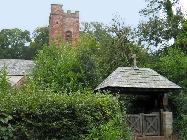
St Gothian's Church, Gwithian
St Gothian's Church, Gwithian is a Grade II* listed parish church in the Church of England Diocese of Truro in Gwithian, Cornwall, England, UK. Nothing is known about St Gothian, Gocianus or Gwithian
Campsites · South West England
Prosper House
Prosper House — a campsite in england south west.
Campsites · South West England
Churchtown Farm Caravan & Camping Site
Churchtown Farm Caravan & Camping Site — a campsite in england south west.
 📷 5
📷 5Historic churches · South West England
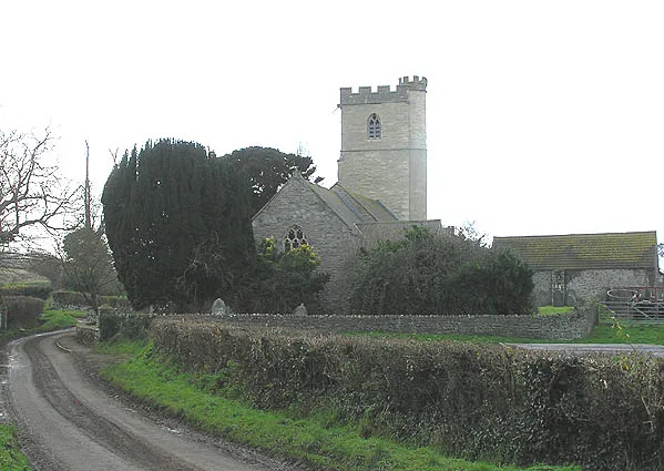
Gwinear–Gwithian
Gwinear–Gwithian (Cornish: Pluw Wynnyer ha Godhyan) is a coastal civil parish in west Cornwall, England, United Kingdom. It includes the villages of Connor Downs, Gwinear, Gwithian, Reawla and Rosewa
 📷 3
📷 3Historic houses · South West England
St Gothian's Chapel
St Gothian's Chapel — a historic house in england-south-west, United Kingdom.
More places in this region
 📷 5
📷 5Historic churches · South West England
Abbey Church of St Mary and St Petroc
Abbey Church of St Mary and St Petroc — church in Bodmin, Cornwall, England, UK; former monastic church.
 📷 5
📷 5Historic churches · South West England
All Saints Church
All Saints Church — church in Dodington, West Somerset, England, UK.
 📷 5
📷 5Historic churches · South West England
All Saints Church, Otterhampton
All Saints Church, Otterhampton — church in Otterhampton, Somerset, England, UK.
 📷 5
📷 5Historic churches · South West England
All Saints Church, South Milton
All Saints Church, South Milton — church in South Milton, Devon, England, UK.
Frequently asked questions
- Where is Gwithian?
- Gwithian is in South-West England, United Kingdom (postcode TR27 5BX), in the parish of Gwinear-Gwithian.
- Is Gwithian free to visit?
- Yes, Gwithian is free to enter.
- How do I get to Gwithian?
- Drivers can navigate to postcode TR27 5BX. It sits within the Camborne and Redruth parliamentary constituency.