Natural landmarks · North East England
Grisedale Pike
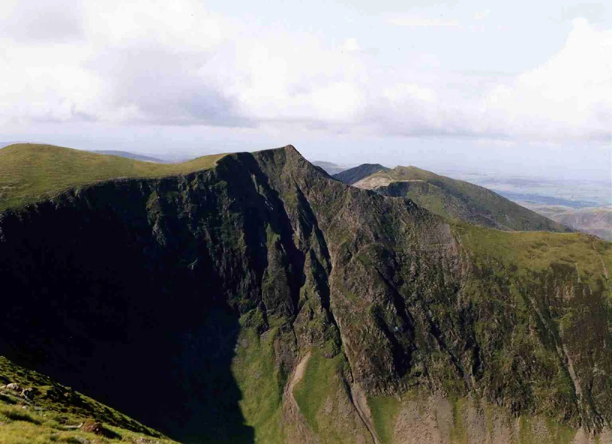
Grisedale Pike — mountain in United Kingdom.

Wikimedia Commons contributors — see linked file page for photographer and licence licence
Plan your visit
- Typical visit
- 1 h–2 h
- Free entry
- Dog-friendly
About
Grisedale Pike is a named natural landmark in the United Kingdom. Wikidata describes it as: "mountain in United Kingdom". Coordinates: 54.5920°, -3.2410°.
Photo gallery
Protected designations
- Site of Special Scientific Interest: River Derwent and Tributaries SSSI
- Site of Special Scientific Interest: Buttermere Fells SSSI
Designations sourced from Natural England open data under OGL v3.
From the Wikipedia article
Grisedale Pike is a fell in the Lake District, Cumbria, England, situated 4+1⁄2 miles (7 kilometres) west of the town of Keswick in the north-western sector of the national park. At a height of 791 metres (2,595 feet) it is the 40th-highest Wainwright in the Lake District; it also qualifies as a Hewitt, Marilyn and Nuttall. Grisedale Pike presents a striking appearance when viewed from the east, particularly from the vicinity of Keswick. It possesses two subsidiary summits: one unnamed (usually referred to as 'subsidiary summit', situated above Hobcarton Crag); the other Hobcarton End.
Excerpt from Wikipedia under CC BY-SA 4.0. See the source article linked in Sources below.
- Coordinates
- 54.5920, -3.2410
- Address
- Cumbria, England
Sources
- wikidata: Q5609620 (CC0)
- wikipedia: Grisedale Pike (CC BY-SA 4.0)
- commons: Grisedale Pike from Barrow.jpg (CC BY-SA 4.0)
Other places nearby
Loading nearby places…
Nearby
📷 3Mountains & hills · North East England
Grisedale Pike
Grisedale Pike — Named summit at 790.3 m.
 📷 3
📷 3Natural landmarks · North East England
Force Crag Mine
Force Crag Mine — a other in england-north-east, United Kingdom.
 📷 3
📷 3Archaeological sites · North East England
Force Crag mines and barytes mill and a prehistoric cairnfield
Force Crag mines and barytes mill and a prehistoric cairnfield — archaeological site in Above Derwent, Allerdale, England, UK.
 📷 3
📷 3Viewpoints · North East England
DOA
DOA is a viewpoint in the United Kingdom.
 📷 3
📷 3Mountains & hills · North East England
Sand Hill
Sand Hill — Named summit at 756 m.
 📷 3
📷 3Mountains & hills · North East England
Hopegill Head
Hopegill Head — Named summit at 769.6 m.
More natural landmarks in this region
 Flagship📷 5
Natural landmarks · North East England
Brothers Water
Brothers Water — lake in Cumbria, England, UK.
 📷 5
📷 5Natural landmarks · North East England
Angle Tarn
Angle Tarn — lake near Patterdale, Cumbria, England, United Kingdom.
 📷 3
📷 3Natural landmarks · North East England
Angletarn Pikes
Angletarn Pikes — mountain in United Kingdom.
 📷 3
📷 3Natural landmarks · North East England
Ard Crags
Ard Crags — mountain in United Kingdom.
Frequently asked questions
- Where is Grisedale Pike?
- Grisedale Pike is in North-East England, United Kingdom.
- Is Grisedale Pike a protected site?
- Yes — Grisedale Pike is part of the River Derwent and Tributaries SSSI Site of Special Scientific Interest and the Buttermere Fells SSSI Site of Special Scientific Interest.
- Is Grisedale Pike free to visit?
- Yes, Grisedale Pike is free to enter.