Museums · East of England
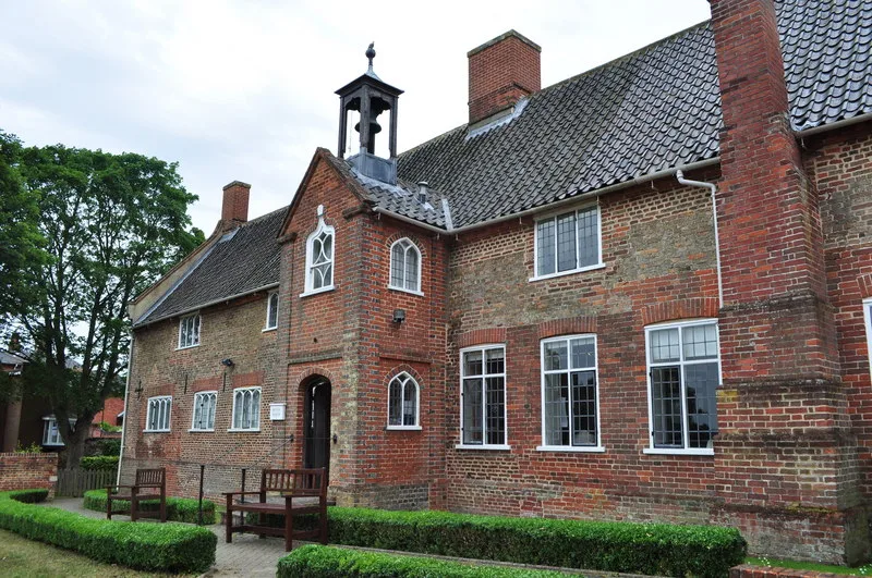
Gressenhall
Gressenhall is a village and civil parish in the English county of Norfolk, along the course of the River Nar. Gressenhall is located 2.9 miles (4.7 km) north-west of Dereham and 18 miles (29 km) nort

Adrian S Pye — CC BY-SA 2.0 via Wikimedia Commons licence
Plan your visit
- Typical visit
- 1.5 h–3 h
- Best time of year
- Year-round
- Family-friendly
- Limited wheelchair access
About
Gressenhall is a village and civil parish in the English county of Norfolk, along the course of the River Nar. Gressenhall is located 2.9 miles (4.7 km) north-west of Dereham and 18 miles (29 km) north-west of Norwich.
Photo gallery
From the Wikipedia article
Gressenhall is a village and civil parish in the English county of Norfolk, along the course of the River Nar. Gressenhall is located 2.9 miles (4.7 km) north-west of Dereham and 18 miles (29 km) north-west of Norwich.
Excerpt from Wikipedia under CC BY-SA 4.0. See the source article linked in Sources below.
Background
History
Gressenhall's name is of Anglo-Saxon origin and derives from the Old English for the grassy or gravelly nook of land. A watermill is recorded in Gressenhall on the River Whitewater as far back as 1060, with the earliest owner listed as Toke, the thane of Gressenhall. The mill was destroyed by fire in 1914. A smock mill also stood in Gressenhall between 1829 and 1970. In the Domesday Book of 1086, Gressenhall is listed as a settlement of 27 households in the hundred of Laundich. In 1086, the village was part of the East Anglian estates of William de Warenne. In 1777, a workhouse was built in Gressenhall to give a strict regime of work to paupers in exchange for food and shelter. The building…
Sourced from Wikipedia under CC BY-SA 4.0.
- Coordinates
- 52.6992, 0.9022
- County
- Norfolk
- District
- Breckland
- Parish
- Gressenhall
- Postcode
- NR19 2QJ
- Parliamentary constituency
- Mid Norfolk
Sources
- wikipedia: Gressenhall (CC BY-SA 4.0)
Other places nearby
Loading nearby places…
Nearby
 📷 3
📷 3Historic churches · East Midlands
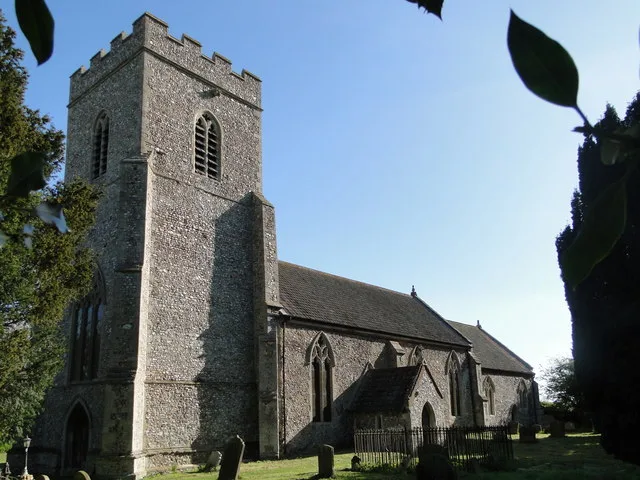
Church of St Mary, Gressenhall
Church of St Mary, Gressenhall — Grade I listed church in Norfolk, England, UK.
Caravan parks · East Midlands
Swallow Lodge
Swallow Lodge — a caravan park in england east midlands.
 📷 3
📷 3Public art & sculpture · East Midlands
Gressenhall Village Sign
Gressenhall Village Sign — a public art in england-east-midlands, United Kingdom.
 📷 3
📷 3Forests & woodlands · East of England
Rush Meadow
Rush Meadow is a forest or woodland in the United Kingdom.
 📷 3
📷 3Museums · East Midlands
Gressenhall Farm and Workhouse
Gressenhall Farm and Workhouse — museum in Gressenhall, Breckland, Norfolk, England, UK.
 Flagship📷 3
Towns & cities · East Midlands
Beetley
Beetley — village in Norfolk, England, UK.
More museums in this region
 📷 3
📷 3Museums · East of England
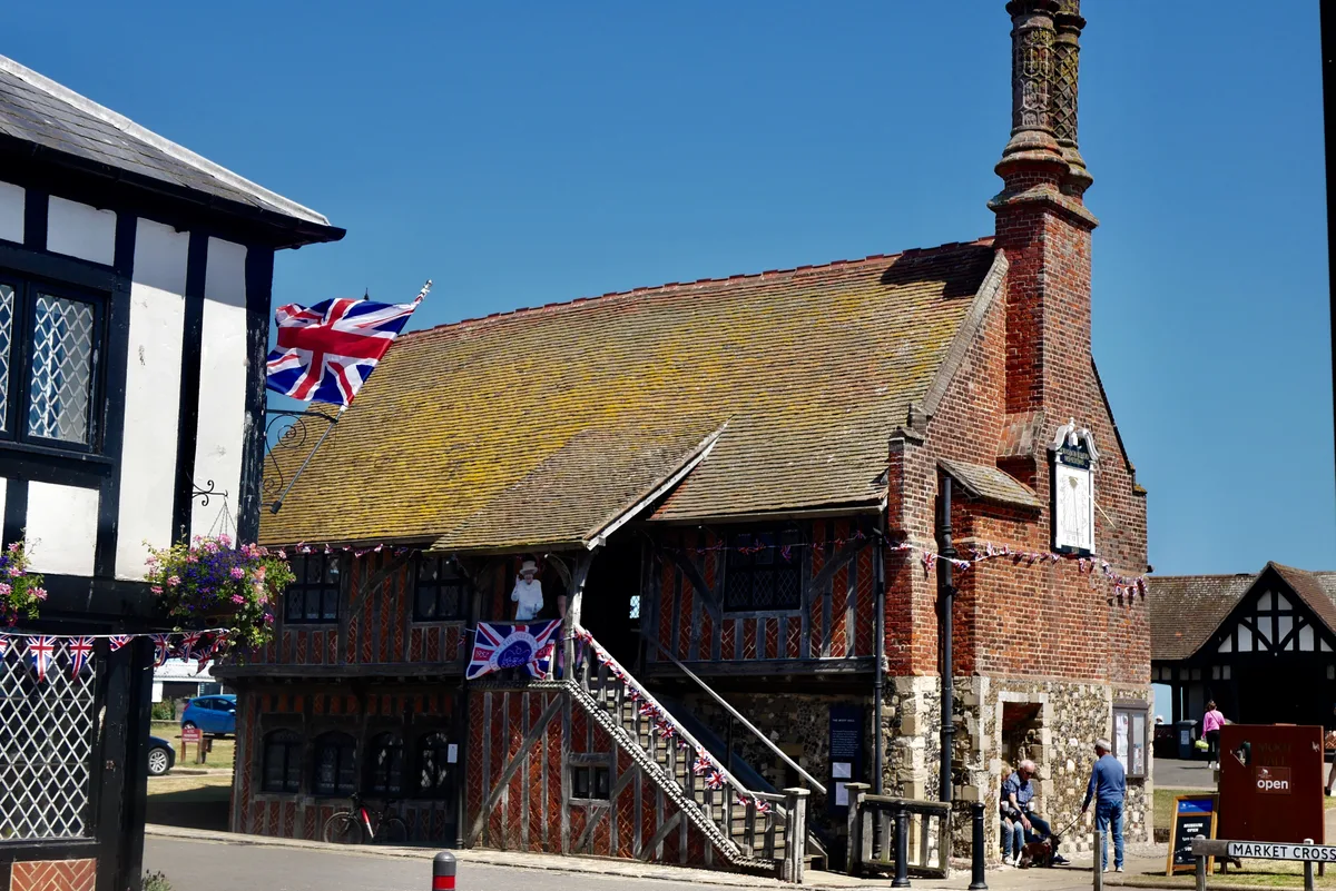
Aldeburgh Museum
Aldeburgh Museum — independent Museum in the East of England, United Kingdom.
 📷 3
📷 3Museums · East of England
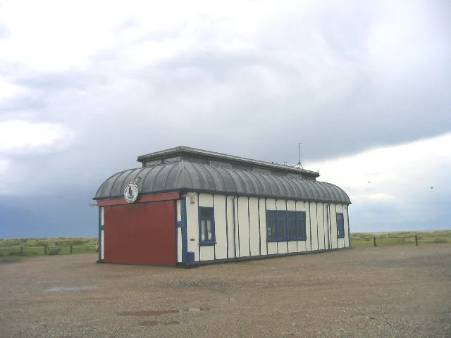
Alfred Corry Lifeboat Museum
Alfred Corry Lifeboat Museum — UK museum in Southwold, East Suffolk, England.
 📷 3
📷 3Museums · East of England
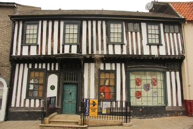
Ancient House Museum
Ancient House Museum — Grade I listed building in Thetford, Breckland District, Norfolk, England, United Kingdom.
 📷 3
📷 3Museums · East of England
Beccles and District Museum
Beccles and District Museum — Museum in United Kingdom.
Frequently asked questions
- Where is Gressenhall?
- Gressenhall is in East of England, in the United Kingdom — coordinates 52.6992°, 0.9022°.
- Is Gressenhall wheelchair accessible?
- Partially — OpenStreetMap notes limited wheelchair access at Gressenhall. Check ahead for specific facilities.