Forests & woodlands · East Midlands
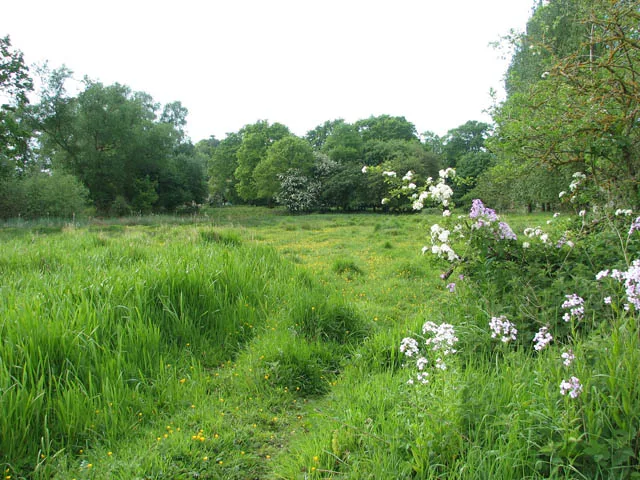
Hoe Rough - Open Access Land
Hoe Rough - Open Access Land is a forest or woodland in the United Kingdom.

Adrian Hodge — CC BY-SA 2.0 via Wikimedia Commons licence
Plan your visit
- Typical visit
- 1 h–3 h
- Nearest railway station
- Dereham · 4.1 km
- Free entry
- Family-friendly
- Dog-friendly
About
Hoe Rough - Open Access Land is woodland in Norfolk, the East Midlands. The site is a designated Site of Special Scientific Interest. It sits within the Mid Norfolk parliamentary constituency. The nearest railway station is Dereham, about 4.1 km away. Postcode area NR20.
Photo gallery
Protected designations
- Site of Special Scientific Interest: River Wensum SSSI
- Site of Special Scientific Interest: Beetley & Hoe Meadows SSSI
Designations sourced from Natural England open data under OGL v3.
Place summary
Hoe Rough is an area of open access land located in the East Midlands, specifically in Norfolk, within the parish of Hoe and Worthing. It is designated as a Site of Special Scientific Interest (SSSI) for both the River Wensum and Beetley & Hoe Meadows, highlighting its ecological significance.
AI-generated from the structured facts on this page (operator, designation, listing, era). Not a substitute for visiting.
- Coordinates
- 52.7143, 0.9305
- County
- Norfolk
- District
- Breckland
- Parish
- Hoe and Worthing
- Postcode
- NR20 4BG
- Parliamentary constituency
- Mid Norfolk
- Nearest railway station
- Dereham — 4.1 km
- Official site
- www.norfolkwildlifetrust.org.uk
Sources
- osm: w249712424 (ODbL)
Other places nearby
Loading nearby places…
Nearby
 📷 5
📷 5Wildlife reserves · East Midlands
Hoe Rough
Hoe Rough — nature reserve in Norfolk, England, UK.
 📷 3
📷 3Museums · East Midlands
Gressenhall Farm and Workhouse
Gressenhall Farm and Workhouse — museum in Gressenhall, Breckland, Norfolk, England, UK.
 📷 3
📷 3Public art & sculpture · East Midlands
Beetley Village Sign
Beetley Village Sign — a public art in england-east-midlands, United Kingdom.
 Flagship📷 3
Towns & cities · East Midlands
Beetley
Beetley — village in Norfolk, England, UK.
Campsites · East Midlands
Field
Field — a campsite in england east midlands.
 📷 3
📷 3Public art & sculpture · East Midlands
Gressenhall Village Sign
Gressenhall Village Sign — a public art in england-east-midlands, United Kingdom.
More forests in this region
 📷 5
📷 5Forests & woodlands · East Midlands
Attenborough Nature Reserve
Attenborough Nature Reserve is a forest or woodland in the United Kingdom.
 📷 3
📷 3Forests & woodlands · East Midlands
Booton Common
Booton Common is a forest or woodland in the United Kingdom.
 📷 3
📷 3Forests & woodlands · East Midlands
Brown End Quarry
Brown End Quarry is a forest or woodland in the United Kingdom.
 📷 3
📷 3Forests & woodlands · East Midlands
Buxton Heath
Buxton Heath is a forest or woodland in the United Kingdom.
Frequently asked questions
- Where is Hoe Rough - Open Access Land?
- Hoe Rough - Open Access Land is in Norfolk, the East Midlands, United Kingdom (postcode NR20 4BG), in the parish of Hoe and Worthing.
- Is Hoe Rough - Open Access Land a protected site?
- Yes — Hoe Rough - Open Access Land is part of the River Wensum SSSI Site of Special Scientific Interest and the Beetley & Hoe Meadows SSSI Site of Special Scientific Interest.
- Is Hoe Rough - Open Access Land free to visit?
- Yes, Hoe Rough - Open Access Land is free to enter.
- How do I get to Hoe Rough - Open Access Land?
- The nearest railway station is Dereham, about 4.1 km away. Drivers can navigate to postcode NR20 4BG.