Natural landmarks · North East England
Great Dodd
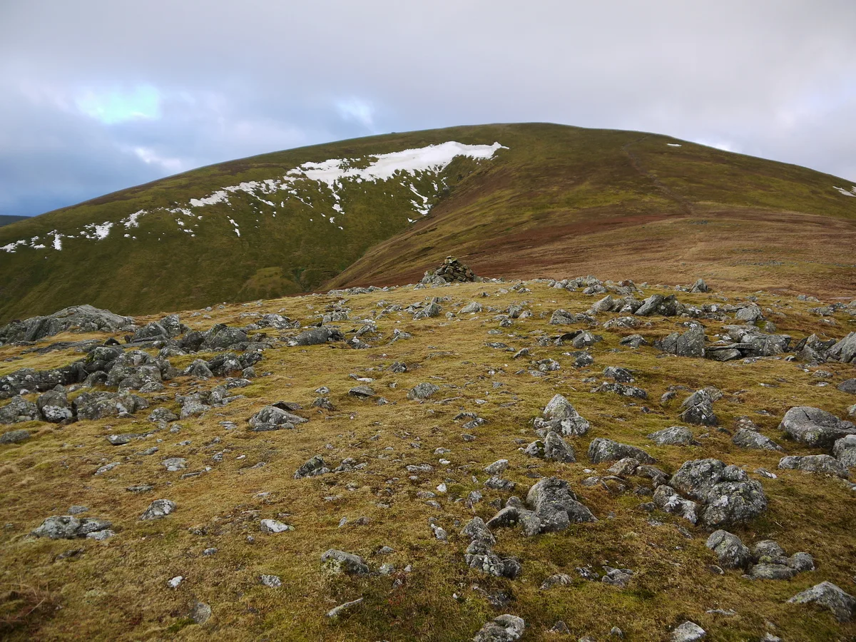
Great Dodd — mountain in the Lake District, Cumbria, United Kingdom.

Wikimedia Commons contributors — see linked file page for photographer and licence licence
Plan your visit
- Typical visit
- 1 h–2 h
- Nearest railway station
- Threlkeld Quarry · 4.0 km
- Free entry
- Dog-friendly
About
Great Dodd is a named natural landmark in the United Kingdom. Wikidata describes it as: "mountain in the Lake District, Cumbria, United Kingdom". Coordinates: 54.5754°, -3.0194°.
Photo gallery
Protected designations
- Site of Special Scientific Interest: River Derwent and Tributaries SSSI
- Site of Special Scientific Interest: River Eden and Tributaries SSSI
Designations sourced from Natural England open data under OGL v3.
From the Wikipedia article
Great Dodd (meaning: big round hill) is a mountain or fell in the English Lake District. It stands on the main ridge of the Helvellyn range, a line of mountains which runs in a north–south direction between the lakes of Thirlmere and Ullswater in the east of the Lake District. Great Dodd, with a height of 857 metres (2,812 ft) is the highest of the fells in this range to the north of Sticks Pass. Walkers may approach Great Dodd from either High Row near Dockray to the east, or from Legburthwaite to the west – or along the main ridge track from either north or south. Scramblers with climbing skills may be attracted to three gill climbs on the western side of the mountain. The summit of Great Dodd is a smooth, grassy, rounded dome, like its two southern neighbours, Watson's Dodd and Stybarrow Dodd. Together, these three are sometimes called ‘The Three Dodds’. These three are made of volcanic rocks of the Borrowdale Volcanic Group, and the tops of all three are covered by the same sheet of rock, which was formed in a series of huge volcanic explosions accompanying the formation of a volcanic caldera about 450 million years ago. Two attempts were made to mine mineral veins in the rocks of Great Dodd, but neither attempt was successful.
Excerpt from Wikipedia under CC BY-SA 4.0. See the source article linked in Sources below.
- Coordinates
- 54.5754, -3.0194
- Address
- Cumbria, England
- Nearest railway station
- Threlkeld Quarry — 4 km
Sources
- wikidata: Q5599075 (CC0)
- wikipedia: Great Dodd (CC BY-SA 4.0)
- commons: Great Dodd from Randerside.JPG (CC BY-SA 4.0)
Other places nearby
Loading nearby places…
Nearby
 📷 3
📷 3Mountains & hills · North East England
Great Dodd
Great Dodd — Named summit at 857 m.
 📷 4
📷 4Natural landmarks · North East England
Watson's Dodd
Watson's Dodd — mountain in the Lake District, Cumbria, United Kingdom.
 📷 4
📷 4Mountains & hills · North East England
Watsons Dodd
Watsons Dodd — Named summit at 789 m.
 📷 4
📷 4Mountains & hills · North East England
Stybarrow Dodd
Stybarrow Dodd — Named summit at 843.7 m.
 📷 4
📷 4Natural landmarks · North East England
Stybarrow Dodd
Stybarrow Dodd — mountain in United Kingdom.
 📷 4
📷 4Natural landmarks · North East England
Hart Side
Hart Side — mountain in United Kingdom.
More natural landmarks in this region
 Flagship📷 5
Natural landmarks · North East England
Brothers Water
Brothers Water — lake in Cumbria, England, UK.
 📷 5
📷 5Natural landmarks · North East England
Angle Tarn
Angle Tarn — lake near Patterdale, Cumbria, England, United Kingdom.
 📷 3
📷 3Natural landmarks · North East England
Angletarn Pikes
Angletarn Pikes — mountain in United Kingdom.
 📷 3
📷 3Natural landmarks · North East England
Ard Crags
Ard Crags — mountain in United Kingdom.
Frequently asked questions
- Where is Great Dodd?
- Great Dodd is in North-East England, United Kingdom.
- Is Great Dodd a protected site?
- Yes — Great Dodd is part of the River Derwent and Tributaries SSSI Site of Special Scientific Interest and the River Eden and Tributaries SSSI Site of Special Scientific Interest.
- Is Great Dodd free to visit?
- Yes, Great Dodd is free to enter.
- How do I get to Great Dodd?
- The nearest railway station is Threlkeld Quarry, about 4.0 km away.