Mountains & hills · Mid Wales
Graig Goch
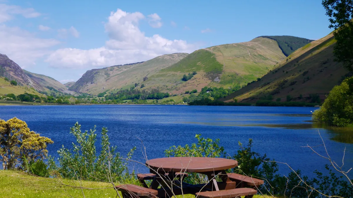
Graig Goch — Named summit at 586 m.

Wikimedia Commons contributors — see linked file page for photographer and licence licence
Plan your visit
- Typical visit
- 3 h–8 h
- Best time of year
- Late spring – early autumn (May–Oct)
- Nearest railway station
- Nant Gwernol · 3.7 km
- Free entry
- Dog-friendly
About
Graig Goch is a named summit in the United Kingdom. Wikidata describes it as: "Named summit at 586 m.". Coordinates: 52.6584°, -3.9026°.
Photo gallery
From the Wikipedia article
Graig Goch is a 586m high hill in the Gwynedd area in Wales and lying within Snowdonia National Park. The hill falls within the communities of Llanfihangel-y-Pennant and Corris, the summit being located in the former. The hill takes the form of a NE-SW aligned ridge with a broad top which rise to subsidiary tops either side of the main summit. These are the 540m+ top of Mynydd Cedris (OS grid ref SH 707080) and the 504m top of Mynydd Rugog (OS grid ref SH 722092). The hill’s most notable feature is the large cliff which stretches the length of its northwestern face overlooking Tal-y-llyn, in part a major rock-slope failure.
Excerpt from Wikipedia under CC BY-SA 4.0. See the source article linked in Sources below.
Background
Visiting
Other than the afforested parts of its southern slopes and parts of its lowermost northern slopes, the entire hill is mapped as open country under the Countryside and Rights of Way Act 2000 thereby giving the public extensive rights to wander at will across it. There are no recorded public rights of way on the hill.
Sourced from Wikipedia under CC BY-SA 4.0.
- Coordinates
- 52.6584, -3.9026
- District
- Gwynedd
- Parish
- Llanfihangel-y-Pennant
- Postcode
- LL36 9AQ
- Parliamentary constituency
- Dwyfor Meirionnydd
- Nearest railway station
- Nant Gwernol — 3.7 km
Sources
- osm: n255372454 (ODbL)
- wikipedia: Graig Goch (CC BY-SA 4.0)
- commons: Graig Goch - geograph.org.uk - 546685.jpg (CC BY-SA 4.0)
Other places nearby
Loading nearby places…
Nearby
 📷 5
📷 5Historic churches · Mid Wales
Tal-y-llyn, Gwynedd
Tal-y-llyn, Gwynedd — a church in wales-mid, United Kingdom.
 📷 5
📷 5Natural landmarks · Mid Wales
Llyn Myngul
Llyn Myngul is a natural landmark in the United Kingdom.
 📷 2
📷 2Mountains & hills · Mid Wales
Mynydd Braich-goch
Mynydd Braich-goch — a mountain in wales-mid, United Kingdom, 597 m.
Campsites · Mid Wales
Cedis farm
Cedis farm — a campsite in wales mid.
Campsites · Mid Wales
Cedris Farm Campsite
Cedris Farm Campsite — a campsite in wales mid.
 📷 3
📷 3Mountains & hills · Mid Wales
Tarren y Gesail
Tarren y Gesail — Named summit at 667 m.
More mountains in this region
 📷 3
📷 3Mountains & hills · Mid Wales
Black Hill
Black Hill — Named summit at 640 m.
 📷 3
📷 3Mountains & hills · Mid Wales
Black Mixen
Black Mixen — Named summit at 650 m.
 📷 5
📷 5Mountains & hills · Mid Wales
Cadair Idris
Cadair Idris — Named summit at 893 m.
 📷 3
📷 3Mountains & hills · Mid Wales
Caer Caradoc
Caer Caradoc — Named summit at 459 m.
Frequently asked questions
- Where is Graig Goch?
- Graig Goch is in Mid Wales, United Kingdom (postcode LL36 9AQ), in the parish of Llanfihangel-y-Pennant.
- Is Graig Goch free to visit?
- Yes, Graig Goch is free to enter.
- How do I get to Graig Goch?
- The nearest railway station is Nant Gwernol, about 3.7 km away. Drivers can navigate to postcode LL36 9AQ.