Towns & cities · North West England
Foulridge
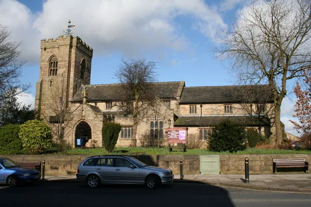
Foulridge — village and civil parish in Lancashire, England.

Wikimedia Commons contributors — see linked file page for photographer and licence licence
Plan your visit
- Typical visit
- 3 h–6 h
- Nearest railway station
- Colne · 1.6 km
- Free entry
- Family-friendly
- Dog-friendly
About
Foulridge is a town, city, village or settlement in the United Kingdom. Recent population estimates put it at around 1,503 people. Address: BB8. Wikidata describes it as: "village and civil parish in Lancashire, England". Coordinates: 53.8667°, -2.1667°.
Photo gallery
Protected designations
- Site of Special Scientific Interest: South Pennine Moors SSSI
Designations sourced from Natural England open data under OGL v3.
From the Wikipedia article
Foulridge (pronounced FOHL-rij) is a village and civil parish in Pendle, Lancashire, close to the border with North Yorkshire in England. It is situated just beyond Colne, on the route from the M65 to Skipton, and is an important stopping point on summit pound of the Leeds and Liverpool Canal, just before it enters the Foulridge Tunnel. Noyna Hill, a well known local landmark, sits 1 mile (1.6 km) east of the village. Foulridge adjoins the Pendle parishes of Salterforth, Kelbrook and Sough, Laneshaw Bridge, Colne and Blacko. Foulridge was once a township in the ancient parish of Whalley. This became a civil parish in 1866, forming part of the Burnley Rural District from 1894 (until 1974). A detached area of the old township to the east around Barnside and Monkhall, moved to Colne in 1935. An old tale is of a cow falling into the canal at one end then passing through the tunnel before rescue. It is said it was taken to the nearby pub and revived with a drink. There is also a large reservoir that feeds the canal. Barge trips are also available on the canal. Foulridge has been part of Lancashire since the Middle Ages and was about 1.5 miles (2.4 km) from the boundary of the old West Riding of Yorkshire. With the creation of the Borough of Pendle in 1974 parts of Yorkshire, including Earby and Barnoldswick, were transferred to Lancashire, and Foulridge moved further away from the White Rose county. There is an old village sign which used to mark the boundary with Yorkshire which has been affixed to the village hall in the centre of Foulridge. There is a large reservoir in the village which feeds the canal and which in turn is fed from other smaller reservoirs around the village. Foulridge also had its own railway station, which closed in 1959. According to the United Kingdom Census 2011, the parish has a population of 1,503, a decrease from 1,506 in the 2001 census.
Excerpt from Wikipedia under CC BY-SA 4.0. See the source article linked in Sources below.
- Coordinates
- 53.8667, -2.1667
- County
- Lancashire
- District
- Pendle
- Parish
- Colne
- Postcode
- BB8
- Parliamentary constituency
- Pendle and Clitheroe
- Population
- 1,503
- Nearest railway station
- Colne — 1.6 km
Sources
- wikidata: Q630115 (CC0)
- wikipedia: Foulridge (CC BY-SA 4.0)
- commons: Foulridge, Lancashire - Barnoldswick Road - geograph.org.uk - 1802443.jpg (CC BY-SA 4.0)
Other places nearby
Loading nearby places…
Nearby
 📷 5
📷 5Museums · North West England
Borough of Pendle
Pendle is a local government district with borough status in Lancashire, England. The council is based in Nelson, the borough's largest town. The borough also includes the towns of Barnoldswick, Brier
 📷 3
📷 3Memorials & monuments · North West England
Foulridge War Memorial
Foulridge War Memorial — Grade II listed building-listed memorial in england-north-west, United Kingdom.
 📷 4
📷 4Theatres · North West England
Pendle Hippodrome Theatre
Pendle Hippodrome Theatre in England North West, United Kingdom.
 📷 3
📷 3Historic churches · North West England
St Bartholomew's Church, Colne
St Bartholomew's Church, Colne — Grade I listed church in Colne, Pendle, Lancashire, England, UK.
 📷 3
📷 3Theatres · North West England
Pendle Hippodrome
Pendle Hippodrome is a theatre in the United Kingdom.
 📷 3
📷 3Theatres · North West England
Alhambra Picture Theatre
Alhambra Picture Theatre in England North West, United Kingdom.
More towns in this region
 Flagship📷 5
Towns & cities · North West England
Aughton
Aughton — village and civil parish within the West Lancashire district of Lancashire, England.
 Flagship📷 5
Towns & cities · North West England
Haigh
Haigh — village and civil parish of the Metropolitan Borough of Wigan in Greater Manchester, England.
 Flagship📷 5
Towns & cities · North West England
Lancaster
Lancaster — county town of Lancashire, England.
 Flagship📷 3
Towns & cities · North West England
Preston
Preston — city and the administrative centre of Lancashire, England.
Frequently asked questions
- Where is Foulridge?
- Foulridge is in Lancashire, North-West England, United Kingdom (postcode BB8), in the parish of Colne.
- Is Foulridge a protected site?
- Yes — Foulridge is part of the South Pennine Moors SSSI Site of Special Scientific Interest.
- Is Foulridge free to visit?
- Yes, Foulridge is free to enter.
- How do I get to Foulridge?
- The nearest railway station is Colne, about 1.6 km away. Drivers can navigate to postcode BB8.