Mountains & hills · North Wales
Foel Faner
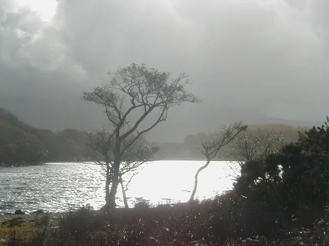
Foel Faner — a mountain in wales-north, United Kingdom, 290 m.

Row17 — CC BY-SA 2.0 via Wikimedia Commons licence
Plan your visit
- Typical visit
- 3 h–8 h
- Best time of year
- Late spring – early autumn (May–Oct)
- Free entry
- Dog-friendly
About
Foel Faner is a named summit in wales-north, United Kingdom, with an elevation of approximately 290 metres. Listed in the Wikidata register of UK peaks; see the Wikipedia article for further details on the mountain's location, geology and walking routes.
Photo gallery
Place summary
Foel Faner is a mountain located in North Wales. It is notable for its distinctive summit and scenic views of the surrounding landscape. The mountain is part of the Carneddau range, which is known for its rugged terrain and natural beauty.
AI-generated from the structured facts on this page (operator, designation, listing, era). Not a substitute for visiting.
- Coordinates
- 52.7667, -3.8799
- District
- Gwynedd
- Parish
- Llanelltyd
- Postcode
- LL40 2NF
- Parliamentary constituency
- Dwyfor Meirionnydd
Sources
- wikidata: Q106710054 (CC0)
Other places nearby
Loading nearby places…
Nearby
Vineyards · North Wales
Moel Faner
Moel Faner — a UK vineyard in wales north, producing English or Welsh wine from cool-climate grape varieties.
📷 3Viewpoints · North Wales
View & Bench
View & Bench is a viewpoint in the United Kingdom.
 📷 3
📷 3Reservoirs & lochs · North Wales
Llyn Cynwch
Llyn Cynwch — lake in Gwynedd, Wales.
 📷 3
📷 3Mountains & hills · North Wales
Foel Cynwch
Foel Cynwch — a mountain in wales-north, United Kingdom, 326 m.
 📷 3
📷 3Mountains & hills · North Wales
Fedw Felen
Fedw Felen — a mountain in wales-north, United Kingdom, 271 m.
 📷 3
📷 3Castles · North Wales
Cymer Castle (ruined)
Cymer Castle (ruined) — a castle in wales-north, United Kingdom.
More mountains in this region
 📷 5
📷 5Mountains & hills · North Wales
Cemlyn Bay and lagoon
Cemlyn Bay and lagoon — Site of Special Scientific Interest in Wales.
 📷 3
📷 3Mountains & hills · North Wales
Aberffraw Bay
Aberffraw Bay — bay on the west coast of Anglesey, in Wales, UK.
 📷 3
📷 3Mountains & hills · North Wales
Allt-fawr
Allt-fawr — Named summit at 698 m.
 📷 3
📷 3Mountains & hills · North Wales
Aran Benllyn
Aran Benllyn — Named summit at 884 m.
Frequently asked questions
- Where is Foel Faner?
- Foel Faner is in North Wales, United Kingdom (postcode LL40 2NF), in the parish of Llanelltyd.
- Is Foel Faner free to visit?
- Yes, Foel Faner is free to enter.
- How do I get to Foel Faner?
- Drivers can navigate to postcode LL40 2NF. It sits within the Dwyfor Meirionnydd parliamentary constituency.