Towns & cities · North East England
Egglescliffe
Egglescliffe — village in unitary authority of Stockton-on-Tees, United Kingdom.

Wikimedia Commons contributors — see linked file page for photographer and licence licence
Plan your visit
- Typical visit
- 3 h–6 h
- Nearest railway station
- Allens West · 1.6 km
- Free entry
- Family-friendly
- Dog-friendly
About
Egglescliffe is a town, city, village or settlement in the United Kingdom. Recent population estimates put it at around 7,908 people. Wikidata describes it as: "village in unitary authority of Stockton-on-Tees, United Kingdom". Coordinates: 54.5120°, -1.3500°.
Photo gallery
From the Wikipedia article
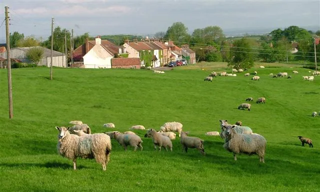
Egglescliffe is a village and civil parish in County Durham, England. Administratively it is located in the borough of Stockton-on-Tees. The civil parish is in the Teesdale with a population of 8,559 at the 2011 Census. In the 2021 census the group of interconnected villages in the parish and Preston-on-Tees had a population of 10,250, in the larger village to small town classification. It has Egglescliffe School (secondary and sixth-form), a light industrial estate, two railway stations and golf club. Villages in the parish include Eaglescliffe, Urlay Nook, Sunningdale, Orchard and a development on the former Allens West MOD site. The village is on top of a hill with the River Tees at the bottom, overlooking Yarm on the other bank. It had a 2001 population of around 595, There is a Church of England primary school, small kids play area, farms, allotments and a public house (called the Pot and Glass).
Excerpt from Wikipedia under CC BY-SA 4.0. See the source article linked in Sources below.
Background
History
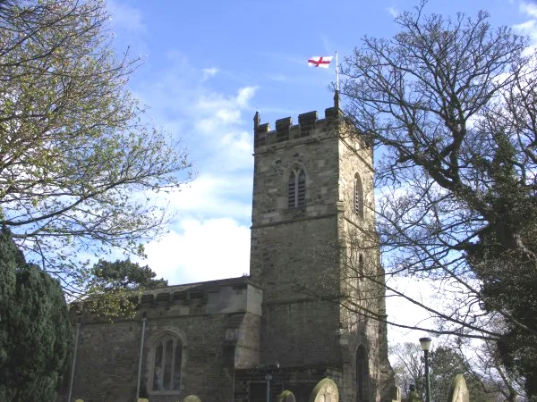
North of the River Tees was not recorded in the Domesday Book of 1086. The parish church is dedicated to St John the Baptist and there has been a place of worship on the site since the twelfth century. Bishop Skirlaw of Durham built a stone bridge, Yarm Bridge, across the Tees in 1400 which still stands. An iron replacement was built in 1805, but it fell down in 1806.
Sourced from Wikipedia under CC BY-SA 4.0.
- Coordinates
- 54.5120, -1.3500
- District
- Stockton-on-Tees
- Parish
- Egglescliffe
- Postcode
- TS16 9DQ
- Parliamentary constituency
- Stockton West
- Population
- 7,908
- Nearest railway station
- Allens West — 1.6 km
- Official site
- www.lucypittaway.co.uk
Sources
- wikidata: Q662172 (CC0)
- wikipedia: Egglescliffe (CC BY-SA 4.0)
- commons: Egglescliffe.jpg (CC BY-SA 4.0)
Other places nearby
Loading nearby places…
Nearby
 📷 3
📷 3Historic churches · North East England
St John the Baptist, Egglescliffe
St John the Baptist, Egglescliffe — church in the United Kingdom.
 📷 3
📷 3Memorials & monuments · North East England
Egglescliffe War Memorial
Egglescliffe War Memorial — Grade II listed building-listed memorial in england-north-east, United Kingdom.
 📷 4
📷 4Historic churches · North East England
Yarm Methodist Church
Yarm Methodist Church in England North East, United Kingdom.
 📷 3
📷 3Historic bridges · North East England
Yarm Bridge
Yarm Bridge is a historic bridge in the United Kingdom.
 📷 3
📷 3Memorials & monuments · North East England
Yarm War Memorial
Yarm War Memorial — a memorial in england-north-east, United Kingdom.
📷 3Galleries · North East England
Lucy Pittaway Gallery Yarm
Lucy Pittaway Gallery Yarm — a gallery in england-north-east, United Kingdom.
More towns in this region
 Flagship📷 3
Towns & cities · North East England
Newby
Newby — village and civil parish in Hambleton, North Yorkshire, England, UK.
 📷 5
📷 5Towns & cities · North East England
Archdeacon Newton
Archdeacon Newton — village and civil parish in County Durham, England, UK.
 📷 3
📷 3Towns & cities · North East England
Bampton
Bampton — village and civil parish in Eden, Cumbria, England.
 📷 3
📷 3Towns & cities · North East England
Bomby
Bomby — village in Cumbria, UK.
Frequently asked questions
- Where is Egglescliffe?
- Egglescliffe is in North-East England, United Kingdom (postcode TS16 9DQ), in the parish of Egglescliffe.
- Is Egglescliffe free to visit?
- Yes, Egglescliffe is free to enter.
- How do I get to Egglescliffe?
- The nearest railway station is Allens West, about 1.6 km away. Drivers can navigate to postcode TS16 9DQ.