Towns & cities · East Midlands
Edingley
Edingley — village in Nottinghamshire, England, UK.

Wikimedia Commons licence
Plan your visit
- Typical visit
- 3 h–6 h
- Nearest railway station
- Bleasby · 6.6 km
- Free entry
- Family-friendly
- Dog-friendly
About
Edingley is a town, city, village or settlement in the United Kingdom. Recent population estimates put it at around 390 people. Address: NG22. Wikidata describes it as: "village in Nottinghamshire, England, UK". Coordinates: 53.0900°, -1.0000°.
Photo gallery
From the Wikipedia article
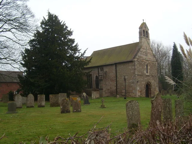
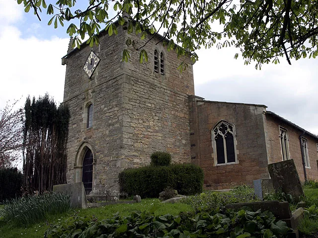
Edingley is a village in the Newark and Sherwood district of Nottinghamshire, England. According to the 2001 census it had a population of 390, increasing to 443 at the 2011 census, and falling to 401 at the 2021 census. It is located 3 miles north-west of Southwell. The name Edingley contains the Old English personal name, Eddi, + lēah (Old English), a forest, wood, glade, clearing; (later) a pasture, meadow.'...so 'Eddi's wood/clearing'. The parish church of St Giles is Norman, almost completely rebuilt in 1890. It is a largely agricultural parish with a public house, The Old Reindeer, and a residential home, Edingley Lodge (formerly Highfields). Its allotments are historic and the plot originally held the poor house and is the same plot as in the enclosure award of 1781 made under the Halam and Edingley Inclosure Act 1777 (17 Geo. 3. c. 117 Pr.) and formally surveyed in 1899. The former Methodist chapel, built in 1838, was part of the Newark and Southwell Methodist Circuit and closed in 2014 due to dwindling attendance. The incumbent minister commented "The village has changed out of all recognition since the chapel was built" and "It has completed its mission...". The village school was built in 1911–12 and closed in the 1960s. The private Edgehill school took over the building and extended northwards with a series of temporary buildings, closing in 1996. The main building, known as the Old Schoolroom, is now the village community hall.
Excerpt from Wikipedia under CC BY-SA 4.0. See the source article linked in Sources below.
- Coordinates
- 53.0900, -1.0000
- County
- Nottinghamshire
- District
- Newark and Sherwood
- Parish
- Halam
- Postcode
- NG22
- Parliamentary constituency
- Newark
- Population
- 390
- Nearest railway station
- Bleasby — 6.6 km
- Official site
- www.edingley.org.uk
Sources
Other places nearby
Loading nearby places…
Nearby
 📷 3
📷 3Historic bridges · East Midlands
Mill And Attached House And Bridge
Mill And Attached House And Bridge — Grade II listed building-listed bridge in england-east-midlands, United Kingdom.
 📷 3
📷 3Historic churches · East Midlands
St Giles' Church, Edingley
St Giles' Church, Edingley — church in Newark and Sherwood, Nottinghamshire, England, UK.
 📷 3
📷 3Historic churches · East Midlands
St Michael the Archangel's Church, Halam
St Michael the Archangel's Church, Halam — church in Newark and Sherwood, Nottinghamshire, England, UK.
Campsites · East Midlands
Edingley Campsite
Edingley Campsite — a campsite in england east midlands.
Vineyards · East Midlands
Little Turncroft Farm
Little Turncroft Farm — a UK vineyard in england east midlands, producing English or Welsh wine from cool-climate grape varieties.
 📷 3
📷 3Manor houses · East Midlands
Osmanthorpe Manor
Osmanthorpe Manor — Grade II listed building-listed manor in england-east-midlands, United Kingdom.
More towns in this region
 Flagship📷 3
Towns & cities · East Midlands
Aldborough
Aldborough — village in Norfolk, England, UK.
 Flagship📷 4
Towns & cities · East Midlands
Alderford
Alderford — village and civil parish in Norfolk, UK.
 Flagship📷 5
Towns & cities · East Midlands
Ashmanhaugh
Ashmanhaugh — village in Norfolk, England, UK.
 Flagship📷 3
Towns & cities · East Midlands
Attlebridge
Attlebridge — a village located in Broadland, United Kingdom.
Frequently asked questions
- Where is Edingley?
- Edingley is in Nottinghamshire, the East Midlands, United Kingdom (postcode NG22), in the parish of Halam.
- Is Edingley free to visit?
- Yes, Edingley is free to enter.
- How do I get to Edingley?
- The nearest railway station is Bleasby, about 6.6 km away. Drivers can navigate to postcode NG22.