Towns & cities · South West England
East Coker
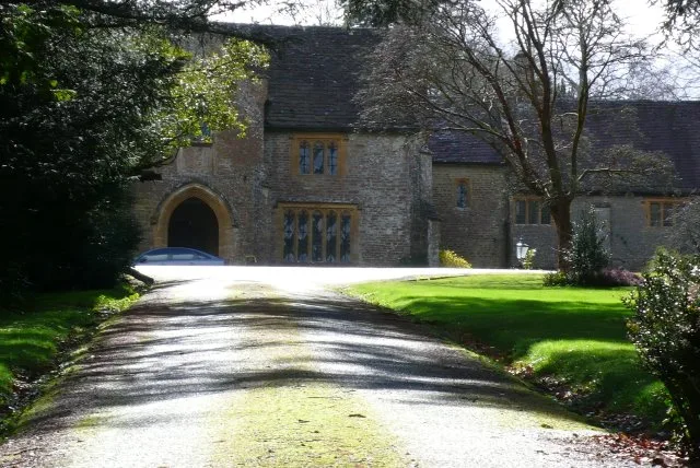
East Coker — village and civil parish in Somerset, England.

Wikimedia Commons contributors — see linked file page for photographer and licence licence
Plan your visit
- Typical visit
- 3 h–6 h
- Nearest railway station
- Yeovil Junction · 3.0 km
- Free entry
- Family-friendly
- Dog-friendly
About
East Coker is a town, city, village or settlement in the United Kingdom. Recent population estimates put it at around 1,667 people. Address: BA22. Wikidata describes it as: "village and civil parish in Somerset, England". Coordinates: 50.9101°, -2.6485°.
Photo gallery
Protected designations
- Area of Outstanding Natural Beauty: Dorset
Designations sourced from Natural England open data under OGL v3.
From the Wikipedia article
East Coker is a village and civil parish in Somerset, England. Its nearest town is Yeovil, two miles (3.2 km) to the north. The village has a population of 1,667. The parish includes the hamlets and areas of North Coker, Burton, Holywell, Coker Marsh, Darvole, Nash, Keyford as well as the southern end of the Wraxhill area.
Excerpt from Wikipedia under CC BY-SA 4.0. See the source article linked in Sources below.
Background
History
in Taunton Castle]] A Roman villa was discovered in East Coker in the 18th century and subsequent excavation has discovered artefacts including a mosaic; however, further work is needed to fully identify the plan of the building. In the Domesday Book of 1086 the villages of West and East Coker were known as Cocre. The parish was part of the hundred of Houndsborough. The Manor of East Coker was held by the Courtenay family of Powderham from 1306 until 1591. They built Coker Court as the manor house which was eventually sold to Edward Phelips, a wealthy landowner in the region. Upon Edward's death, the manor was left to his trustee, William Helyar, whose family it descended into for the next…
Sourced from Wikipedia under CC BY-SA 4.0.
- Coordinates
- 50.9101, -2.6485
- District
- Somerset
- Parish
- East Coker
- Postcode
- BA22
- Parliamentary constituency
- Yeovil
- Population
- 1,667
- Nearest railway station
- Yeovil Junction — 3 km
- Official site
- www.somersetintelligence.org.uk
Sources
- wikidata: Q593655 (CC0)
- wikipedia: East Coker (CC BY-SA 4.0)
- commons: East Coker Church - geograph.org.uk - 542241.jpg (CC BY-SA 4.0)
Other places nearby
Loading nearby places…
Nearby
 📷 4
📷 4Historic houses · South West England
Helyar Almshouses
Helyar Almshouses — a Grade II*-listed historic house in england-south-west, United Kingdom.
 📷 5
📷 5Stately homes · South West England
Coker Court
Coker Court — Grade I listed house in East Coker, Somerset, England, UK.
 📷 4
📷 4Farms (open to visitors) · South West England
Hymerford House
Hymerford House — a Grade I-listed farm in england-south-west, United Kingdom.
 📷 4
📷 4Historic houses · South West England
Pavyotts Mill House
Pavyotts Mill House — house in East Coker, South Somerset, England, UK.
 📷 3
📷 3Reservoirs & lochs · South West England
Sutton Bingham Reservoir
Sutton Bingham Reservoir — reservoir in Somerset, UK.
 📷 3
📷 3Manor houses · South West England
Sutton Bingham Manor
Sutton Bingham Manor — Grade II listed building-listed manor in england-south-west, United Kingdom.
More towns in this region
 Flagship📷 10
Towns & cities · South West England
All Saints
All Saints — village and civil parish in Devon, England, UK.
 Flagship📷 10
Towns & cities · South West England
Axmouth
Axmouth — village and civil parish in Devon, England, UK.
 ★ Iconic📷 10
Towns & cities · South West England
Beer
Beer — village and civil parish in Devon, UK.
 Flagship📷 10
Towns & cities · South West England
Branscombe
Branscombe — village and civil parish in Devon, UK.
Frequently asked questions
- Where is East Coker?
- East Coker is in South-West England, United Kingdom (postcode BA22), in the parish of East Coker.
- Is East Coker a protected site?
- Yes — East Coker is part of the Dorset National Landscape (AONB).
- Is East Coker free to visit?
- Yes, East Coker is free to enter.
- How do I get to East Coker?
- The nearest railway station is Yeovil Junction, about 3.0 km away. Drivers can navigate to postcode BA22.