Natural landmarks · North West England
Easedale Tarn
Easedale Tarn — lake in the United Kingdom.

Wikimedia Commons contributors — see linked file page for photographer and licence licence
Plan your visit
- Typical visit
- 1 h–2 h
- Free entry
- Dog-friendly
About
Easedale Tarn is a named natural landmark in the United Kingdom. Wikidata describes it as: "lake in the United Kingdom". Coordinates: 54.4695°, -3.0696°.
Photo gallery
Protected designations
- Site of Special Scientific Interest: River Derwent and Tributaries SSSI
Designations sourced from Natural England open data under OGL v3.
From the Wikipedia article
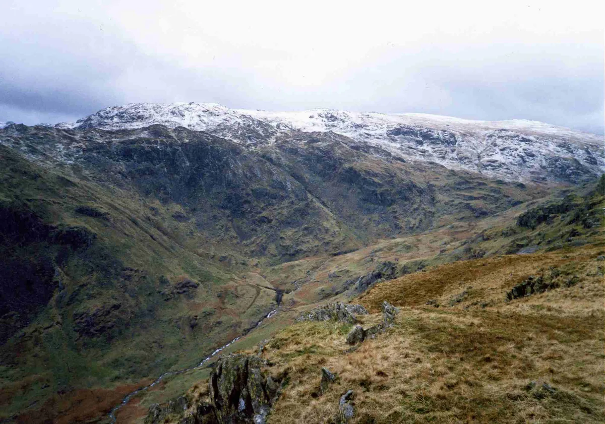
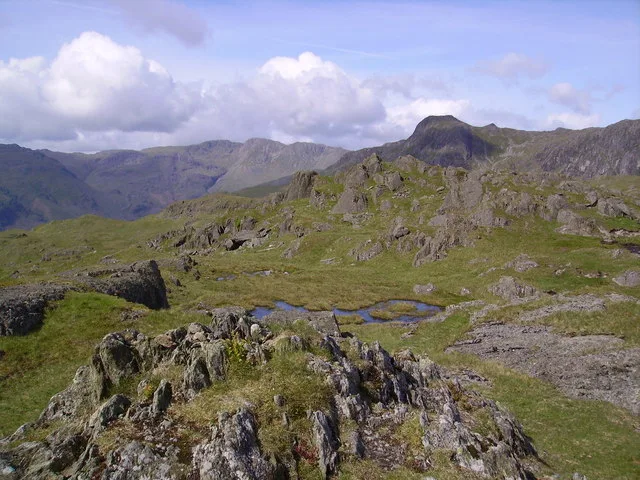
Easedale Tarn is a tarn in the centre of the English Lake District, about two miles west of the village of Grasmere. It lies in a hollow between Tarn Crag to the north and Blea Rigg to the south, about 910 feet or 280 metres above sea level. The hollow was formed by a small corrie glacier, and is believed to have filled with water around 11,000 years ago when the ice finished melting. Easedale Tarn is one of the larger tarns in the district, about 480 metres (1,570 ft) long and 300 metres (980 ft) wide. Its outflow is Sourmilk Gill, named after the milky white colour of its waterfalls, which runs east towards Grasmere. The gill displays impressive water scenery when seen from Grasmere, and from the path to the tarn. The tarn is a popular destination for walkers. Many people climb the path from Grasmere which overlooks Sourmilk Gill. The ascent was popular during the Victorian period, and a refreshment hut was even established in the 19th century by Robert Hayton of Grasmere above the outlet of the tarn to service the thirsty visitors. The hut is long gone, and nettles now grow where the ruins used to be.
Excerpt from Wikipedia under CC BY-SA 4.0. See the source article linked in Sources below.
- Coordinates
- 54.4695, -3.0696
- District
- Westmorland and Furness
- Parish
- Lakes
- Postcode
- LA22 9QL
- Parliamentary constituency
- Westmorland and Lonsdale
Sources
- wikidata: Q5327494 (CC0)
- wikipedia: Easedale Tarn (CC BY-SA 4.0)
- commons: Easedale Tarn - geograph.org.uk - 945455.jpg (CC BY-SA 4.0)
Other places nearby
Loading nearby places…
Nearby
 📷 3
📷 3Natural landmarks · North West England
Tarn Crag (Easedale)
Tarn Crag (Easedale) — mountain in Cumbria, United Kingdom.
 📷 3
📷 3Mountains & hills · North West England
Tarn Crag (Wainwright)
Tarn Crag (Wainwright) — Named summit at 549 m.
 📷 5
📷 5Mountains & hills · North West England
Blea Rigg (Wainwright)
Blea Rigg (Wainwright) — Named summit at 541.5 m.
 📷 5
📷 5Natural landmarks · North West England
Blea Rigg
Blea Rigg — mountain in the United Kingdom.
 📷 3
📷 3Historic bridges · North West England
Willy Goodwaller Bridge
Willy Goodwaller Bridge — Grade II listed building-listed bridge in england-north-west, United Kingdom.
 ★ Iconic📷 5
National parks · North West England
Lake District National Park
England's largest national park — mountains, lakes, Wordsworth country, UNESCO.
More natural landmarks in this region
 ★ Iconic📷 4
Natural landmarks · North West England
Coniston Water
Lake District lake — Swallows and Amazons setting and Donald Campbell water-speed history.
 📷 3
📷 3Natural landmarks · North West England
Elter Water
Elter Water — lake in the United Kingdom.
 📷 3
📷 3Natural landmarks · North West England
Esthwaite Water
Esthwaite Water — lake in the United Kingdom.
 Flagship📷 5
Natural landmarks · North West England
Semerwater
Semerwater — lake in North Yorkshire, England, UK.
Frequently asked questions
- Where is Easedale Tarn?
- Easedale Tarn is in North-West England, United Kingdom (postcode LA22 9QL), in the parish of Lakes.
- Is Easedale Tarn a protected site?
- Yes — Easedale Tarn is part of the River Derwent and Tributaries SSSI Site of Special Scientific Interest.
- Is Easedale Tarn free to visit?
- Yes, Easedale Tarn is free to enter.
- How do I get to Easedale Tarn?
- Drivers can navigate to postcode LA22 9QL. It sits within the Westmorland and Lonsdale parliamentary constituency.