Museums · North Wales
Earlestown
Earlestown ( URLZ-town) is a town contiguous with Newton-le-Willows in the Metropolitan Borough of St Helens, Merseyside, England. At the 2011 Census the town had a population of 10,830. The town's na

Sue Adair — CC BY-SA 2.0 via Wikimedia Commons licence
Plan your visit
- Typical visit
- 1.5 h–3 h
- Best time of year
- Year-round
- Family-friendly
- Limited wheelchair access
About
Earlestown ( URLZ-town) is a town contiguous with Newton-le-Willows in the Metropolitan Borough of St Helens, Merseyside, England. At the 2011 Census the town had a population of 10,830. The town's name is derived from Hardman Earle, a businessman and director of the London and North Western Railway who established a railway workshop here.
Photo gallery
From the Wikipedia article
Earlestown ( URLZ-town) is a town contiguous with Newton-le-Willows in the Metropolitan Borough of St Helens, Merseyside, England. At the 2011 Census the town had a population of 10,830. The town's name is derived from Hardman Earle, a businessman and director of the London and North Western Railway who established a railway workshop here.
Excerpt from Wikipedia under CC BY-SA 4.0. See the source article linked in Sources below.
Background
History
Within the boundaries of the historic county of Lancashire, Earlestown is named after Sir Hardman Earle (11 July 1792 – 25 January 1877.) He was a senior and long-standing director of the London and North Western Railway (L&NWR). In July 1831, the Warrington and Newton Railway was opened, less than six months after the Liverpool and Manchester Railway began service. A railway station was built at the junction of the two railways, a mile west of the town of Newton in Makerfield, now Newton-le-Willows, and was given the name Newton Junction.}} The foundry was adjacent to the railway on its north side between the station and the Sankey Canal In 1855 the works and the new town that sprang up…
Sourced from Wikipedia under CC BY-SA 4.0.
- Coordinates
- 53.4500, -2.6500
- District
- St. Helens
- Parish
- St. Helens, unparished area
- Postcode
- WA12 9ZN
- Parliamentary constituency
- St Helens North
Sources
- wikipedia: Earlestown (CC BY-SA 4.0)
Other places nearby
Loading nearby places…
Nearby
 📷 5
📷 5Historic bridges · North Wales
Nine Arches
Nine Arches is a historic bridge in the United Kingdom.
 📷 3
📷 3Historic bridges · North Wales
Sankey Street Bridge
Sankey Street Bridge is a historic bridge in the United Kingdom.
 📷 3
📷 3Historic churches · North Wales
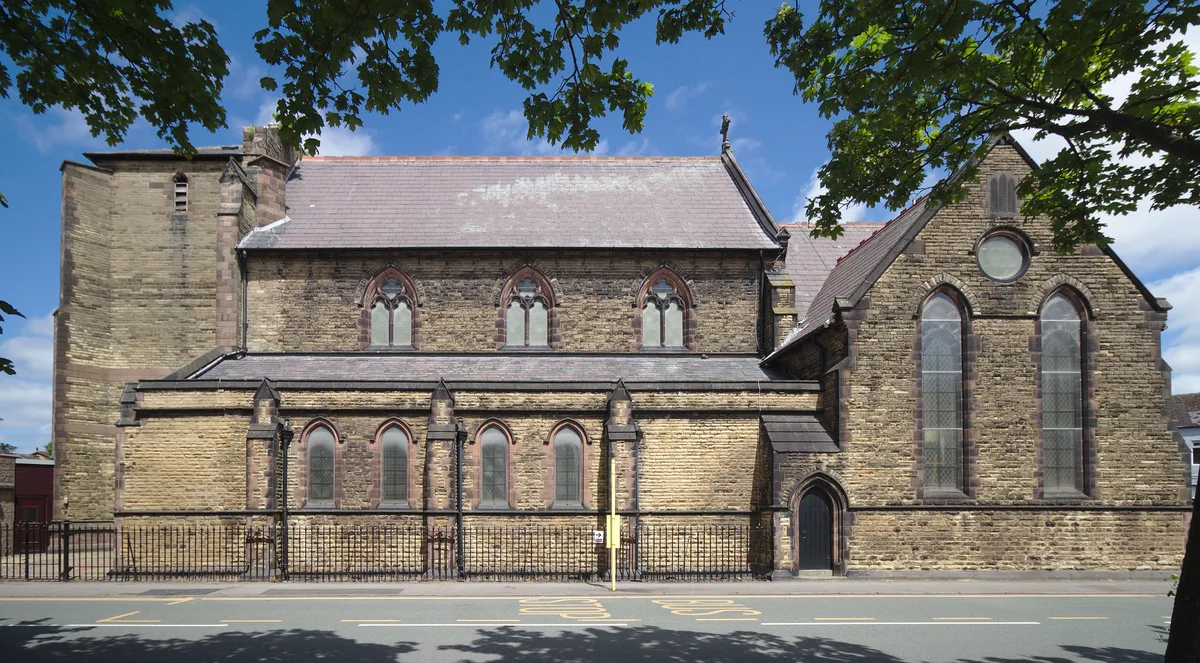
St John the Baptist's Church, Earlestown
St John the Baptist's Church, Earlestown — Anglican church in Earlestown, St Helens, Merseyside, UK.
 📷 3
📷 3Memorials & monuments · North Wales
Earlestown War Memorial
Earlestown War Memorial — Grade II listed building-listed memorial in wales-north, United Kingdom.
 📷 5
📷 5Forts · North Wales
Earlestown Market Cross
Earlestown Market Cross — a martello broad in wales-north, United Kingdom.
 📷 3
📷 3Canal locks · North Wales
Bradley Lock, Sankey Canal
Bradley Lock, Sankey Canal — grade II listed canal lock in Newton-le-Willows, St. Helens, Merseyside, England, UK.
More museums in this region
 📷 4
📷 4Museums · North Wales
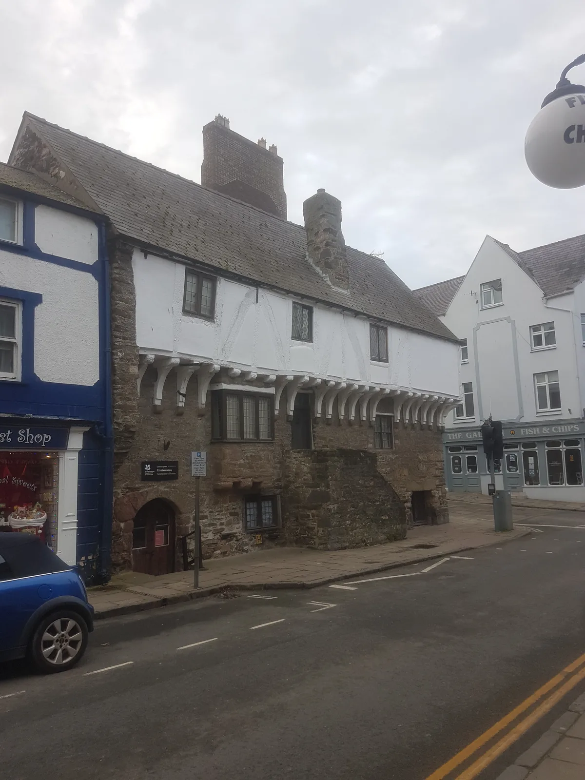
Aberconwy House Museum
Aberconwy House Museum — museum in Betws y Coed.
 📷 3
📷 3Museums · North Wales
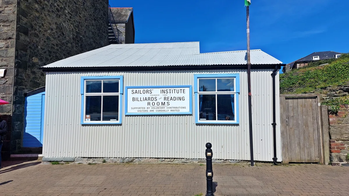
Barmouth Sailors' Institute
Barmouth Sailors' Institute — Community centre, heritage organisation and museum in the Barmouth, Wales, UK.
 📷 3
📷 3Museums · North Wales
British Music Experience
British Music Experience is a museum in the United Kingdom.
 📷 3
📷 3Museums · North Wales
Caernarfon Castle and Town Walls
Caernarfon Castle and Town Walls — part of a World Heritage site in the United Kingdom.
Frequently asked questions
- Where is Earlestown?
- Earlestown is in North Wales, in the United Kingdom — coordinates 53.4500°, -2.6500°.
- Is Earlestown wheelchair accessible?
- Partially — OpenStreetMap notes limited wheelchair access at Earlestown. Check ahead for specific facilities.