Towns & cities · West Midlands
Duntisbourne Abbots
Duntisbourne Abbots — village in Gloucestershire, England, UK.

Wikimedia Commons contributors — see linked file page for photographer and licence licence
Plan your visit
- Typical visit
- 3 h–6 h
- Free entry
- Family-friendly
- Dog-friendly
About
Duntisbourne Abbots is a town, city, village or settlement in the United Kingdom. Recent population estimates put it at around 225 people. Address: GL7. Wikidata describes it as: "village in Gloucestershire, England, UK". Coordinates: 51.7692°, -2.0436°.
Photo gallery
Protected designations
- Area of Outstanding Natural Beauty: Cotswolds
Designations sourced from Natural England open data under OGL v3.
From the Wikipedia article
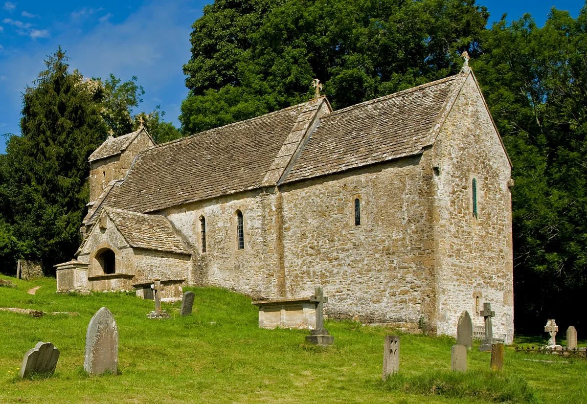
Duntisbourne Abbots is a village and civil parish located in the English county of Gloucestershire. Duntisbourne Abbots forms part of the Cotswold District. The Five Mile House is a 17th-century Grade II listed public house at Old Gloucester Road. It is on the Campaign for Real Ale's National Inventory of Historic Pub Interiors. St Peter's Church in the village was built in the 12th century, on the site of an earlier, Saxon, church. Its tower dates from Norman times, and has belfry lights of pierced stone lattice work that date from the 13th century. Inside the church, the font also dates from Norman times, while the unusual chancel arch dates from an extensive Victorian restoration. It also features in the title of μ-Ziq's 2007 album Duntisbourne Abbots Soulmate Devastation Technique.
Excerpt from Wikipedia under CC BY-SA 4.0. See the source article linked in Sources below.
- Coordinates
- 51.7692, -2.0436
- County
- Gloucestershire
- District
- Cotswold
- Parish
- Duntisbourne Abbots
- Postcode
- GL7
- Parliamentary constituency
- North Cotswolds
- Population
- 225
- Official site
- neighbourhood.statistics.gov.uk
Sources
- wikidata: Q1823825 (CC0)
- wikipedia: Duntisbourne Abbots (CC BY-SA 4.0)
- commons: Davenport House, Duntisbourne Abbots.jpg (CC BY-SA 4.0)
Other places nearby
Loading nearby places…
Nearby
 📷 3
📷 3Memorials & monuments · West Midlands
Unidentified Monument In The Churchyard Approximately 7 Metres South Of Tower To Church Of St Peter
Unidentified Monument In The Churchyard Approximately 7 Metres South Of Tower To Church Of St Peter — Grade II listed building-listed memorial in england-west-midlands, United Kingdom.
 📷 3
📷 3Archaeological sites · West Midlands
Hoar Stone
Hoar Stone — a archaeological in england-west-midlands, United Kingdom.
 📷 4
📷 4Historic houses · West Midlands
Five Mile House
Five Mile House — a Grade II*-listed historic house in england-west-midlands, United Kingdom.
 📷 2
📷 2Burial mounds & barrows · West Midlands
Jack Barrow
Jack Barrow — a burial mound in england-west-midlands, United Kingdom.
Campsites · West Midlands
Jackbarrow Camping
Jackbarrow Camping — a campsite in england west midlands.
 📷 5
📷 5Historic churches · West Midlands
St Michael's Church, Duntisbourne Rouse
St Michael's Church, Duntisbourne Rouse — Grade I listed church in Duntisbourne Rouse, Cotswold, UK.
More towns in this region
 Flagship📷 3
Towns & cities · West Midlands
Adderbury
Adderbury — village and civil parish in Cherwell district, Oxfordshire, England.
 Flagship📷 3
Towns & cities · West Midlands
Admington
Admington — village in Warwickshire, England, UK.
 Flagship📷 3
Towns & cities · West Midlands
Aldington
Aldington — village in Worcestershire, United Kingdom.
 Flagship📷 5
Towns & cities · West Midlands
Anstey
Anstey — large village in Leicestershire, England.
Frequently asked questions
- Where is Duntisbourne Abbots?
- Duntisbourne Abbots is in Gloucestershire, the West Midlands, United Kingdom (postcode GL7), in the parish of Duntisbourne Abbots.
- Is Duntisbourne Abbots a protected site?
- Yes — Duntisbourne Abbots is part of the Cotswolds National Landscape (AONB).
- Is Duntisbourne Abbots free to visit?
- Yes, Duntisbourne Abbots is free to enter.
- How do I get to Duntisbourne Abbots?
- Drivers can navigate to postcode GL7. It sits within the North Cotswolds parliamentary constituency.