Historic churches · Scottish Lowlands
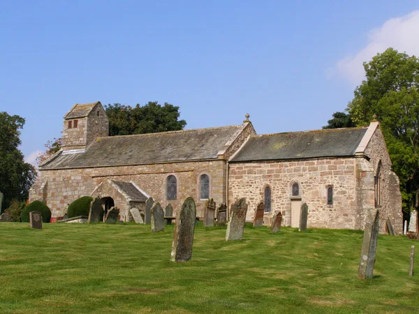
Dunscore Old Kirk
Dunscore Old Kirk — church building in Dumfries and Galloway, Scotland, UK, now demolished.

Wikimedia Commons licence
Plan your visit
- Typical visit
- 30 min–1 h
- Nearest railway station
- Dumfries · 8.3 km
- Free entry
About
Dunscore Old Kirk is a historic church in the United Kingdom. Wikidata describes it as: "church building in Dumfries and Galloway, Scotland, UK, now demolished". Coordinates: 55.1319°, -3.6851°.
Photo gallery
From the Wikipedia article
Dunscore Old Kirk (NGR NX 92661 83241) was a pre-reformation kirk (church) situated on rising ground off a minor road to Merkland, Parish of Dunscore, Dumfriesshire, Dumfries and Galloway, Scotland; about 3 km from Auldgirth. The church was known locally as the Kirk of Dunscore; it lies close to Fardingwell Farm and was between Isle Tower and Ellisland of Robert Burns, in the eastern part of the Civil Parish of Dunscore. No identifiable remains of the church can now be seen. The churchyard, consecrated ground, continues to be used for the inhabitants of the local farms, Isle Tower, Friars Carse, etc.
Excerpt from Wikipedia under CC BY-SA 4.0. See the source article linked in Sources below.
Background
History
About AD1170 the original place of worship was established by a Norman lord. The land was gifted to the Abbey of Holywood by the Cistercian monks of Melrose. The monks played an important part in developing the area by improving the drainage, growing new crops and by promoting animal husbandry at such places the Friars' Carse grange and elsewhere. In AD1257 the first mention of the church occurs in a monastic dispute, and then again in 1412. Clearly shown on Timothy Pont's map of circa 1600 as 'Kirk of Dunscore', In 1645 it was recorded that the church was so ruinous and its position so peripheral to the parish that it was decided to build a new church at what is now known as Dunscore.
Description
The 1855 OS map shows a rectangular grave yard in the fields off a minor road to the north of Fardingwell Farm. A track runs up to the enclosure and ends at a rectangular area next to the 'Laird of Lag's Tomb'. The site is now enclosed within a well built stone wall. Trees are shown encircling the cemetery in 1855. The largest structure is now the mausoleum of the Ferguson family of the nearby Isle Tower. The dedication inscription reads "In memory of Robert Ferguson of Isle Esq. a most worthy gentleman and warm friend: who died the last heir-male of that antient and respectable family on September XVII MDCCLXVII (AD1767) in the LXIX year of his age. This monument is erected by Mrs. Isobel…
Sourced from Wikipedia under CC BY-SA 4.0.
- Coordinates
- 55.1319, -3.6851
- District
- Dumfries and Galloway
- Postcode
- DG2 0RP
- Parliamentary constituency
- Dumfriesshire, Clydesdale and Tweeddale
- Nearest railway station
- Dumfries — 8.3 km
Sources
- wikidata: Q5315673 (CC0)
- wikipedia: Dunscore Old Kirk (CC BY-SA 4.0)
Other places nearby
Loading nearby places…
Nearby
Vineyards · Scottish Lowlands
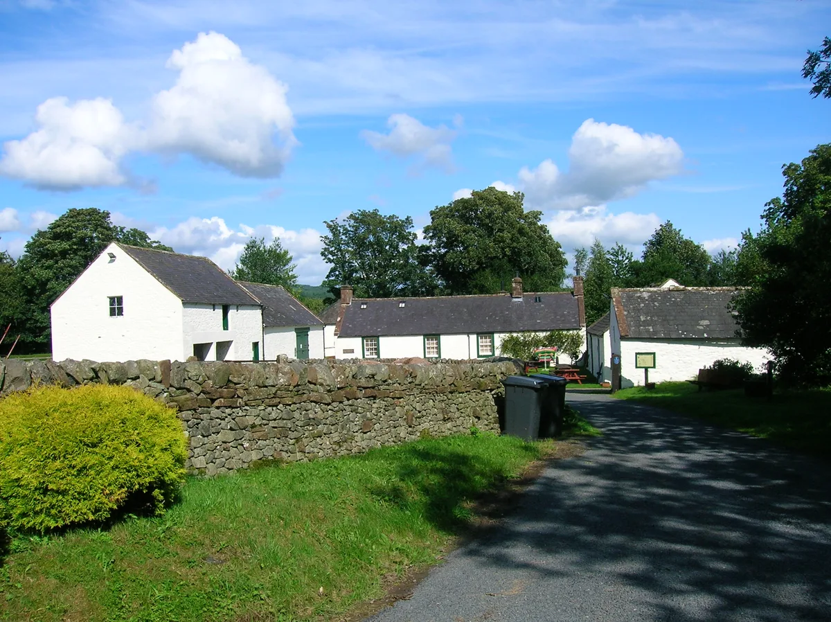
Lagg’s Tomb
Lagg’s Tomb — a UK vineyard in scotland lowlands, producing English or Welsh wine from cool-climate grape varieties.
 📷 3
📷 3Museums · Scottish Lowlands
Ellisland Farm
Ellisland Farm — museum in Dumfries and Galloway, Scotland, UK.
 📷 3
📷 3Public art & sculpture · Scottish Lowlands
Garden of Taking Leave Of Your Senses
Garden of Taking Leave Of Your Senses — a public art in scotland-lowlands, United Kingdom.
📷 3Public art & sculpture · Scottish Lowlands
Nonsense Pavilion
Nonsense Pavilion — a public art in scotland-lowlands, United Kingdom.
📷 3Public art & sculpture · Scottish Lowlands
Quark Walk
Quark Walk — a public art in scotland-lowlands, United Kingdom.
📷 3Public art & sculpture · Scottish Lowlands
Time Garden
Time Garden — a public art in scotland-lowlands, United Kingdom.
More places in this region
 📷 3
📷 3Historic churches · Scottish Lowlands
All Saints Church
All Saints Church — church in Bolton, Cumbria, England, UK.
 📷 3
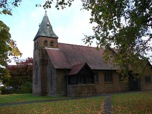
📷 3Historic churches · Scottish Lowlands
All Saints Church, Boltongate
All Saints Church, Boltongate — Grade I listed church in Boltongate, Cumbria, United Kingdom.
 📷 3
📷 3Historic churches · Scottish Lowlands
All Saints Church, Lockerbie
All Saints Church, Lockerbie — church of the Scottish Episcopal Church in Lockerbie, Dumfries and Galloway, Scotland, UK.
 📷 3
📷 3Historic churches · Scottish Lowlands
All Saints' Church
All Saints' Church — grade II listed church in Monkwearmouth, Sunderland, UK.
Frequently asked questions
- Where is Dunscore Old Kirk?
- Dunscore Old Kirk is in the Scottish Lowlands, United Kingdom (postcode DG2 0RP).
- Is Dunscore Old Kirk free to visit?
- Yes, Dunscore Old Kirk is free to enter.
- How do I get to Dunscore Old Kirk?
- Drivers can navigate to postcode DG2 0RP. It sits within the Dumfriesshire, Clydesdale and Tweeddale parliamentary constituency.