Castles · Scottish Lowlands
Dumfries and Galloway
Dumfries and Galloway (Scots: Dumfries an Gallowa; Scottish Gaelic: Dùn Phrìs is Gall-Ghaidhealaibh) is one of the 32 unitary council areas of Scotland, situated in the western part of the Southern Up

Colin Kinnear — CC BY-SA 2.0 via Wikimedia Commons licence
Plan your visit
- Typical visit
- 1.5 h–3 h
- Family-friendly
- Limited wheelchair access
About
Dumfries and Galloway (Scots: Dumfries an Gallowa; Scottish Gaelic: Dùn Phrìs is Gall-Ghaidhealaibh) is one of the 32 unitary council areas of Scotland, situated in the western part of the Southern Uplands. It is bordered by East Ayrshire, South Ayrshire, and South Lanarkshire to the north; the Scottish Borders to the northeast; and the English county of Cumbria, the Solway Firth, and the Irish Sea to the south. To the west, it faces the North Channel. The administrative centre and largest settlement is the town of Dumfries. The second-largest town, Stranraer, lies approximately 76 miles (122 km) west of Dumfries on the North Channel coast. Dumfries and Galloway corresponds to the historic shire counties of Dumfriesshire, Kirkcudbrightshire, and Wigtownshire, the latter two collectively known as Galloway. These three counties were merged in 1975 to form the Dumfries and Galloway Region, which consisted of four districts. The district system was abolished in 1996, when the area became a single unitary authority under the same name. For lieutenancy purposes, Dumfries and Galloway is divided into three ceremonial areas: Dumfries, Wigtown, and the Stewartry of Kirkcudbright, each corresponding broadly to the former historic counties.
Photo gallery
From the Wikipedia article
Dumfries and Galloway (Scots: Dumfries an Gallowa; Scottish Gaelic: Dùn Phrìs is Gall-Ghaidhealaibh) is one of the 32 unitary council areas of Scotland, situated in the western part of the Southern Uplands. It is bordered by East Ayrshire, South Ayrshire, and South Lanarkshire to the north; the Scottish Borders to the northeast; and the English county of Cumbria, the Solway Firth, and the Irish Sea to the south. To the west, it faces the North Channel. The administrative centre and largest settlement is the town of Dumfries. The second-largest town, Stranraer, lies approximately 76 miles (122 km) west of Dumfries on the North Channel coast. Dumfries and Galloway corresponds to the historic shire counties of Dumfriesshire, Kirkcudbrightshire, and Wigtownshire, the latter two collectively known as Galloway. These three counties were merged in 1975 to form the Dumfries and Galloway Region, which consisted of four districts. The district system was abolished in 1996, when the area became a single unitary authority under the same name. For lieutenancy purposes, Dumfries and Galloway is divided into three ceremonial areas: Dumfries, Wigtown, and the Stewartry of Kirkcudbright, each corresponding broadly to the former historic counties.
Excerpt from Wikipedia under CC BY-SA 4.0. See the source article linked in Sources below.
Background
History
The term Dumfries and Galloway has been used since at least the 19th century – by 1911 the three counties had a united sheriffdom under that name. Dumfries and Galloway covers the majority of the western area of the Southern Uplands, it also hosts Scotland's most Southerly point, at the Mull of Galloway in the west of the region.
Sourced from Wikipedia under CC BY-SA 4.0.
- Coordinates
- 55.1000, -3.9000
- District
- Dumfries and Galloway
- Postcode
- DG2 9UD
- Parliamentary constituency
- Dumfries and Galloway
Sources
- wikipedia: Dumfries and Galloway (CC BY-SA 4.0)
Other places nearby
Loading nearby places…
Nearby
Vineyards · Scottish Lowlands
settlement 1000m S of Auchenhay
settlement 1000m S of Auchenhay — a UK vineyard in scotland lowlands, producing English or Welsh wine from cool-climate grape varieties.
 📷 5
📷 5Historic bridges · Scottish Lowlands
Glaisters Bridge
Glaisters Bridge — category B listed building-listed bridge in scotland-lowlands, United Kingdom.
 📷 3
📷 3Memorials & monuments · Scottish Lowlands
Turner's Monument
Turner's Monument — a memorial in scotland-lowlands, United Kingdom.
 📷 5
📷 5Historic bridges · Scottish Lowlands
Corsock Bridge
Corsock Bridge — category B listed building-listed bridge in scotland-lowlands, United Kingdom.
 📷 3
📷 3Chapels · Scottish Lowlands
Chapel, Corsock
Chapel, Corsock — architectural structure in Dumfries and Galloway, Scotland, UK.
 📷 4
📷 4Public art & sculpture · Scottish Lowlands
Standing Figure
Standing Figure — a public art in scotland-lowlands, United Kingdom.
More castles in this region
 📷 3
📷 3Castles · Scottish Lowlands
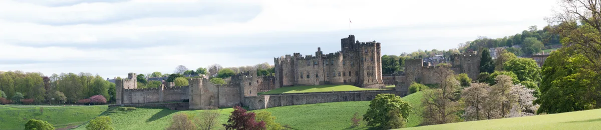
Alnwick Castle
Alnwick Castle — castle and stately home in Alnwick, Northumberland, England, UK; seat of the Duke of Northumberland, England, UK.
 ★ Iconic📷 4
Castles · Scottish Lowlands
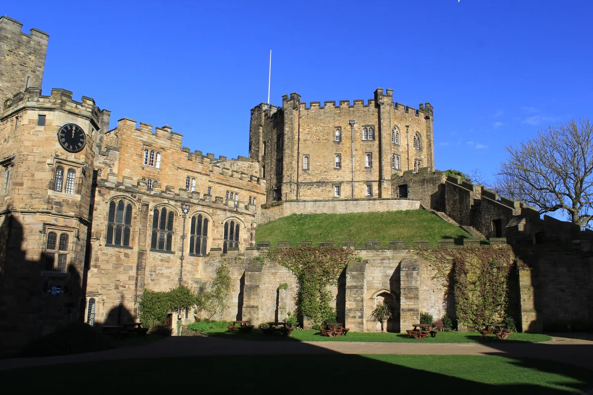
Durham Castle
Durham Castle — Grade I listed historic house museum in Durham, England, UK.
 📷 3
📷 3Castles · Scottish Lowlands
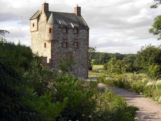
Abbot's Tower
Abbot's Tower — castle in Dumfries and Galloway, Scotland, UK.
 📷 3
📷 3Castles · Scottish Lowlands
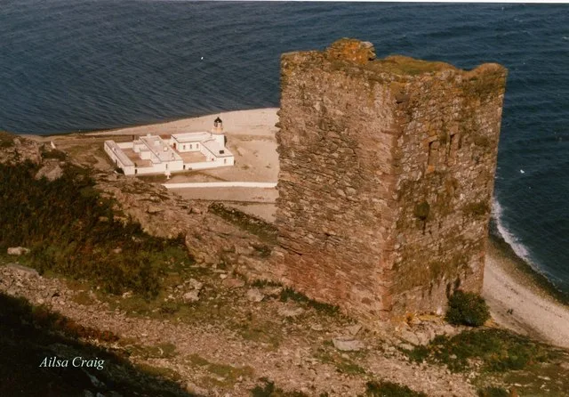
Ailsa Craig Castle
Ailsa Craig Castle — castle in South Ayrshire, Scotland, UK.
Frequently asked questions
- Where is Dumfries and Galloway?
- Dumfries and Galloway is in the Scottish Lowlands, United Kingdom (postcode DG2 9UD).
- Who owns Dumfries and Galloway?
- Dumfries and Galloway is owned by Dumfries and Galloway Council.
- Does Dumfries and Galloway charge admission?
- Dumfries and Galloway typically charges admission. Check the official site for current ticket prices and opening hours.
- How do I get to Dumfries and Galloway?
- Drivers can navigate to postcode DG2 9UD. It sits within the Dumfries and Galloway parliamentary constituency.