Hill forts · Northern Ireland
Drumskinny
Also known as: Droim Scine
Drumskinny — human settlement in Northern Ireland.

Wikimedia Commons contributors — see linked file page for photographer and licence licence
Plan your visit
- Typical visit
- 1 h–2 h
- Free entry
- Family-friendly
- Dog-friendly
About
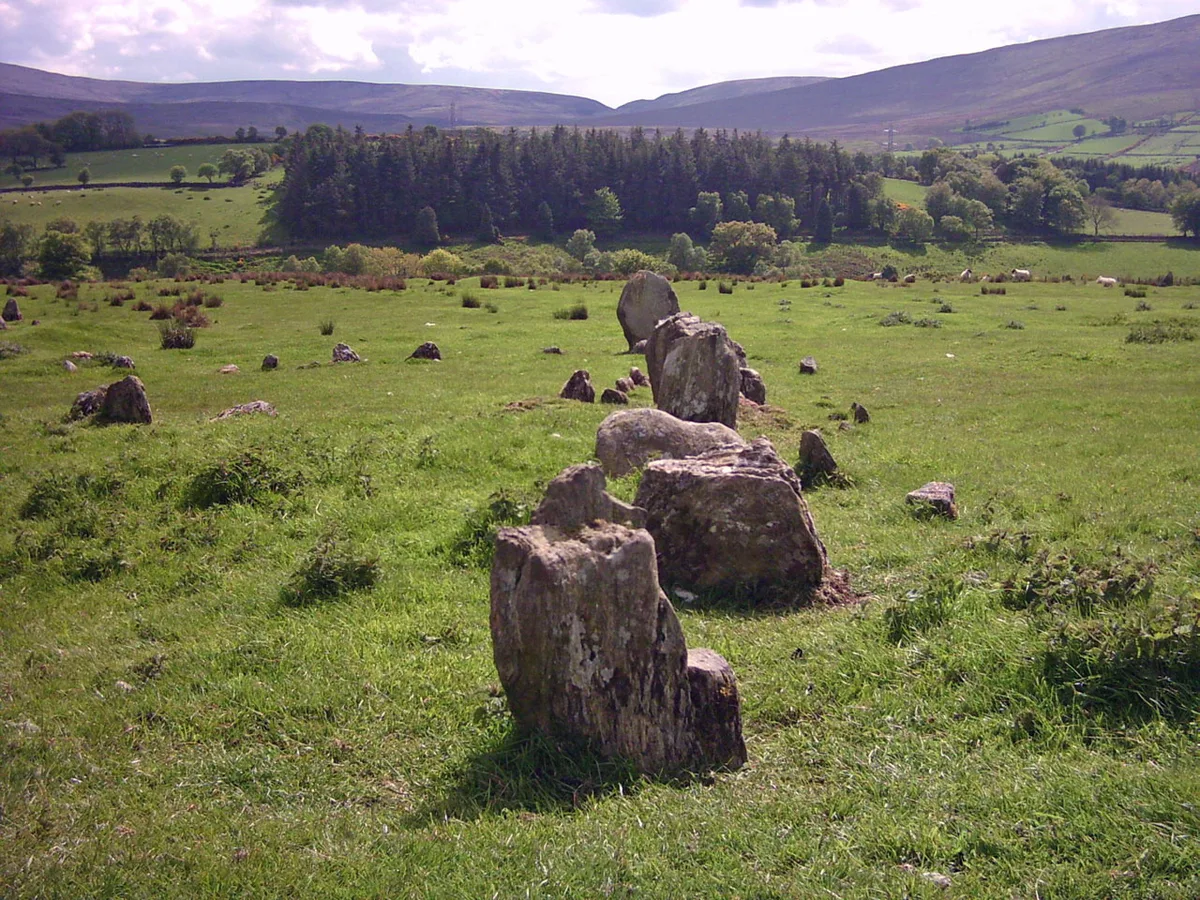
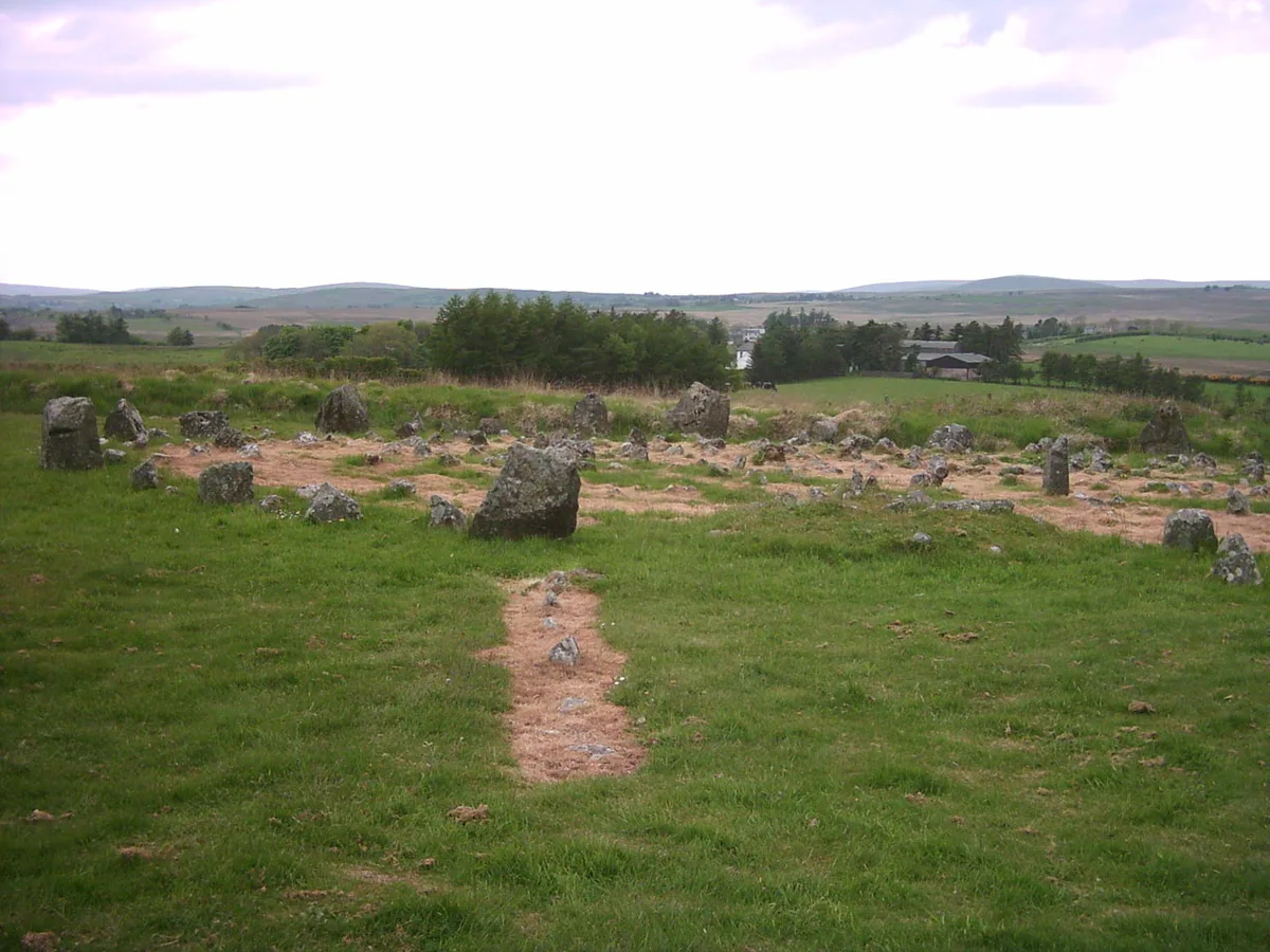
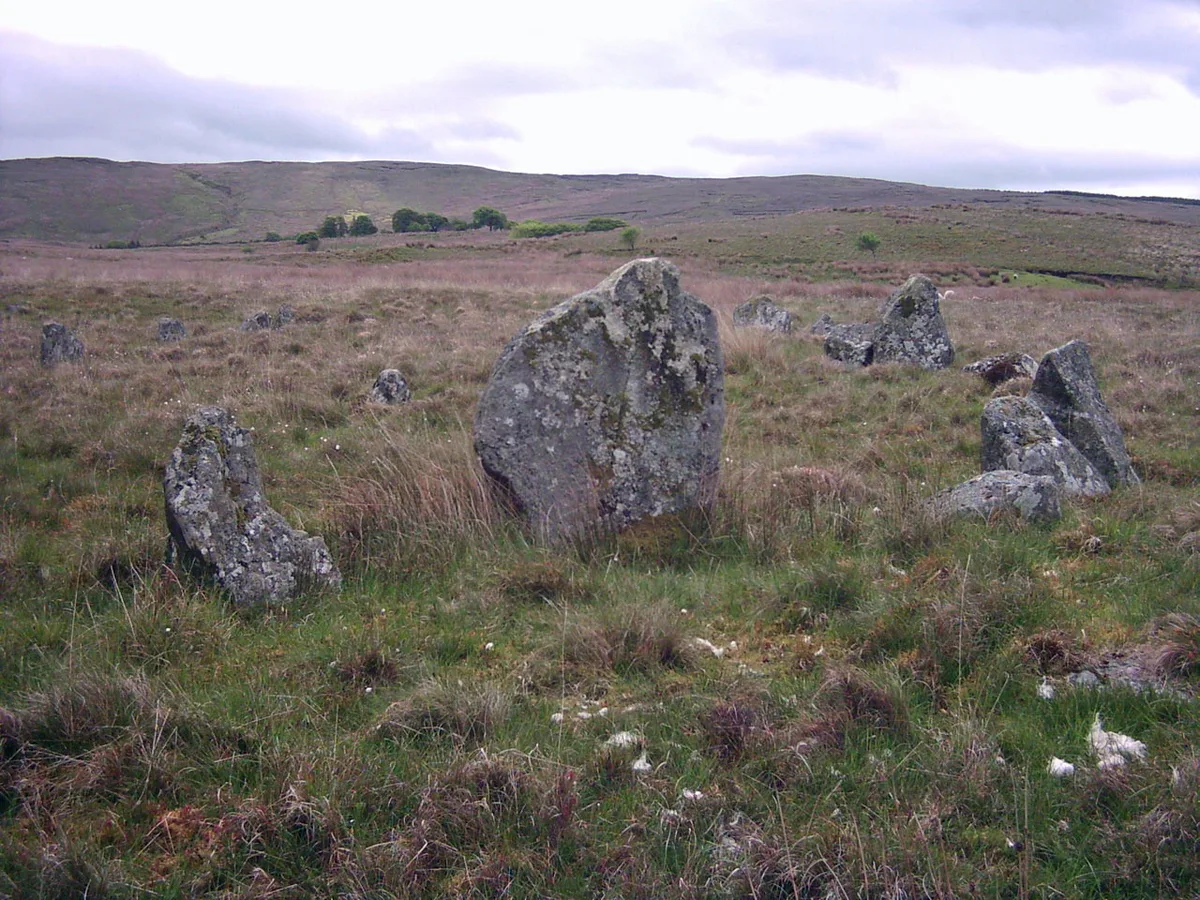
Drumskinny is a hill fort in the United Kingdom. Wikidata describes it as: "human settlement in Northern Ireland". Coordinates: 54.5844°, -7.6905°.
Photo gallery
From the Wikipedia article
Drumskinny (from Irish Droim Scine 'ridge of the knife/edge') is the site of a stone circle in the townland of Drumskinny, County Fermanagh, Northern Ireland. With the inclusion of an adjacent cairn and alignment, the stone circle is a State Care Historic Monument in Fermanagh and Omagh district, at grid ref: H 2009 7072. The site was discovered in 1934 and excavated in 1962 and is believed to have been built around 2000 BC. The circle is 43 feet in diameter and appears to similar to the Beaghmore stone circles found in County Tyrone. Drumskinny originally had 39 stones which ranged in size, thickness and height. There are also two other townlands in Northern Ireland called Drumskinny: in the civil parish of Clonfeacle in County Tyrone; and in the civil parish of Dromore also in County Tyrone.
Excerpt from Wikipedia under CC BY-SA 4.0. See the source article linked in Sources below.
- Coordinates
- 54.5844, -7.6905
- District
- Fermanagh and Omagh
- Postcode
- BT93 1JX
- Parliamentary constituency
- Fermanagh and South Tyrone
Sources
- wikidata: Q1261327 (CC0)
- wikipedia: Drumskinny (CC BY-SA 4.0)
- commons: Drumskinny-stones.jpg (CC BY-SA 4.0)
Other places nearby
Loading nearby places…
Nearby
 📷 3
📷 3Stone circles · Northern Ireland
Drumskinny Stone Circle
Drumskinny Stone Circle — a stone circle in northern-ireland, United Kingdom.
 📷 3
📷 3Mountains & hills · Northern Ireland
Rotten Mountain
Rotten Mountain in Northern Ireland, United Kingdom.
 📷 3
📷 3Memorials & monuments · Northern Ireland
Oghill Round Tower
Oghill Round Tower — a memorial in northern-ireland, United Kingdom.
 📷 3
📷 3Historic houses · Northern Ireland
Ederney Town Hall
Ederney Town Hall in Northern Ireland, United Kingdom.
 📷 3
📷 3Natural landmarks · Northern Ireland
Glendarragh River Picnic Site
Glendarragh River Picnic Site — a other in northern-ireland, United Kingdom.
 📷 4
📷 4Natural landmarks · Northern Ireland
Ederney
Ederney in Northern Ireland, United Kingdom.
More places in this region
 📷 3
📷 3Hill forts · Northern Ireland
Aughlish
Aughlish — archaeological site in County Londonderry, Northern Ireland, England, UK.
 📷 3
📷 3Hill forts · Northern Ireland
Beaghmore
Beaghmore — complex of early Bronze Age megalithic features in Northern Ireland.
 📷 3
📷 3Hill forts · Northern Ireland
Corick
Corick — archaeological site in United Kingdom.
 📷 3
📷 3Hill forts · Northern Ireland
Craig Hill
Craig Hill is a hill fort in the United Kingdom.
Frequently asked questions
- Where is Drumskinny?
- Drumskinny is in Northern Ireland, United Kingdom (postcode BT93 1JX).
- Is Drumskinny free to visit?
- Yes, Drumskinny is free to enter.
- How do I get to Drumskinny?
- Drivers can navigate to postcode BT93 1JX. It sits within the Fermanagh and South Tyrone parliamentary constituency.