Parks · Northern Ireland
Donard Park
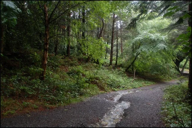
Donard Park in Northern Ireland, United Kingdom.

Eric Jones — CC BY-SA 2.0 via Wikimedia Commons licence
Plan your visit
- Typical visit
- 1 h–2 h
- Free entry
- Family-friendly
- Dog-friendly
About
Donard Park is a place of interest in Northern Ireland, United Kingdom — drawn from open-data sources for visitor reference. See the linked Wikipedia article for the full description.
Photo gallery
From the Wikipedia article
Donard Park is a public park located in Newcastle, County Down, Northern Ireland. It is next to the Glen River, which forms the boundary along one side and is at the foot of Slieve Donard, the highest mountain in Northern Ireland, part of the Mourne Mountains. It is owned and run by Down District Council.
Excerpt from Wikipedia under CC BY-SA 4.0. See the source article linked in Sources below.
Background
History
The park was previously owned by the Annesley family until given over to the people of Newcastle and the local council took responsibility for maintaining it. During World War I members of the 10th Battalion of Royal Irish Rifles were stationed at Donard lodge in the park for training, before being sent to the Somme in France. During World War II members of the U.S. Army 5th infantry division were based in Donard Park in preparation for D-Day. They arrived in late October 1943.
Description
The park features football and hockey pitches and picnic facilities. It is also used as a starting point for ramblers to climb the Mourne Mountains and has a YMCA centre including camping facilities. In 2006 the main entrance and car park were redeveloped and facilities upgraded. There are future plans for retail space and rentable accommodation beside the park. The local council have been petitioned to build a swimming pool in the park and had put in a request for a Northern Ireland National Cycling Velodrome Centre to be built there for the 2012 London Olympics. In 2008 local planners indicated they would not back the construction of the scheme in an area of outstanding natural beauty at…
Sourced from Wikipedia under CC BY-SA 4.0.
- Coordinates
- 54.2040, -5.9030
- District
- Newry, Mourne and Down
- Postcode
- BT33 0GR
- Parliamentary constituency
- South Down
- Opening
- All year | status = Open
- Official site
- www.visitmournemountains.co.uk
Sources
- wikidata: Q5295385 (CC0)
- wikipedia: Donard Park (CC BY-SA 4.0)
Other places nearby
Loading nearby places…
Nearby
 📷 4
📷 4Archaeological sites · Northern Ireland
Donard Forest
Donard Forest is a archaeological site in the United Kingdom.
 📷 3
📷 3Public art & sculpture · Northern Ireland
Cone of Light
Cone of Light — a public art in northern-ireland, United Kingdom.
 📷 3
📷 3Public art & sculpture · Northern Ireland
Global Journeys
Global Journeys — a public art in northern-ireland, United Kingdom.
 📷 3
📷 3Public art & sculpture · Northern Ireland
Midnight Tentacles
Midnight Tentacles — a public art in northern-ireland, United Kingdom.
 📷 3
📷 3Galleries · Northern Ireland
Spy Pond Photo Space
Spy Pond Photo Space — a gallery in northern-ireland, United Kingdom.
 📷 3
📷 3Public art & sculpture · Northern Ireland
Starita
Starita — a public art in northern-ireland, United Kingdom.
More parks in this region
 📷 3
📷 3Parks · Northern Ireland
Alexandra Park, Belfast
Alexandra Park, Belfast — park in United Kingdom.
 📷 5
📷 5Parks · Northern Ireland
Carnfunnock Country Park
Carnfunnock Country Park — park in the United Kingdom.
 📷 3
📷 3Parks · Northern Ireland
Maghery Country Park
Maghery Country Park — park in the United Kingdom.
 📷 5
📷 5Parks · Northern Ireland
Peatlands Park
Peatlands Park — park in the United Kingdom.
Frequently asked questions
- Where is Donard Park?
- Donard Park is in Northern Ireland, United Kingdom (postcode BT33 0GR).
- Who owns Donard Park?
- Donard Park is owned by Down District Council.
- Is Donard Park free to visit?
- Yes, Donard Park is free to enter.
- How do I get to Donard Park?
- Drivers can navigate to postcode BT33 0GR. It sits within the South Down parliamentary constituency.