Mountains & hills · Scottish Lowlands
Dodd
Dodd — Named summit at 502 m.

Wikimedia Commons contributors — see linked file page for photographer and licence licence
Plan your visit
- Typical visit
- 3 h–8 h
- Best time of year
- Late spring – early autumn (May–Oct)
- Nearest railway station
- Threlkeld Quarry Station · 8.7 km
- Free entry
- Dog-friendly
About
Dodd is a named summit in the United Kingdom. Wikidata describes it as: "Named summit at 502 m.". Coordinates: 54.6356°, -3.1721°.
Photo gallery
Protected designations
- Site of Special Scientific Interest: Skiddaw Group SSSI
- Site of Special Scientific Interest: River Derwent and Tributaries SSSI
Designations sourced from Natural England open data under OGL v3.
From the Wikipedia article
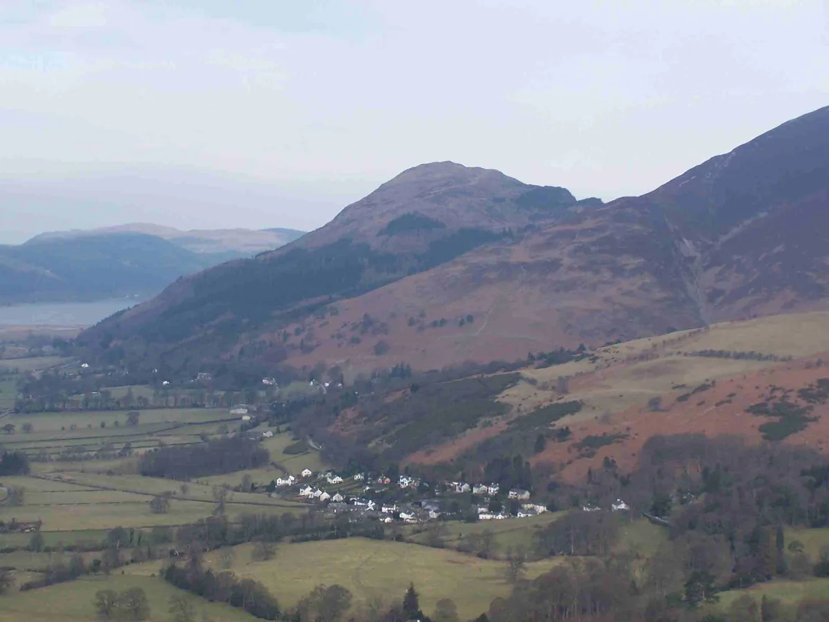
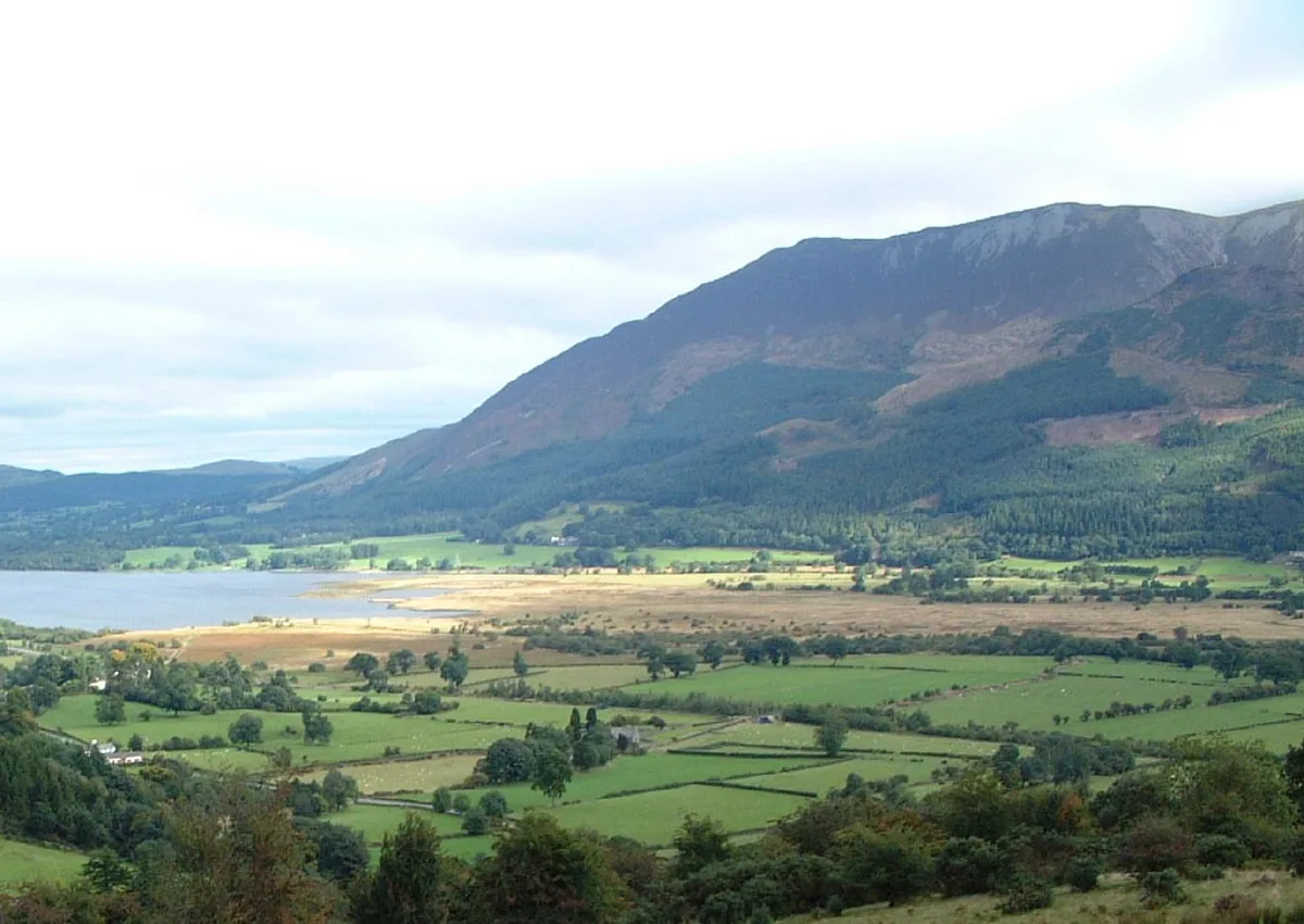
Dodd is a small fell in the Lake District, Cumbria, England, four kilometres north-west of Keswick. It forms part of the Skiddaw range in the northern part of the national park and the slopes are heavily wooded.
Excerpt from Wikipedia under CC BY-SA 4.0. See the source article linked in Sources below.
- Coordinates
- 54.6356, -3.1721
- District
- Cumberland
- Parish
- Underskiddaw
- Postcode
- CA12 4QD
- Parliamentary constituency
- Penrith and Solway
- Nearest railway station
- Threlkeld Quarry Station — 8.7 km
Sources
- osm: n29951965 (ODbL)
- wikipedia: Dodd (Lake District) (CC BY-SA 4.0)
- commons: Dodd from near Keswick.jpg (CC BY-SA 4.0)
Other places nearby
Loading nearby places…
Nearby
 📷 3
📷 3Natural landmarks · Scottish Lowlands
Dodd
Dodd — mountain in United Kingdom.
 📷 3
📷 3Viewpoints · Scottish Lowlands
Osprey Watch
Osprey Watch is a viewpoint in the United Kingdom.
 📷 3
📷 3Natural landmarks · Scottish Lowlands
Long Side
Long Side — mountain in United Kingdom.
 📷 3
📷 3Mountains & hills · Scottish Lowlands
Long Side
Long Side — Named summit at 734 m.
 📷 3
📷 3Mountains & hills · Scottish Lowlands
Carl Side
Carl Side — Named summit at 746.8 m.
 📷 3
📷 3Mountains & hills · Scottish Lowlands
Ullock Pike
Ullock Pike — Named summit at 690.4 m.
More mountains in this region
 📷 3
📷 3Mountains & hills · Scottish Lowlands
Andrewhinney Hill
Andrewhinney Hill — Named summit at 677 m.
 📷 3
📷 3Mountains & hills · Scottish Lowlands
Arbory Hill
Arbory Hill — Named summit at 429 m.
 📷 3
📷 3Mountains & hills · Scottish Lowlands
Auchenton Hill ( East Mount Lowther)
Auchenton Hill ( East Mount Lowther) — Named summit at 631 m.
 📷 3
📷 3Mountains & hills · Scottish Lowlands
Bakestall
Bakestall — Named summit at 673.5 m.
Frequently asked questions
- Where is Dodd?
- Dodd is in the Scottish Lowlands, United Kingdom (postcode CA12 4QD), in the parish of Underskiddaw.
- Is Dodd a protected site?
- Yes — Dodd is part of the Skiddaw Group SSSI Site of Special Scientific Interest and the River Derwent and Tributaries SSSI Site of Special Scientific Interest.
- Is Dodd free to visit?
- Yes, Dodd is free to enter.
- How do I get to Dodd?
- Drivers can navigate to postcode CA12 4QD. It sits within the Penrith and Solway parliamentary constituency.