Canals · South Wales
Crumlin Arm
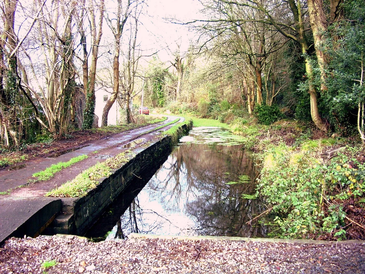
Crumlin Arm — branch of the Monmouthshire & Brecon Canal.

Adrian Dust — CC BY-SA 2.0 via Wikimedia Commons licence
Plan your visit
- Typical visit
- 1 h–2 h
- Nearest railway station
- Newbridge · 1.7 km
- Free entry
- Dog-friendly
About
Crumlin Arm is a canal in the United Kingdom. Heritage designation: National Monuments of Wales. Part of Monmouthshire and Brecon Canal. Wikidata describes it as: "branch of the Monmouthshire & Brecon Canal". Coordinates: 51.6798°, -3.1368°.
Photo gallery
From the Wikipedia article
The Crumlin Arm of the Monmouthshire canal is part of the Monmouthshire & Brecon Canal network in South Wales. It connected Crumlin and its tramways to the Docks at Newport.
Excerpt from Wikipedia under CC BY-SA 4.0. See the source article linked in Sources below.
Background
History
The Crumlin to Abercarn section opened in March 1794 and two years later the branch was open except for Fourteen Locks. It was not until April 1799 that the proprietors (shareholders) declared that the canal was finally complete. The branch was 11 mi long, rising 358 ft through 32 locks.
Sourced from Wikipedia under CC BY-SA 4.0.
- Coordinates
- 51.6798, -3.1368
- District
- Caerphilly
- Parish
- Crumlin
- Postcode
- NP11 5EP
- Parliamentary constituency
- Newport West and Islwyn
- Nearest railway station
- Newbridge — 1.7 km
Sources
- wikidata: Q5190052 (CC0)
- wikipedia: Crumlin Arm (Monmouthshire canal) (CC BY-SA 4.0)
Other places nearby
Loading nearby places…
Nearby
 📷 5
📷 5Historic bridges · South Wales
Crumlin Old Bridge over River Ebbw
Crumlin Old Bridge over River Ebbw — Grade II listed building-listed bridge in wales-south, United Kingdom.
 📷 3
📷 3Gardens · South Wales
Workingman's Institute and Memorial Hall
Workingman's Institute and Memorial Hall — a garden in wales-south, United Kingdom.
 📷 5
📷 5Historic churches · South Wales
Church Of Our Lady Of Peace And Attached Presbytery
Church Of Our Lady Of Peace And Attached Presbytery — Grade II* listed building-listed church in wales-south, United Kingdom.
 📷 5
📷 5Historic churches · South Wales
Beulah Welsh Baptist Chapel
Beulah Welsh Baptist Chapel — Grade II listed building-listed church in wales-south, United Kingdom.
Campsites · South Wales
CRAI Scout Activity Centre
CRAI Scout Activity Centre — a campsite in wales south.
Hostels · South Wales
Lodge
Lodge — a hostel in wales south.
More places in this region
 📷 5
📷 5Canals · South Wales
Glamorganshire Canal
Glamorganshire Canal — Site of Special Scientific Interest in Wales.
 📷 3
📷 3Canals · South Wales
Aberdare Canal
Aberdare Canal is a canal in the United Kingdom.
 📷 3
📷 3Canals · South Wales
Bute Docks Feeder
Bute Docks Feeder — canal in Cardiff, Wales, UK.
.jpg?width=1200) 📷 3
📷 3Canals · South Wales
Monmouthshire and Brecon Canal
Monmouthshire and Brecon Canal — network of canals in South Wales.
Frequently asked questions
- Where is Crumlin Arm?
- Crumlin Arm is in South Wales, United Kingdom (postcode NP11 5EP), in the parish of Crumlin.
- Is Crumlin Arm a listed building?
- Crumlin Arm is officially recognised as National Monuments of Wales listed.
- Is Crumlin Arm free to visit?
- Yes, Crumlin Arm is free to enter.
- How do I get to Crumlin Arm?
- The nearest railway station is Newbridge, about 1.7 km away. Drivers can navigate to postcode NP11 5EP.