Hill forts · South West England
Craddock Moor stone circle
Craddock Moor stone circle — stone circle on Bodmin Moor, Cornwall, England.

Wikimedia Commons contributors — see linked file page for photographer and licence licence
Plan your visit
- Typical visit
- 1 h–2 h
- Nearest railway station
- Liskeard · 8.1 km
- Free entry
- Dog-friendly
About
Craddock Moor stone circle is a hill fort in the United Kingdom. Wikidata describes it as: "stone circle on Bodmin Moor, Cornwall, England". Coordinates: 50.5199°, -4.4717°.
Photo gallery
Protected designations
- Area of Outstanding Natural Beauty: Cornwall
Designations sourced from Natural England open data under OGL v3.
From the Wikipedia article
Craddock Moor Stone Circle or Craddock Moor Circle is a stone circle located near Minions on Bodmin Moor in Cornwall, UK. It is situated around half a mile Northwest of The Hurlers.
Excerpt from Wikipedia under CC BY-SA 4.0. See the source article linked in Sources below.
Background
Description
The circle consists of sixteen fallen stones with one remaining possible stump, all considerably overgrown making it one of the harder circles to find on the moor. John Barnatt has suggested that the circle was situated so that the summit of Brown Willy marked the midsummer sunset. It is nearby to Craddock Moor stone row and an embanked enclosure. Christopher Tilley noted what he called a "possible axis of movement" linking the stone row, an embanked enclosure, the circle and the Hurlers. As these cannot be seen from each other, he commented "It is difficult to imagine how such a striking alignment could occur purely by chance."
Sourced from Wikipedia under CC BY-SA 4.0.
- Coordinates
- 50.5199, -4.4717
- District
- Cornwall
- Parish
- St. Cleer
- Postcode
- PL14 6ED
- Parliamentary constituency
- South East Cornwall
- Nearest railway station
- Liskeard — 8.1 km
Sources
- wikidata: Q5180461 (CC0)
- wikipedia: Craddock Moor stone circle (CC BY-SA 4.0)
- commons: Stone circle on Craddock Moor - geograph.org.uk - 1511039.jpg (CC BY-SA 4.0)
Other places nearby
Loading nearby places…
Nearby
 📷 3
📷 3Historic houses · South West England
Mine Ruins
Mine Ruins — a historic house in england-south-west, United Kingdom.
 📷 3
📷 3Historic houses · South West England
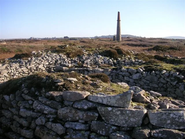
Craddock Moor Mine Engine House
Craddock Moor Mine Engine House — a historic house in england-south-west, United Kingdom.
 📷 3
📷 3Memorials & monuments · South West England
1846 RIL 6
1846 RIL 6 — a memorial in england-south-west, United Kingdom.
 📷 3
📷 3Memorials & monuments · South West England
WB1
WB1 — a memorial in england-south-west, United Kingdom.
 📷 3
📷 3Archaeological sites · South West England
The Hurlers: North circle
The Hurlers: North circle — a archaeological in england-south-west, United Kingdom.
 📷 3
📷 3Caves · South West England
Daniel Gumb's Cave
Daniel Gumb's Cave — a cave in england-south-west, United Kingdom.
More places in this region
 📷 5
📷 5Hill forts · South West England
Ballowall Barrow
Ballowall Barrow — archaeological site in St Just, Cornwall, England, UK.
 📷 5
📷 5Hill forts · South West England
Barnstaple Castle
Barnstaple Castle — castle in Devon, England, UK.
 📷 5
📷 5Hill forts · South West England
Bartinney Castle
Bartinney Castle — Iron Age enclosure in Cornwall, England, UK.
 📷 5
📷 5Hill forts · South West England
Berry's Wood
Berry's Wood — iron Age hill fort in south Devon, England, UK.
Frequently asked questions
- Where is Craddock Moor stone circle?
- Craddock Moor stone circle is in South-West England, United Kingdom (postcode PL14 6ED), in the parish of St. Cleer.
- Is Craddock Moor stone circle a protected site?
- Yes — Craddock Moor stone circle is part of the Cornwall National Landscape (AONB).
- Is Craddock Moor stone circle free to visit?
- Yes, Craddock Moor stone circle is free to enter.
- How do I get to Craddock Moor stone circle?
- Drivers can navigate to postcode PL14 6ED. It sits within the South East Cornwall parliamentary constituency.