Natural landmarks · South West England
Cotswold Way
102-mile National Trail along the Cotswold escarpment from Chipping Campden to Bath.

Jaggery — CC BY-SA 2.0 via Wikimedia Commons licence
Plan your visit
- Typical visit
- 1 h–2 h
- Free entry
- Dog-friendly
About
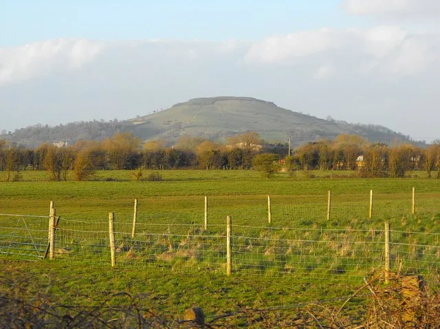
The Cotswold Way is the 102-mile National Trail along the Cotswold escarpment from Chipping Campden to Bath — opened 2007, running south through honey-stone villages, AONB landscape, with sweeping views west across the Severn Vale. Typically walked over 7-10 days.
Photo gallery
From the Wikipedia article
The Cotswold Way is a 102-mile (164 km) long-distance footpath, running along the Cotswold Edge escarpment of the Cotswold Hills in England. It was officially inaugurated as a National Trail on 24 May 2007 and several new rights of way have been created.
Excerpt from Wikipedia under CC BY-SA 4.0. See the source article linked in Sources below.
Background
History
The Cotswold Way route was first suggested some 50 years ago by Gloucestershire-area Ramblers, of which Tony Drake of Cheltenham area and the Cyril Trenfield of the South Gloucestershire area were principals. Although recognised as a suitable route for a National Trail in due course, the path was initially sponsored by Gloucestershire County Council, who had no powers of footpath creation, and so used only existing rights of way. An early guide to the Way, in the hand-drawn pictorial style of Alfred Wainwright, was produced by another Cheltenham-area rambler, Mark Richards, in 1973. The foreword from Tony Drake says:<mapframe latitude="51.733833" longitude="-2.101135" zoom="8" width="394"…
Sourced from Wikipedia under CC BY-SA 4.0.
- Coordinates
- 51.8333, -2.2167
- County
- Gloucestershire
- District
- Gloucester
- Parish
- Gloucester, unparished area
- Postcode
- GL4 6JS
- Parliamentary constituency
- Gloucester
- Official site
- www.ramblers.org.uk
Sources
- manual: cotswold-way (manual)
- wikipedia: Cotswold Way (CC BY-SA 4.0)
Featured in these 2 guides
Other places nearby
Loading nearby places…
Nearby
 📷 3
📷 3Manor houses · West Midlands
Matson House
Matson House — a manor in england-west-midlands, United Kingdom.
 📷 5
📷 5Follies · West Midlands
Roman temple on the Portway
Roman temple on the Portway — a temple folly in england-west-midlands, United Kingdom.
📷 3Manor houses · West Midlands
Robins Farm
Robins Farm — a manor in england-west-midlands, United Kingdom.
 📷 3
📷 3Archaeological sites · West Midlands
Sneedhams Green Moat
Sneedhams Green Moat — a archaeological in england-west-midlands, United Kingdom.
 📷 3
📷 3Manor houses · West Midlands
Grove Court
Grove Court — a manor in england-west-midlands, United Kingdom.
📷 3Manor houses · West Midlands
Little Court
Little Court — a manor in england-west-midlands, United Kingdom.
Other natural landmarks from this era
_(cropped).JPG?width=1200) 📷 5
📷 5Natural landmarks · London
George Stuart White
George Stuart White — Public artwork (statue).
 📷 5
📷 5Natural landmarks · London
Homage to Leonardo
Homage to Leonardo — Public artwork (statue).
 📷 5
📷 5Natural landmarks · London
John Keats
John Keats — Public artwork (statue) by Stuart Williamson.
 📷 5
📷 5Natural landmarks · London
José de San Martín
José de San Martín — Public artwork (statue).
More natural landmarks in this region
 Flagship📷 10
Natural landmarks · South West England
Becky Falls
Dartmoor's 21-metre waterfall and woodland park, with animal encounters for kids.
 📷 5
📷 5Natural landmarks · South West England
Brent Knoll
Brent Knoll — hill on the Somerset Levels, in Somerset, England.
 📷 5
📷 5Natural landmarks · South West England
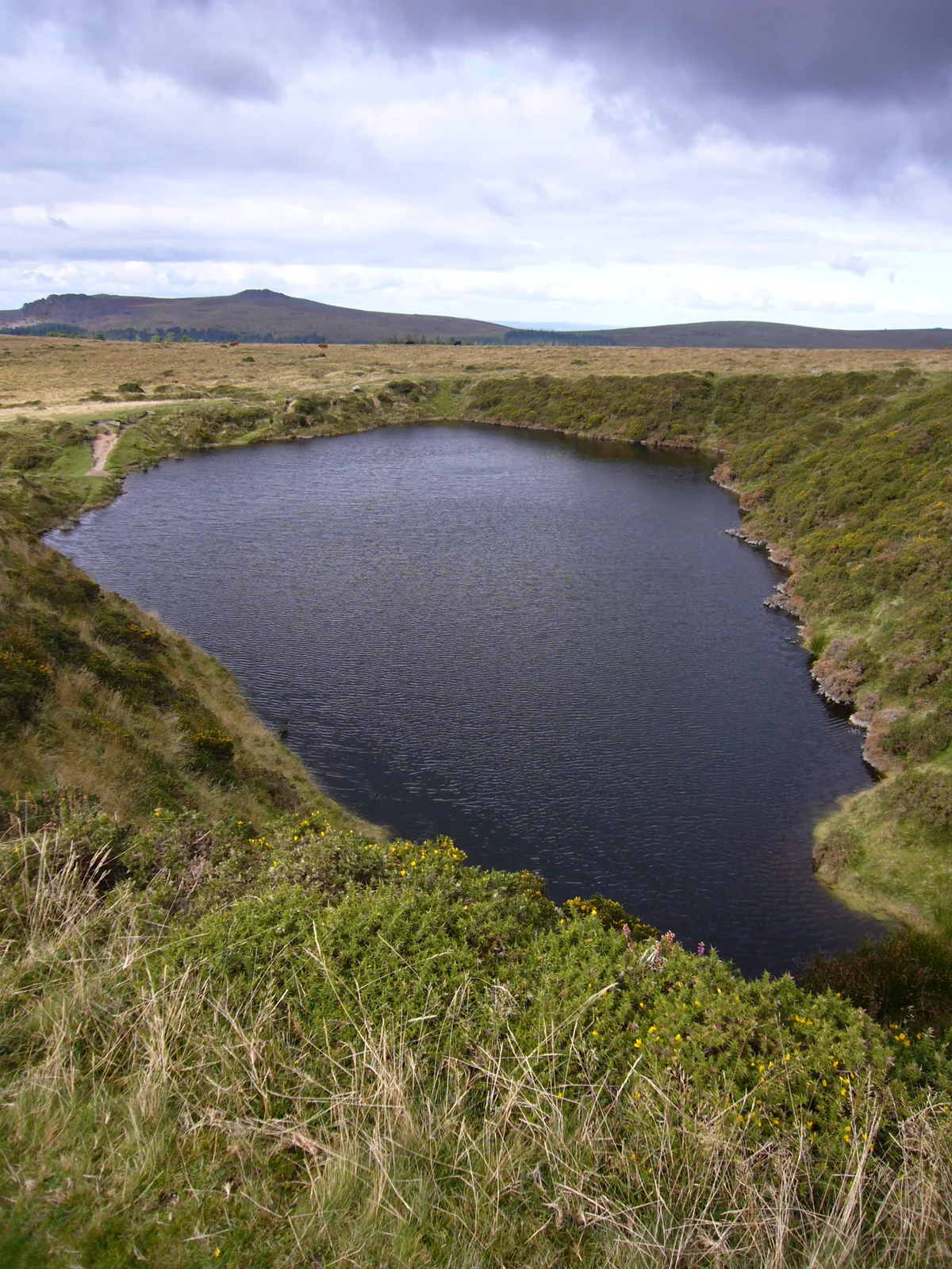
Crazywell Pool
Crazywell Pool — lake in Devon, England, UK.
 📷 5
📷 5Natural landmarks · South West England
Dozmary Pool
Dozmary Pool — lake in Cornwall, England, UK.
Frequently asked questions
- Where is Cotswold Way?
- Cotswold Way is in Gloucestershire, South-West England, United Kingdom (postcode GL4 6JS), in the parish of Gloucester, unparished area.
- When was Cotswold Way built?
- Dates from the modern period.
- Is Cotswold Way free to visit?
- Yes, Cotswold Way is free to enter.
- How do I get to Cotswold Way?
- Drivers can navigate to postcode GL4 6JS. It sits within the Gloucester parliamentary constituency.