Museums · East Midlands
Cotgrave
Cotgrave () is a town and civil parish in the borough of Rushcliffe in Nottinghamshire, England. It is 5 miles (8 km) south-east of Nottingham. It perches on the South Nottinghamshire Wolds about 131

Alan Murray-Rust — CC BY-SA 2.0 via Wikimedia Commons licence
Plan your visit
- Typical visit
- 1.5 h–3 h
- Best time of year
- Year-round
- Family-friendly
- Limited wheelchair access
About
Cotgrave () is a town and civil parish in the borough of Rushcliffe in Nottinghamshire, England. It is 5 miles (8 km) south-east of Nottingham. It perches on the South Nottinghamshire Wolds about 131 feet (40 metres) above sea level. The population of the parish in the 2001 census was 7,373 which then decreased to 7,203 at the 2011 census, though Owthorpe was included. It was estimated at 8,113 in 2019. Statistics from the 2021 census show the population had risen to 8,206.
Photo gallery
From the Wikipedia article
Cotgrave () is a town and civil parish in the borough of Rushcliffe in Nottinghamshire, England. It is 5 miles (8 km) south-east of Nottingham. It perches on the South Nottinghamshire Wolds about 131 feet (40 metres) above sea level. The population of the parish in the 2001 census was 7,373 which then decreased to 7,203 at the 2011 census, though Owthorpe was included. It was estimated at 8,113 in 2019. Statistics from the 2021 census show the population had risen to 8,206.
Excerpt from Wikipedia under CC BY-SA 4.0. See the source article linked in Sources below.
Background
History
Cotgrave's origins may be in the Iron Age. A 6th-century Anglo-Saxon burial ground has been excavated at Mill Hill to the north of the old village. There was certainly a Saxon church a century before the Norman Conquest. The Roman Fosse Way passes a mile to the east, where it changes direction slightly. The A46 follows its course, and during improvements in 2012–13, excavations uncovered Ice Age flint tools. Evidence of an Iron Age settlement was also found at Owthorpe Junction, just to the east, and a 4,000-year-old Neolithic circular monument with eight Bronze Age burials emerged slightly further north at Stragglethorpe junction. The place-name Cotgrave seems to contain an Old English…
Sourced from Wikipedia under CC BY-SA 4.0.
- Coordinates
- 52.9140, -1.0420
- County
- Nottinghamshire
- District
- Rushcliffe
- Parish
- Cotgrave
- Postcode
- NG12 3HL
- Parliamentary constituency
- Rushcliffe
- Official site
- www.cotgrave-tc.gov.uk
Sources
- wikipedia: Cotgrave (CC BY-SA 4.0)
Other places nearby
Loading nearby places…
Nearby
 📷 3
📷 3Historic churches · East Midlands
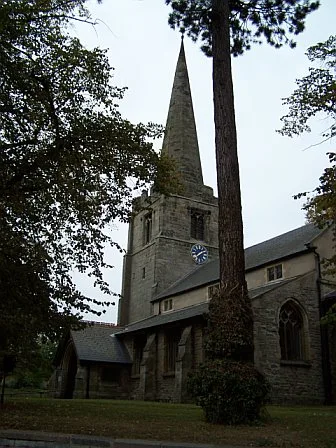
All Saints' Church, Cotgrave
All Saints' Church, Cotgrave — Grade I listed church in Cotgrave, Rushcliffe, Nottinghamshire, England, UK.
B&Bs · East Midlands
Primrose House B&B
Primrose House B&B — a bed-and-breakfast in england east midlands.
 📷 3
📷 3Viewpoints · East Midlands
Windmill Hill
Windmill Hill is a viewpoint in the United Kingdom.
Campsites · East Midlands
Hollygate Scout Camp
Hollygate Scout Camp — a campsite in england east midlands.
 📷 5
📷 5Museums · East Midlands
Borough of Rushcliffe
Rushcliffe is a local government district with borough status in south Nottinghamshire, England. Its council is based in West Bridgford. The borough also includes the towns of Bingham and Cotgrave as
Campsites · East Midlands
Canping & Caravan Club Nottingham Site
Canping & Caravan Club Nottingham Site — a campsite in england east midlands.
More museums in this region
 📷 3
📷 3Museums · East Midlands
6 Former Filter Beds, Water Tank With Gazebo, And Steps At Swithland Reservoir Water Works
6 Former Filter Beds, Water Tank With Gazebo, And Steps At Swithland Reservoir Water Works — architectural ensemble in Quorndon, Charnwood, Leicestershire, England, UK.
 📷 3
📷 3Museums · East Midlands
Abbeydale Industrial Hamlet
Abbeydale Industrial Hamlet — hamlet and industrial museum in Sheffield, UK.
 📷 3
📷 3Museums · East Midlands
Alstonefield Geohut
Alstonefield Geohut — museum in Alstonefield, Staffordshire, England, UK.
 📷 3
📷 3Museums · East Midlands
Ashby de la Zouch Museum
Ashby de la Zouch Museum — local museum in Ashby de la Zouch, Leicestershire, United Kingdom.
Frequently asked questions
- Where is Cotgrave?
- Cotgrave is in East Midlands, in the United Kingdom — coordinates 52.9140°, -1.0420°.
- Is Cotgrave wheelchair accessible?
- Partially — OpenStreetMap notes limited wheelchair access at Cotgrave. Check ahead for specific facilities.