Beaches · South West England
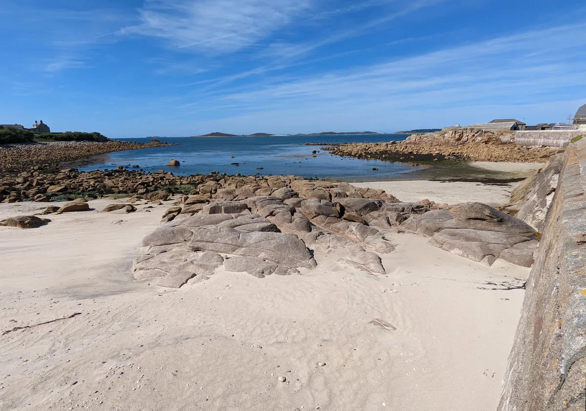
Compass Cove
Compass Cove — Beach (pebblestone).

Humphrey Bolton — CC BY-SA 2.0 via Wikimedia Commons licence
Plan your visit
- Typical visit
- 1 h–3 h
- Best time of year
- Summer (Jun–Aug)
- Free entry
- Family-friendly
- Dog-friendly
About
Compass Cove is a beach on the coast of South-West England. The site is within the Cornwall National Landscape (AONB), and is a designated Site of Special Scientific Interest. It sits within the North Cornwall parliamentary constituency. Postcode area EX23.
Photo gallery
Protected designations
- Site of Special Scientific Interest: Bude Coast SSSI
- Area of Outstanding Natural Beauty: Cornwall
Designations sourced from Natural England open data under OGL v3.
From the Wikipedia article
Operation Compass (also Italian: Battaglia della Marmarica) was the first large British military operation of the Western Desert Campaign (1940–1943) during the Second World War. British metropolitan, Imperial and Commonwealth forces attacked the Italian and Libyan forces of the 10th Army (Marshal Rodolfo Graziani) in western Egypt and Cyrenaica, the eastern province of Libya, from December 1940 to February 1941. The Western Desert Force (WDF) (Lieutenant-General Richard O'Connor) with about 36,000 men, advanced from Mersa Matruh in Egypt on a five-day raid against the Italian positions of the 10th Army, which had about 150,000 troops in fortified posts around Sidi Barrani in Egypt and in Cyrenaica to the west. The WDF swiftly defeated the Italians in their fortified posts and at Sidi Barrani, forced the rest of the 10th Army out of Egypt and captured the ports along the Cyrenaican coast in Libya. The 10th Army was cut off as it retreated towards Tripolitania at the Battle of Beda Fomm, the remnants being pursued to El Agheila on the Gulf of Sirte. The British took over 138,000 Italian and Libyan prisoners, hundreds of tanks, more than a thousand guns and many aircraft. The WDF suffered casualties of 1,900 men killed and wounded, about 10 per cent of the infantry. The WDF was unable to continue beyond El Agheila, due to worn-out vehicles and the diversion in March 1941 of the best-equipped units to conduct Operation Lustre for the Battle of Greece. The Italians rushed reinforcements to Libya to defend Tripoli, assisted by the Deutsches Afrikakorps and the Luftwaffe.
Excerpt from Wikipedia under CC BY-SA 4.0. See the source article linked in Sources below.
Background
Description
The attack on Tummar West began at after the 7th RTR had refuelled and artillery had bombarded the defences for an hour. Another approach from the north-west was made and tanks broke through the perimeter, followed twenty minutes later by the infantry. The defenders held out for longer than the Nibeiwa garrison but by Tummar West was overrun except for the north-eastern corner. The tanks moved on to Tummar East, the greater part of which was captured by nightfall. The 4th Armoured Brigade had advanced to Azziziya, where the garrison of surrendered and light patrols of the 7th Hussars pushed forward to cut the road from Sidi Barrani to Buq Buq, while armoured cars of the 11th Hussars ranged…
Sourced from Wikipedia under CC BY-SA 4.0.
- Coordinates
- 50.8279, -4.5568
- District
- Cornwall
- Parish
- Bude-Stratton
- Postcode
- EX23 8SE
- Parliamentary constituency
- North Cornwall
Sources
- osm: n9660778332 (ODbL)
- wikipedia: Operation Compass (CC BY-SA 4.0)
Other places nearby
Loading nearby places…
Nearby
 📷 3
📷 3Follies · South West England
The Storm Tower
The Storm Tower — Folly or eyecatcher.
 📷 5
📷 5Canal locks · South West England
Post medieval sea lock at Bude Canal
Post medieval sea lock at Bude Canal — lock in Bude-Stratton, Cornwall, England, UK.
 📷 3
📷 3Canal locks · South West England
Sea Lock, Lock Gates And Hand Winches
Sea Lock, Lock Gates And Hand Winches — lock in Bude-Stratton, Cornwall, England, UK.
 📷 3
📷 3Beaches · South West England
Summerleaze Beach
Summerleaze Beach is a beach in the United Kingdom.
 📷 3
📷 3Historic churches · South West England
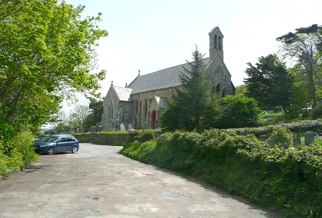
St Michael and All Angels Church, Bude
St Michael and All Angels Church, Bude — grade II listed church in Bude-Stratton, Cornwall, England, UK.
Campsites · South West England
Efford Downs Campsite
Efford Downs Campsite — a campsite in england south west.
More beaches in this region
 📷 5
📷 5Beaches · South West England
Amy's Cove
Amy's Cove is a beach in the United Kingdom.
 📷 5
📷 5Beaches · South West England
Arlo Porth
Arlo Porth is a beach in the United Kingdom.
 📷 5
📷 5Beaches · South West England
Arthur's Beach (Sunny Cove)
Arthur's Beach (Sunny Cove) is a beach in the United Kingdom.
 📷 5
📷 5Beaches · South West England
Ayrmer Cove
Ayrmer Cove is a beach in the United Kingdom.
Frequently asked questions
- Where is Compass Cove?
- Compass Cove is in South-West England, United Kingdom (postcode EX23 8SE), in the parish of Bude-Stratton.
- Is Compass Cove a protected site?
- Yes — Compass Cove is part of the Bude Coast SSSI Site of Special Scientific Interest and the Cornwall National Landscape (AONB).
- Is Compass Cove free to visit?
- Yes, Compass Cove is free to enter.
- How do I get to Compass Cove?
- Drivers can navigate to postcode EX23 8SE. It sits within the North Cornwall parliamentary constituency.