Canals · South West England
Bude Canal
Also known as: Dowrgleudh Porth Bud
Bude Canal — Canal in Cornwall, England.

Wikimedia Commons contributors — see linked file page for photographer and licence licence
Plan your visit
- Typical visit
- 1 h–2 h
- Free entry
- Dog-friendly
- Wheelchair accessible
About
Bude Canal is a canal in the United Kingdom. Wikidata describes it as: "Canal in Cornwall, England". Coordinates: 50.8275°, -4.5479°.
Photo gallery
Protected designations
- Area of Outstanding Natural Beauty: Cornwall
Designations sourced from Natural England open data under OGL v3.
From the Wikipedia article
The Bude Canal was a canal built to serve the hilly hinterland in the Cornwall and Devon border territory in the United Kingdom, chiefly to bring lime-bearing sand for agricultural fertiliser. The Bude Canal system was one of the most unusual in Britain. It was remarkable in using inclined planes to haul tub boats on wheels to the upper levels. There were only two conventional locks, in the short broad canal section near the sea at Bude itself. It had a total extent of 35 miles (56 km), and it rose from sea level to an altitude of 433 feet (132 m). The design of the canal influenced the design of the Rolle Canal.
Excerpt from Wikipedia under CC BY-SA 4.0. See the source article linked in Sources below.
Background
History
The coastal area at Bude has sand unusually rich in minerals, and the poor agricultural land of the locality was found to benefit considerably from application of the sand. In the pre-industrial age, actually transporting it was difficult, even to land relatively close to the coast. | repeal_date = | repealing_legislation = | related_legislation = | status = Current | original_text = https://books.google.co.uk/books?id=WrmXQpgmfMAC&pg=PA410 | collapsed = yes }} Several schemes were put forward for canals to bring the sand to the countryside, and these proposals did not lack ambition. One early scheme, conceived by Cornish engineer John Edyvean, aimed at distributing Welsh coal from the port…
Description
The project: The main line of the canal ran south east from Bude to Druxton Wharf near Launceston, with an easterly branch to Blagdonmoor, beyond Holsworthy. There was a northerly feeder arm leading from a new reservoir at Virworthy, now called Lower Tamar Lake. There were two conventional locks in the short broad canal section, each with a vertical interval of 5 ft. This section terminated at Helebridge, about 2 mi from Bude, and ordinary coastal barges travelled this far up the canal. The tub boats were designed to use the main part of the system, and they generally made the transit from the harbour at Bude, or from Helebridge if trans-shipping from coastal vessels there. After…
Sourced from Wikipedia under CC BY-SA 4.0.
- Coordinates
- 50.8275, -4.5479
- District
- Cornwall
- Parish
- Bude-Stratton
- Postcode
- EX23 8LG
- Parliamentary constituency
- North Cornwall
- Established
- 1823
- Official site
- www.thecastlebude.co.uk
Sources
- wikidata: Q702730 (CC0)
- wikipedia: Bude Canal (CC BY-SA 4.0)
- commons: Bude canal lock 189X.jpg (CC BY-SA 4.0)
Other places nearby
Loading nearby places…
Nearby
 📷 3
📷 3Natural landmarks · South West England
The Old Forge
The Old Forge — a other in england-south-west, United Kingdom.
 📷 5
📷 5Memorials & monuments · South West England
Bude Light
Bude Light is a memorial in the United Kingdom.
 📷 3
📷 3Historic churches · South West England
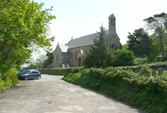
St Michael and All Angels Church, Bude
St Michael and All Angels Church, Bude — grade II listed church in Bude-Stratton, Cornwall, England, UK.
 📷 3
📷 3Memorials & monuments · South West England
Shalder Hill War Memorial
Shalder Hill War Memorial — Grade II listed building-listed memorial in england-south-west, United Kingdom.
 📷 3
📷 3Museums · South West England
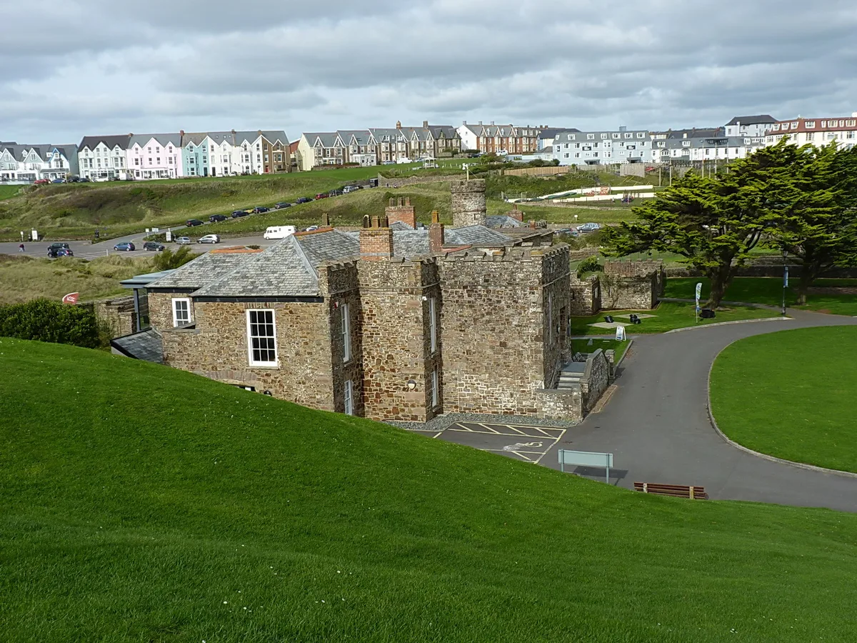
The Castle Heritage Centre
The Castle Heritage Centre — museum in Bude, England, United Kingdom.
.jpg?width=1200) 📷 5
📷 5Chapels · South West England
Central Methodist Chapel
Central Methodist Chapel — chapel in Bude-Stratton, Cornwall, England, UK.
More places in this region
 📷 5
📷 5Canals · South West England
Braunton Canal
Braunton Canal — cut of the River Caen.
 📷 5
📷 5Canals · South West England
Bridgwater and Taunton Canal
Bridgwater and Taunton Canal — Canal in south-west England.
 📷 5
📷 5Canals · South West England
Bristol Feeder Canal
Bristol Feeder Canal is a canal in the United Kingdom.
 📷 5
📷 5Canals · South West England
Cann Quarry Canal
Cann Quarry Canal — former canal in Devon, England.
Frequently asked questions
- Where is Bude Canal?
- Bude Canal is in South-West England, United Kingdom (postcode EX23 8LG), in the parish of Bude-Stratton.
- When was Bude Canal built?
- Built or established in 1823.
- Is Bude Canal a protected site?
- Yes — Bude Canal is part of the Cornwall National Landscape (AONB).
- Is Bude Canal free to visit?
- Yes, Bude Canal is free to enter.
- How do I get to Bude Canal?
- Drivers can navigate to postcode EX23 8LG. It sits within the North Cornwall parliamentary constituency.