Forests & woodlands · Scottish Highlands
Clyde Muirshiel Regional Park
Also known as: Pàirc Roinneil Muirshiel Chluaidh
Clyde Muirshiel Regional Park is a forest or woodland in the United Kingdom.

Wikimedia Commons licence
Plan your visit
- Typical visit
- 1 h–3 h
- Nearest railway station
- Lochwinnoch · 7.5 km
- Free entry
- Family-friendly
- Dog-friendly
About
Clyde Muirshiel Regional Park is a named forest, woodland or nature reserve in the United Kingdom. Also known as: Pàirc Roinneil Muirshiel Chluaidh. Coordinates: 55.8141°, -4.7256°.
Photo gallery
From the Wikipedia article
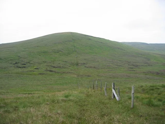
Clyde Muirshiel Regional Park is the collective name for areas of countryside set aside for conservation and recreation on the South Clyde estuary in Scotland. The park covers an area of 280 km2 (110 sq mi) of Inverclyde, North Ayrshire and Renfrewshire, stretching from Greenock in the north, down the coast to Largs and West Kilbride and inland to Dalry and Lochwinnoch. There are three visitor centres within the Park Castle Semple Loch, Muirshiel Country Park and the Greenock Cut (formerly Cornalees Bridge). Muirshiel, a Scots language name, translates to "moorhut" in English.
Excerpt from Wikipedia under CC BY-SA 4.0. See the source article linked in Sources below.
Background
History
Originally a grouse shooting estate, based around Muirshiel House - a shooting lodge among Duchal Moor and Queenside Moor. The estate passed through a number of owners including Lord Howard of Glossop, the Marquess Conyngham. Lord Howard of Glossop sold part of the estate to the county council and to a mining company in the late 1930s and early 1940s. The remainder was sold to Renfrewshire County Council in 1952. A Regional Park designation for the area was first proposed in 1947. However it was 20 years later that Renfrewshire County Council proposed the Renfrewshire Regional Park and implemented a programme to manage an area of 30000 acre including the creation of Muirshiel Country Park…
Description
The Sustrans Lochwinnoch Loop Line cycle track runs through the Castle Semple Loch visitors centre. It is 14 mi long and is part of the Lochs and Glens Route. It follows the National Cycle Route 75 from Paisley Canal Railway Station to Johnstone and then heads southwest to Kilbarchan, Lochwinnoch and Kilbirnie passing Castle Semple, Barr and Kilbirnie Lochs. Being mainly built on an old railway line it has easy gradients and is mostly traffic free. National Cycle Route 753 branches south off Route 75 in Gourock to Lunderston Bay, where it passes the toilets and picnic areas within the park, before it continues along the coast of the bay to terminate at Inverkip War Memorial. Short sections…
Sourced from Wikipedia under CC BY-SA 4.0.
- Coordinates
- 55.8141, -4.7256
- Address
- Inverclyde, North Ayrshire and Renfrewshire
- Nearest railway station
- Lochwinnoch — 7.5 km
- Official site
- clydemuirshiel.co.uk
Sources
- osm: w421685070 (ODbL)
- wikipedia: Clyde Muirshiel Regional Park (CC BY-SA 4.0)
Other places nearby
Loading nearby places…
Nearby
 📷 3
📷 3Mountains & hills · Scottish Highlands
Misty Law
Misty Law — a mountain in scotland-highlands, United Kingdom.
 📷 3
📷 3Mountains & hills · Scottish Highlands
Hill of Stake
Hill of Stake — Named summit at 522 m.
 📷 5
📷 5Forts · Scottish Highlands
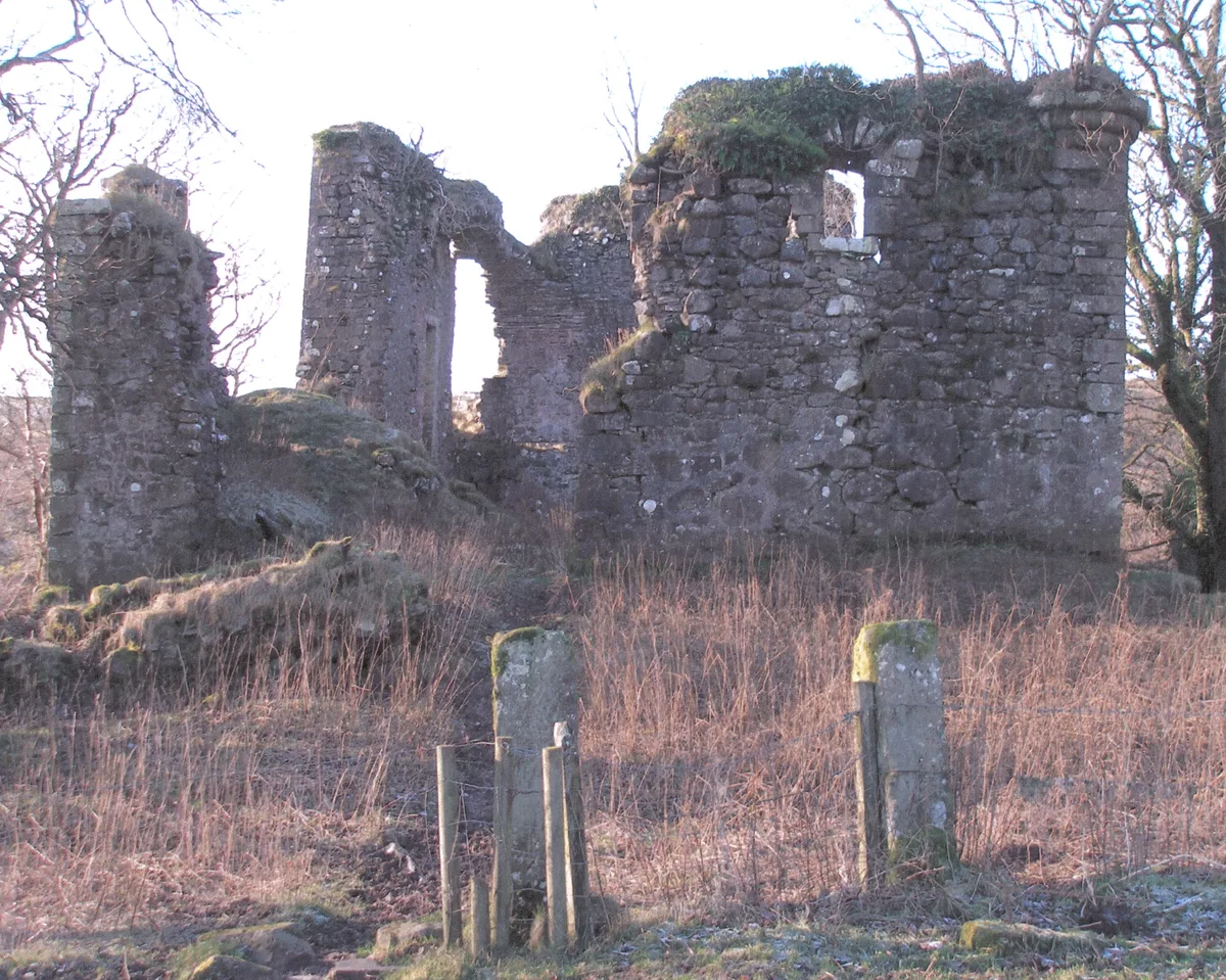
Grave and Monument to Lord Francis Nathaniel Conyngham
Grave and Monument to Lord Francis Nathaniel Conyngham — a martello broad in scotland-highlands, United Kingdom.
 📷 3
📷 3Memorials & monuments · Scottish Highlands
Lord Francis Nathaniel Conyngham Memorial
Lord Francis Nathaniel Conyngham Memorial — a memorial in scotland-highlands, United Kingdom.
 📷 4
📷 4Mountains & hills · Scottish Highlands
Irish Law
Irish Law — a mountain in scotland-highlands, United Kingdom.
 📷 5
📷 5Castles · Scottish Highlands
Glengarnock Castle
Glengarnock Castle — castle in North Ayrshire, Scotland, UK.
More forests in this region
 📷 3
📷 3Forests & woodlands · Scottish Highlands
Abernethy National Nature Reserve
Abernethy National Nature Reserve is a forest or woodland in the United Kingdom.
 📷 5
📷 5Forests & woodlands · Scottish Highlands
Ariundle Oakwood National Nature Reserve
Ariundle Oakwood National Nature Reserve is a forest or woodland in the United Kingdom.
 📷 3
📷 3Forests & woodlands · Scottish Highlands
Balnaguard Glen Nature Reserve
Balnaguard Glen Nature Reserve is a forest or woodland in the United Kingdom.
 📷 5
📷 5Forests & woodlands · Scottish Highlands
Ben Wyvis National Nature Reserve
Ben Wyvis National Nature Reserve is a forest or woodland in the United Kingdom.
Frequently asked questions
- Where is Clyde Muirshiel Regional Park?
- Clyde Muirshiel Regional Park is in the Scottish Highlands, United Kingdom.
- Who owns Clyde Muirshiel Regional Park?
- Clyde Muirshiel Regional Park is owned by | world_heritage_site =.
- Is Clyde Muirshiel Regional Park free to visit?
- Yes, Clyde Muirshiel Regional Park is free to enter.
- How do I get to Clyde Muirshiel Regional Park?
- The nearest railway station is Lochwinnoch, about 7.5 km away.