Hill forts · South Wales
Clegyr Boia
Clegyr Boia — hillfort in Pembrokeshire.

Wikimedia Commons contributors — see linked file page for photographer and licence licence
Plan your visit
- Typical visit
- 1 h–2 h
- Free entry
- Dog-friendly
About
Clegyr Boia is a hill fort in the United Kingdom. Heritage designation: scheduled monument. Wikidata describes it as: "hillfort in Pembrokeshire". Coordinates: 51.8785°, -5.2885°.
Photo gallery
From the Wikipedia article
Clegyr Boia, or Clegyr Fwya, is a prehistoric site on the St David's peninsula, Pembrokeshire, Wales, 33 to 65 feet (10 to 20 m) above the surrounding area. It is about 1 mile (1.6 km) west of St Davids, and about 0.75 miles (1.21 km) east of the Pembrokeshire coast. The hilltop's rocky outcrop contains evidence of Neolithic and Iron Age settlements. The site's nearest water source was Ffynnon Lygaid, a 1 foot (0.30 m) deep pool, fed by a spring. Near the base of the outcrop's southern side, the pool is in a small hollow, measuring about 1 foot (0.30 m) by 8 inches (0.20 m). The site was excavated in 1902 by Sabine Baring-Gould, and by Audrey Williams, for the Ancient Monuments Inspectorate, in 1943. The outcrop became the stronghold of a 6th-century CE Irish pirate named Boia, after whom (with clegyr (English: crag)) it is now called.
Excerpt from Wikipedia under CC BY-SA 4.0. See the source article linked in Sources below.
- Coordinates
- 51.8785, -5.2885
- District
- Pembrokeshire
- Parish
- St. David's and the Cathedral Close
- Postcode
- SA62 6QD
- Parliamentary constituency
- Mid and South Pembrokeshire
- Official site
- coflein.gov.uk
Sources
- wikidata: Q16516438 (CC0)
- wikipedia: Clegyr Boia (CC BY-SA 4.0)
- commons: Clegyr Boia, view east - geograph.org.uk - 738802.jpg (CC BY-SA 4.0)
Other places nearby
Loading nearby places…
Nearby
 📷 3
📷 3Archaeological sites · South Wales
Ring and Bailey
Ring and Bailey — a archaeological in wales-south, United Kingdom.
 📷 3
📷 3Historic houses · South Wales
Lime Kiln Ruins
Lime Kiln Ruins — a historic house in wales-south, United Kingdom.
Campsites · South Wales
Rhosson Ganol
Rhosson Ganol — a campsite in wales south.
Campsites · South Wales
Porthclais Farm Campsite
Porthclais Farm Campsite — a campsite in wales south.
 📷 5
📷 5Historic bridges · South Wales
Pont Cerwyn Dewi
Pont Cerwyn Dewi — Grade II* listed building-listed bridge in wales-south, United Kingdom.
 📷 5
📷 5Harbours & ports · South Wales
Porthclais
Porthclais — harbour in Pembrokeshire, Wales.
More places in this region
 📷 3
📷 3Hill forts · South Wales
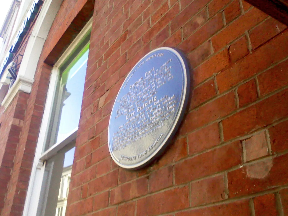
Blestium
Blestium — archaeological site in Monmouth, Wales, UK.
 📷 5
📷 5Hill forts · South Wales
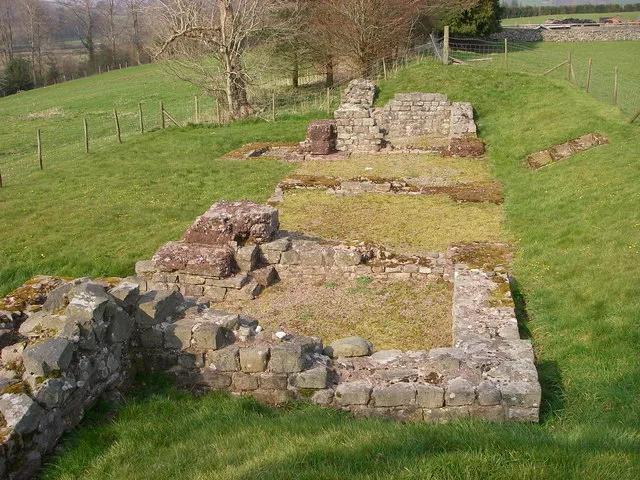
Brecon Gaer Roman Fort
Brecon Gaer Roman Fort — UK archaeological site.
 📷 3
📷 3Hill forts · South Wales
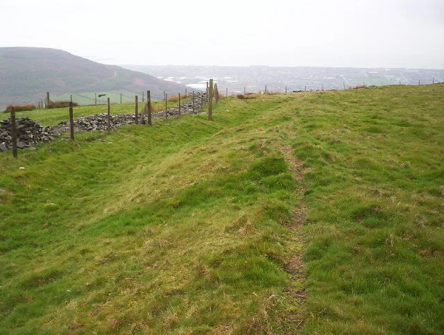
Buarth-y-Gaer
Buarth-y-Gaer — archaeological site in United Kingdom.
 📷 3
📷 3Hill forts · South Wales
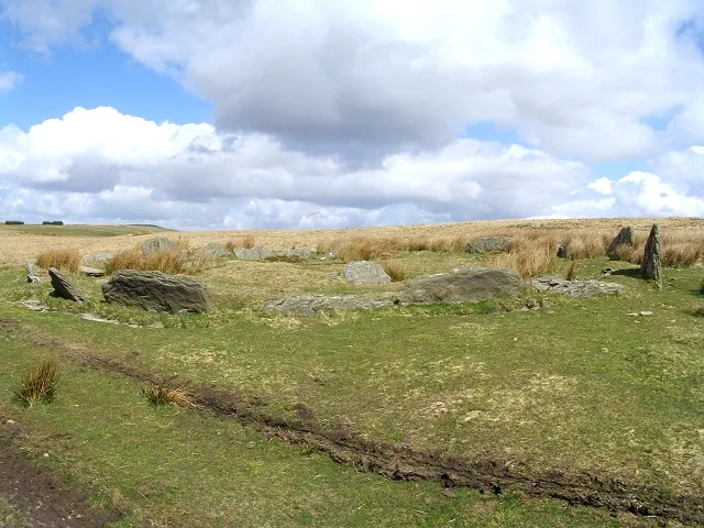
Carn Llechart
Carn Llechart — archaeological site in Neath Port Talbot County Borough, Wales, UK.
Frequently asked questions
- Where is Clegyr Boia?
- Clegyr Boia is in South Wales, United Kingdom (postcode SA62 6QD), in the parish of St. David's and the Cathedral Close.
- Is Clegyr Boia a listed building?
- Clegyr Boia is officially recognised as scheduled monument listed.
- Is Clegyr Boia free to visit?
- Yes, Clegyr Boia is free to enter.
- How do I get to Clegyr Boia?
- Drivers can navigate to postcode SA62 6QD. It sits within the Mid and South Pembrokeshire parliamentary constituency.