Museums · South Wales
Clearwell
Clearwell (anciently "Clower-Wall" etc.) is a village and former ancient manor in the Forest of Dean, West Gloucestershire, England. Situated 3 miles south of Coleford and 2.5 miles east of the Welsh

Helen Steed — CC BY-SA 2.0 via Wikimedia Commons licence
Plan your visit
- Typical visit
- 1.5 h–3 h
- Best time of year
- Year-round
- Family-friendly
- Limited wheelchair access
About
Clearwell (anciently "Clower-Wall" etc.) is a village and former ancient manor in the Forest of Dean, West Gloucestershire, England. Situated 3 miles south of Coleford and 2.5 miles east of the Welsh border (with Monmouthshire), a recent survey indicated that the population of Clearwell is approximately 350. There are mines locally that date back over 7,000 years to the mining of ochre and are known as Clearwell Caves. Later, the Romans mined iron at Clearwell Meend. Iron production expanded in medieval times and peaked in the 16th and 17th centuries, leaving a legacy of fine stone built buildings. Clearwell Castle, a 'mock' castle of Gothic architecture built in 1728, is located in Clearwell.
Photo gallery
From the Wikipedia article
Clearwell (anciently "Clower-Wall" etc.) is a village and former ancient manor in the Forest of Dean, West Gloucestershire, England. Situated 3 miles south of Coleford and 2.5 miles east of the Welsh border (with Monmouthshire), a recent survey indicated that the population of Clearwell is approximately 350. There are mines locally that date back over 7,000 years to the mining of ochre and are known as Clearwell Caves. Later, the Romans mined iron at Clearwell Meend. Iron production expanded in medieval times and peaked in the 16th and 17th centuries, leaving a legacy of fine stone built buildings. Clearwell Castle, a 'mock' castle of Gothic architecture built in 1728, is located in Clearwell.
Excerpt from Wikipedia under CC BY-SA 4.0. See the source article linked in Sources below.
Background
History
The village of Clearwell began as a group of hamlets which coalesced to form the village. It formed around three roads which run down shallow valleys to a central junction. The hamlets on the three roads were Clearwell, Peak, and Platwell, with a fourth hamlet, Wainlete, to the north-west of Clearwell. Clearwell and Platwell had dwellings by around 1300. In 1462 fourteen houses were mentioned at Clearwell and Wainlete, thirteen at Platwell, and sixteen at Peak. Most of the houses that formed Clearwell village were replaced by stone cottages in the late 18th century and the 19th, although several older buildings survive, including the Wyndham Arms which is a substantial 17th-century house.…
Sourced from Wikipedia under CC BY-SA 4.0.
- Coordinates
- 51.7691, -2.6244
- County
- Gloucestershire
- District
- Forest of Dean
- Parish
- Newland
- Postcode
- GL16 8LF
- Parliamentary constituency
- Forest of Dean
Sources
- wikipedia: Clearwell (CC BY-SA 4.0)
Other places nearby
Loading nearby places…
Nearby
 📷 3
📷 3Historic churches · South Wales
Church of St Peter, and 2 Pairs of Gate Piers with Gate
Church of St Peter, and 2 Pairs of Gate Piers with Gate — church in Forest of Dean, UK.
 📷 3
📷 3Castles · South Wales
Clearwell Castle
Clearwell Castle — a castle in wales-south, United Kingdom.
 📷 3
📷 3Natural landmarks · South Wales
Clearwell Caves
Clearwell Caves — a other in wales-south, United Kingdom.
 📷 3
📷 3Natural landmarks · South Wales
Puzzlewood
Puzzlewood — a other in wales-south, United Kingdom.
 📷 3
📷 3Castles · South Wales
Stow Green
Stow Green — castle in St Briavels, Gloucestershire, England, UK.
 📷 3
📷 3Natural landmarks · South Wales
Perrygrove Railway
Perrygrove Railway — a other in wales-south, United Kingdom.
More museums in this region
 📷 3
📷 3Museums · South Wales
Baked Bean Museum of Excellence
Baked Bean Museum of Excellence — food museum in Wales.
 📷 5
📷 5Museums · South Wales
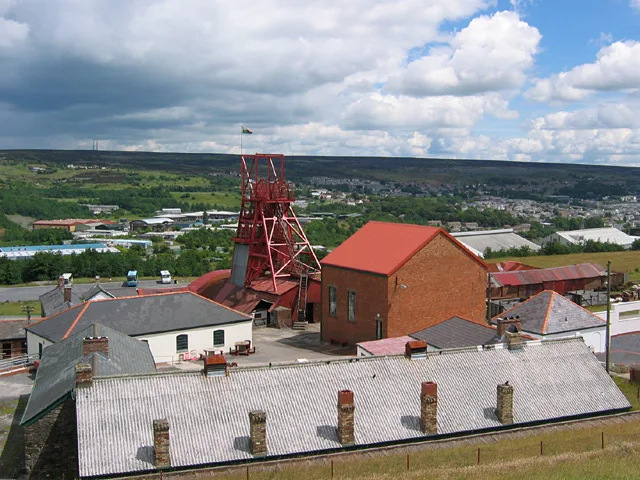
Big Pit National Coal Museum
Big Pit National Coal Museum — former coal mine and industrial heritage museum in Blaenavon in south-east Wales, United Kingdom.
 📷 5
📷 5Museums · South Wales
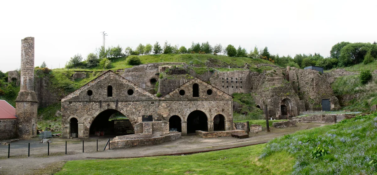
Blaenavon Ironworks
Blaenavon Ironworks — former ironworks transformed into a museum.
 📷 4
📷 4Museums · South Wales
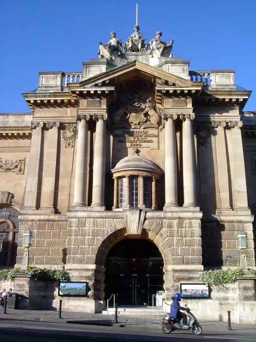
Bristol City Museum & Art Gallery
Bristol City Museum & Art Gallery is a museum in the United Kingdom.
Frequently asked questions
- Where is Clearwell?
- Clearwell is in South Wales, in the United Kingdom — coordinates 51.7691°, -2.6244°.
- Is Clearwell wheelchair accessible?
- Partially — OpenStreetMap notes limited wheelchair access at Clearwell. Check ahead for specific facilities.