Hill forts · South East England
Chiselbury
Chiselbury — site of an Iron Age univallate hillfort located in Wiltshire, England, UK.

Wikimedia Commons contributors — see linked file page for photographer and licence licence
Plan your visit
- Typical visit
- 1 h–2 h
- Nearest railway station
- Tisbury · 7.3 km
- Free entry
- Dog-friendly
About
Chiselbury is a hill fort in the United Kingdom. Heritage designation: scheduled monument. Wikidata describes it as: "site of an Iron Age univallate hillfort located in Wiltshire, England, UK". Coordinates: 51.0522°, -1.9757°.
Photo gallery
Protected designations
- Site of Special Scientific Interest: River Avon System SSSI
- Area of Outstanding Natural Beauty: Cranborne Chase & West Wiltshire Downs
Designations sourced from Natural England open data under OGL v3.
From the Wikipedia article
Chiselbury is the site of an Iron Age univallate hillfort in Wiltshire, England. The hillfort is sub-circular in plan, and encloses an area of approximately 10.5 acres (460,000 sq ft). It is defined by an earthen rampart up to 3.6 metres (12 ft) in height and an external ditch, up to a maximum of 1.6 metres (5.2 ft) in depth. A gap in the south-eastern side of the rampart, and a corresponding causeway across the ditch, is thought to be the original entrance and is associated with a small D-shaped embanked enclosure, which is apparently visible on aerial photographs. Although the enclosure has subsequently been degraded by ploughing, it is still apparent as a series of low earthworks. Limited archaeological investigation of the interior of the hillfort in the early 20th century failed to find any direct traces of occupation. However, outside of the fort some Iron Age pottery and a lead spindle whorl were found. In addition, two Roman coins, one of which dated to the reign of Emperor Constantine I, were said to have been found within the central area. An Iron Age sword and scabbard were also found on the nearby trackway which runs along the ridge top. The hillfort is abutted on both its northern and southern sides by embanked ditches or cross dykes. Their precise function is unknown but the manner in which they cut the ridge suggests that they were intended to prevent movement along it. The Northern Cross dyke, 90 metres (300 ft) in length, ran from the ditch of the hillfort across the top of the ridge before continuing part way down its northern slopes. Although visible in 1928, the section between the hillfort and the edge of the ridge has subsequently been infilled by ploughing, but survives as a buried feature. The Southern Cross dyke, which survives as a discontinuous series of banks and ditches, (sections of which are filled in but survive as buried features) is a total of 180 metres (590 ft) in length. It travels roughly south-south-east from the D-shaped…
Excerpt from Wikipedia under CC BY-SA 4.0. See the source article linked in Sources below.
- Coordinates
- 51.0522, -1.9757
- District
- Wiltshire
- Parish
- Fovant
- Postcode
- SP3 5JE
- Parliamentary constituency
- Salisbury
- Nearest railway station
- Tisbury — 7.3 km
- Official site
- www.fovantbadges.com
Sources
- wikidata: Q5102064 (CC0)
- wikipedia: Chiselbury (CC BY-SA 4.0)
- commons: Chiselbury 8.JPG (CC BY-SA 4.0)
Other places nearby
Loading nearby places…
Nearby
 📷 5
📷 5Public art & sculpture · South East England
6th (City of London) Battalion, the London Regiment (Rifles) (Fovant Badge)
6th (City of London) Battalion, the London Regiment (Rifles) (Fovant Badge) — a public art in england-south-east, United Kingdom.
 📷 5
📷 5Public art & sculpture · South East England
Australian Commonwealth Military Forces (Fovant Badge)
Australian Commonwealth Military Forces (Fovant Badge) — a public art in england-south-east, United Kingdom.
📷 5Public art & sculpture · South East England
Royal Corps of Signals (Fovant Badge)
Royal Corps of Signals (Fovant Badge) — a public art in england-south-east, United Kingdom.
📷 5Public art & sculpture · South East England
The Wiltshire Regiment (Fovant Badge)
The Wiltshire Regiment (Fovant Badge) — a public art in england-south-east, United Kingdom.
📷 5Public art & sculpture · South East England
London Rifle Brigade (Fovant Badge)
London Rifle Brigade (Fovant Badge) — a public art in england-south-east, United Kingdom.
📷 5Public art & sculpture · South East England
Post Office Rifles (Fovant Badge)
Post Office Rifles (Fovant Badge) — a public art in england-south-east, United Kingdom.
More places in this region
 Flagship📷 10
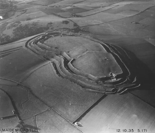
Hill forts · South East England
Castrum Anderitum
Castrum Anderitum — 3rd century Roman fort in the province of Britannia.
 Flagship📷 10
Hill forts · South East England
Maiden Castle
Maiden Castle — Iron Age hill fort in Dorset, England, UK.
 Flagship📷 10
Hill forts · South East England
Portus Adurni
Portus Adurni is a hill fort in the United Kingdom.
 Flagship📷 10
Hill forts · South East England
Richborough Roman Fort
Richborough Roman Fort — Roman fort at Richborough, Ash, United Kingdom.
Frequently asked questions
- Where is Chiselbury?
- Chiselbury is in South-East England, United Kingdom (postcode SP3 5JE), in the parish of Fovant.
- Is Chiselbury a listed building?
- Chiselbury is officially recognised as scheduled monument listed.
- Is Chiselbury a protected site?
- Yes — Chiselbury is part of the River Avon System SSSI Site of Special Scientific Interest and the Cranborne Chase & West Wiltshire Downs National Landscape (AONB).
- Is Chiselbury free to visit?
- Yes, Chiselbury is free to enter.
- How do I get to Chiselbury?
- The nearest railway station is Tisbury, about 7.3 km away. Drivers can navigate to postcode SP3 5JE.