Beaches · South West England
Chesil Beach
Also known as: Chesil Bank
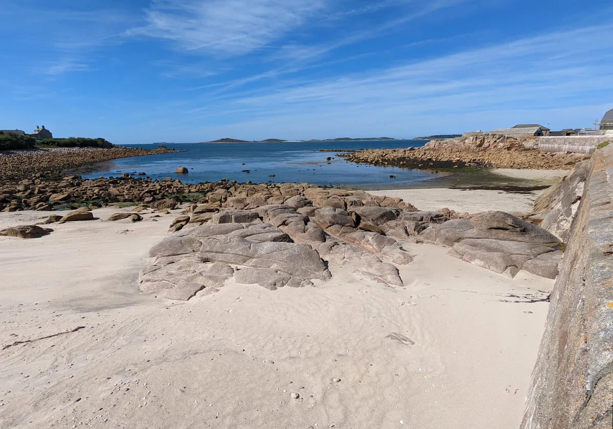
Chesil Beach — Beach (pebblestone).

Wikimedia Commons contributors — see linked file page for photographer and licence licence
Plan your visit
- Typical visit
- 1 h–3 h
- Best time of year
- Summer (Jun–Aug)
- Nearest railway station
- Weymouth · 6.1 km
- Free entry
- Family-friendly
- Dog-friendly
About
Chesil Beach is a named beach on the United Kingdom coastline. Also known as: Chesil Bank. Wikidata describes it as: "Beach (pebblestone).". Coordinates: 50.6153°, -2.5418°.
Photo gallery
Protected designations
- Site of Special Scientific Interest: Chesil & The Fleet SSSI
- Area of Outstanding Natural Beauty: Dorset
- Ramsar wetland: Chesil Beach & the Fleet
Designations sourced from Natural England open data under OGL v3.
From the Wikipedia article
Chesil Beach (also known as Chesil Bank) is a major shingle beach structure in Dorset, England. Behind the beach is the Fleet, a shallow tidal lagoon. The beach runs for a length of 29 kilometres (18 mi) from West Bay to the Isle of Portland and in places is up to 15 metres (50 ft) high and 200 metres (660 ft) wide. The beach is often identified as a tombolo, although research has revealed that it is in fact a barrier beach. Chesil Beach and the Fleet are part of the Jurassic Coast (a UNESCO World Heritage Site) and the Dorset National Landscape (an Area of Outstanding Natural Beauty), and have several conservation designations. Simon Jenkins rates the view of Chesil Beach from Abbotsbury along the coast to Portland Bill as one of the top ten in England. The name Chesil is derived from chessil (Old English ceosel or cisel), meaning "gravel" or "shingle". The beach curves sharply at the eastern end, near the village of Chiswell, and forms Chesil Cove against the cliffs of the Isle of Portland, and this protects the low-lying village from flooding. It has been the scene of many shipwrecks and was named "Dead Man's Bay" by Thomas Hardy. The beach provides shelter from the prevailing winds and waves for the town of Weymouth, Dorset, and the village of Chiswell on Portland.
Excerpt from Wikipedia under CC BY-SA 4.0. See the source article linked in Sources below.
Background
History
There have been many shipwrecks on Chesil Beach, particularly during the age of sail. The beach was particularly dangerous within the English Channel, as it forms an extended lee shore during south-westerly gales. A ship coming up the Channel had to clear Portland Bill to be safe, but the wind and tide would be pushing it northwards into Lyme Bay. When sailing ships were common, a strong string of coastguards were based along the beach, with lookouts and cottages at Chiswell, Wyke Regis, Chickerell, Langton Herring, Abbotsbury, East Bexington, Burton Bradstock and West Bay. At present there are no manned Coastguard lookouts along the beach, with coverage provided when required from the…
Description
From West Bay to Cliff End the beach is piled up against the cliff. At Cliff End a hollow forms behind the beach and at Abbotsbury a stretch of saline (or brackish) water called the Fleet lagoon begins. This is up to 3m in depth. Located in the Upper Fleet, within Abbotsbury Swannery, is Bum Point, and adjacent to this is an artificial island known as Tern Island, which was created to provide a nesting site for common terns. The lagoon is a designated bass nursery area, and the species are frequently seen on an underwater camera connected to the Chesil Beach Visitor Centre. Accordingly, angling for the fish is only permitted in the lower Fleet area, from the Narrows to Ferrybridge, and only…
Visiting
In the novel The Well-Beloved: A Sketch of a Temperament by Thomas Hardy he calls Chesil Beach Deadman's Bay. The Fleet and Chesil Beach feature in the novel Moonfleet by J. Meade Falkner (1898), in which the village of Moonfleet is based on the real village of Fleet. Despite being the setting for the novel, it was not used as a location for the film adaptation Moonfleet (1954) which was filmed entirely in Hollywood, California. Ian McEwan's Booker Prize nominated novel On Chesil Beach is, primarily, set in a hotel overlooking Chesil Beach. In the final sections of the book, there are scenes on Chesil Beach itself. This was adapted into a 2017 film of the same name. The cover of the 1980 UK…
Sourced from Wikipedia under CC BY-SA 4.0.
- Coordinates
- 50.6153, -2.5418
- District
- Dorset
- Parish
- Fleet
- Postcode
- DT3 4ED
- Parliamentary constituency
- West Dorset
- Nearest railway station
- Weymouth — 6.1 km
Sources
- osm: w123227804 (ODbL)
- wikipedia: Chesil Beach (CC BY-SA 4.0)
- commons: Chesil Beach, Isle of Portland, Dorset-9457.jpg (CC BY-SA 4.0)
Featured in this guide
Other places nearby
Loading nearby places…
Nearby
Hotels · South West England
Moonfleet Manor
Moonfleet Manor — a hotel in england south west.
Campsites · South West England
Sea Barn Farm
Sea Barn Farm — a campsite in england south west.
 📷 5
📷 5Towns & cities · South West England
Fleet
Fleet — village and civil parish in Dorset, England.
Campsites · South West England
West Fleet Farm
West Fleet Farm — a campsite in england south west.
Campsites · South West England
Bagwell Farm
Bagwell Farm — a campsite in england south west.
Campsites · South West England
East Fleet Farm Touring Park
East Fleet Farm Touring Park — a campsite in england south west.
More beaches in this region
 📷 5
📷 5Beaches · South West England
Amy's Cove
Amy's Cove is a beach in the United Kingdom.
 📷 5
📷 5Beaches · South West England
Arlo Porth
Arlo Porth is a beach in the United Kingdom.
 📷 5
📷 5Beaches · South West England
Arthur's Beach (Sunny Cove)
Arthur's Beach (Sunny Cove) is a beach in the United Kingdom.
 📷 5
📷 5Beaches · South West England
Ayrmer Cove
Ayrmer Cove is a beach in the United Kingdom.
Frequently asked questions
- Where is Chesil Beach?
- Chesil Beach is in South-West England, United Kingdom (postcode DT3 4ED), in the parish of Fleet.
- Who owns Chesil Beach?
- Chesil Beach is owned by | designation =.
- Is Chesil Beach a protected site?
- Yes — Chesil Beach is part of the Chesil & The Fleet SSSI Site of Special Scientific Interest and the Dorset National Landscape (AONB).
- Is Chesil Beach free to visit?
- Yes, Chesil Beach is free to enter.
- How do I get to Chesil Beach?
- The nearest railway station is Weymouth, about 6.1 km away. Drivers can navigate to postcode DT3 4ED.