Hill forts · Central Scotland
Castle Greg
Castle Greg — archaeological site of a Roman fort in West Lothian, Scotland, UK.

Wikimedia Commons contributors — see linked file page for photographer and licence licence
Plan your visit
- Typical visit
- 1 h–2 h
- Nearest railway station
- West Calder · 5.1 km
- Free entry
- Dog-friendly
About
Castle Greg is a hill fort in the United Kingdom. Heritage designation: scheduled monument. Wikidata describes it as: "archaeological site of a Roman fort in West Lothian, Scotland, UK". Coordinates: 55.8171°, -3.5172°.
Photo gallery
From the Wikipedia article
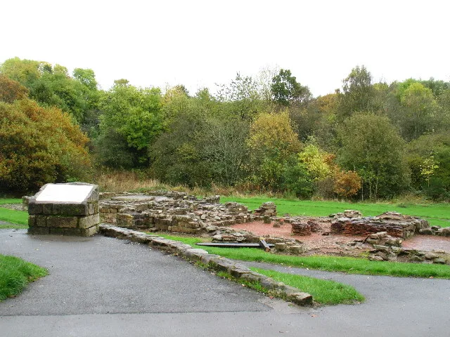
Castle Greg is the archaeological remains of a Roman fortlet in Harburn on the Camilty Plantation, approximately three miles south-east of West Calder, West Lothian, in Scotland. The site is less than an acre in size, and lies just off the B7008. It is one of the best preserved Roman earthworks in the country and was first excavated in the 19th century by Sir Daniel Wilson, the interior excavation having taken place in 1852. The remains take the form of two defensive ditches protecting a clearly visible rectangular rampart. Originally, these ditches would have been at least fifteen feet in depth. The rampart behind the ditches still stands up to five feet high in places, though obviously, this would have been far higher when the fortlet was in use. On the rampart stood a wooden palisade, at least ten feet high, with a walkway running the length of the fortlet. There is an entrance through the rampart at the eastern end, over which would have stood a wooden tower attached to the walkway. Very little remains of the flat interior of the fortlet, although it is known that within there would have been two rows of barracks, between which there was a well. There would also have been a stable block. During the 1852 excavation of the interior, pottery was discovered from the well between the two barracks. Castle Greg was a most likely used as a monitoring base for an east–west road running along the foot of the nearby Pentlands, from the Forth to the Clyde Valley. Although the fortlet currently commands no long-distance views, during the 1st century AD, when the fort was in use, the surrounding countryside was not forested, and Castle Greg would have been able to view clearly up to the Fife coastline and the mountains beyond. The name Castle Greg is possibly derived from the Roman name Camulosessa Præsidium, from nearby Camilty, itself derived from Camulos Tref – literally, village of Camulos.
Excerpt from Wikipedia under CC BY-SA 4.0. See the source article linked in Sources below.
- Coordinates
- 55.8171, -3.5172
- District
- West Lothian
- Postcode
- EH55 8RX
- Parliamentary constituency
- Livingston
- Nearest railway station
- West Calder — 5.1 km
Sources
- wikidata: Q5050099 (CC0)
- wikipedia: Castle Greg (CC BY-SA 4.0)
- commons: Castle Greg. - geograph.org.uk - 89231.jpg (CC BY-SA 4.0)
Other places nearby
Loading nearby places…
Nearby
 📷 3
📷 3Castles · Central Scotland
Castle Greg Roman Fortlet
Castle Greg Roman Fortlet — a castle in scotland-central, United Kingdom.
 📷 3
📷 3Archaeological sites · Central Scotland
Mine
Mine — a archaeological in scotland-central, United Kingdom.
 📷 3
📷 3Memorials & monuments · Central Scotland
Monument to Charles X of France
Monument to Charles X of France — a memorial in scotland-central, United Kingdom.
📷 5Memorials & monuments · Central Scotland
Monument, Harburn House
Monument, Harburn House — category B listed building-listed memorial in scotland-central, United Kingdom.
 📷 3
📷 3Reservoirs & lochs · Central Scotland
Crosswood Reservoir
Crosswood Reservoir — reservoir in West Lothian, Scotland, UK.
 📷 3
📷 3Reservoirs & lochs · Central Scotland
Cobbinshaw Reservoir
Cobbinshaw Reservoir — lake in West Lothian, Scotland, UK.
More places in this region
 Flagship📷 4
Hill forts · Central Scotland
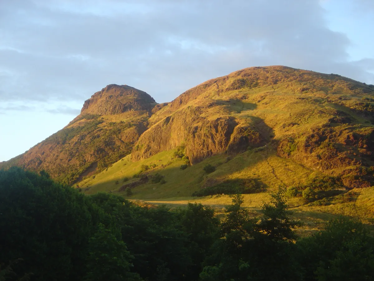
Holyrood Park
Holyrood Park — park in Edinburgh, Scotland, UK.
 📷 3
📷 3Hill forts · Central Scotland
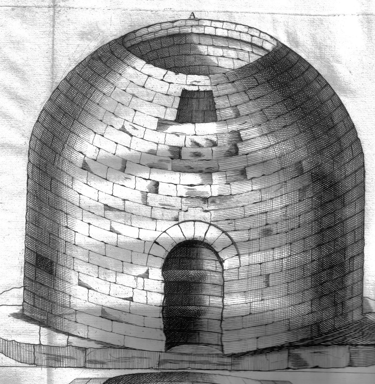
Arthur's O'on temple
Arthur's O'on temple — probable Roman temple near Falkirk, Scotland, destroyed in 1743.
 📷 5
📷 5Hill forts · Central Scotland
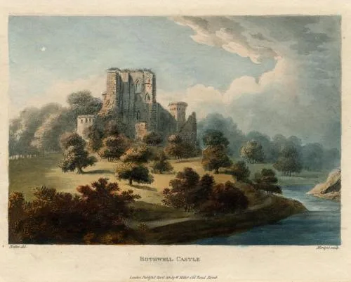
Bothwell Castle
Bothwell Castle — castle in South Lanarkshire, Scotland, UK.
 📷 3
📷 3Hill forts · Central Scotland
Bothwellhaugh Roman Fort
Bothwellhaugh Roman Fort — architectural structure in North Lanarkshire, Scotland, UK.
Frequently asked questions
- Where is Castle Greg?
- Castle Greg is in central Scotland, United Kingdom (postcode EH55 8RX).
- Is Castle Greg a listed building?
- Castle Greg is officially recognised as scheduled monument listed.
- Is Castle Greg free to visit?
- Yes, Castle Greg is free to enter.
- How do I get to Castle Greg?
- The nearest railway station is West Calder, about 5.1 km away. Drivers can navigate to postcode EH55 8RX.