Archaeological sites · North West England
Castle Folds Romano-British defended stone hut circle settlement and medieval shieling
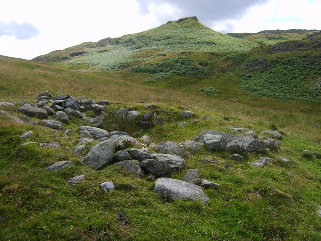
Castle Folds Romano-British defended stone hut circle settlement and medieval shieling — Romano-British walled settlement in Asby, Westmorland and Furness, Cumbria, England, UK.

Wikimedia Commons contributors — see linked file page for photographer and licence licence
Plan your visit
- Typical visit
- 45 min–1.5 h
- Free entry
- Dog-friendly
About
Castle Folds Romano-British defended stone hut circle settlement and medieval shieling is an archaeological site in the United Kingdom. Heritage designation: scheduled monument. Wikidata describes it as: "Romano-British walled settlement in Asby, Westmorland and Furness, Cumbria, England, UK". Coordinates: 54.4781°, -2.5416°.
Photo gallery
Protected designations
- Site of Special Scientific Interest: Great Asby Scar SSSI
- Site of Special Scientific Interest: River Eden and Tributaries SSSI
- National Nature Reserve: GREAT ASBY SCAR
- Area of Outstanding Natural Beauty: North Pennines
Designations sourced from Natural England open data under OGL v3.
From the Wikipedia article
Castle Folds or Castlesteads was a Romano-British walled settlement on Great Asby Scar – an area of limestone pavement in the parish of Asby, Cumbria, England. In medieval times, it was used as a shieling – a temporary summer shelter. It is now in ruins but is protected as a scheduled monument.
Excerpt from Wikipedia under CC BY-SA 4.0. See the source article linked in Sources below.
Background
Architecture
The settlement covered most of a small knoll on the limestone pavement of the scar. A walled enclosure surrounded most of the knoll and, on the western side, the eight-foot thick walls extended the steep escarpment of the knoll to form a significant obstacle. The area enclosed is about 1.25 acres. There were about a dozen stone huts built into the walls of the enclosure so that the central space was open. The wall was constructed from orthostats – standing stone slabs – which enclosed rubble. A parapet would have made the wall's height about thirteen feet in total – comparable with a standard Roman vallum. The construction of the walls and huts is not Roman in pattern and R. G. Collingwood…
Sourced from Wikipedia under CC BY-SA 4.0.
- Coordinates
- 54.4781, -2.5416
- District
- Westmorland and Furness
- Parish
- Orton
- Postcode
- CA10 3SQ
- Parliamentary constituency
- Westmorland and Lonsdale
Sources
- wikidata: Q17651077 (CC0)
- wikipedia: Castle Folds (CC BY-SA 4.0)
- commons: Castlefolds, Great Asby Scar - geograph.org.uk - 612587.jpg (CC BY-SA 4.0)
Other places nearby
Loading nearby places…
Nearby
 📷 3
📷 3Castles · North West England
Castle Folds
Castle Folds — a castle in england-north-west, United Kingdom.
 📷 3
📷 3Forests & woodlands · North West England
Great Asby Scar National Nature Reserve
Great Asby Scar National Nature Reserve is a forest or woodland in the United Kingdom.
Archaeological sites · North West England
Friar Biggins monastic grange
Friar Biggins monastic grange — a archaeological in england-north-west, United Kingdom.
 📷 4
📷 4Other places · North East England
Sunbiggin
Sunbiggin in England North East, United Kingdom.
 📷 4
📷 4Stone circles · North East England
Gamelands stone circle
Gamelands stone circle in England North East, United Kingdom.
Memorials & monuments · North West England
Beacon Monument
Beacon Monument — a memorial in england-north-west, United Kingdom.
More archaeological sites in this region
 📷 3
📷 3Archaeological sites · North West England
Chapel Hill Motte, Arkholme
Chapel Hill Motte, Arkholme — archaeological site in Arkholme-with-Cawood, Lancaster, England, UK.
 📷 3
📷 3Archaeological sites · North West England
Dike, circles and cairns on Bleaberry Haws
Dike, circles and cairns on Bleaberry Haws — Scheduled Monument in the parish of Torver, Cumbria, England, UK.
 📷 3
📷 3Archaeological sites · North West England
Fother Royd Wood
Fother Royd Wood is a archaeological site in the United Kingdom.
 📷 5
📷 5Archaeological sites · North West England
Giggle Alley
Giggle Alley — woodland in Eskdale Green, England.
Frequently asked questions
- Where is Castle Folds Romano-British defended stone hut circle settlement and medieval shieling?
- Castle Folds Romano-British defended stone hut circle settlement and medieval shieling is in North-West England, United Kingdom (postcode CA10 3SQ), in the parish of Orton.
- Is Castle Folds Romano-British defended stone hut circle settlement and medieval shieling a listed building?
- Castle Folds Romano-British defended stone hut circle settlement and medieval shieling is officially recognised as scheduled monument listed.
- Is Castle Folds Romano-British defended stone hut circle settlement and medieval shieling a protected site?
- Yes — Castle Folds Romano-British defended stone hut circle settlement and medieval shieling is part of the Great Asby Scar SSSI Site of Special Scientific Interest and the River Eden and Tributaries SSSI Site of Special Scientific Interest.
- How do I get to Castle Folds Romano-British defended stone hut circle settlement and medieval shieling?
- Drivers can navigate to postcode CA10 3SQ. It sits within the Westmorland and Lonsdale parliamentary constituency.