Castles · North West England
Carrbrook
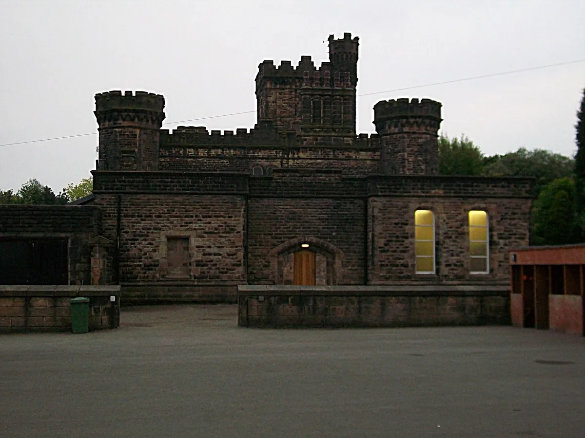
Carrbrook is a village east of Stalybridge, in Greater Manchester, England. Historically part of Cheshire, the area still has many seventeenth and eighteenth-century buildings. Much of the late-ninete

JThomas — CC BY-SA 2.0 via Wikimedia Commons licence
Plan your visit
- Typical visit
- 1.5 h–3 h
- Family-friendly
- Limited wheelchair access
About
Carrbrook is a village east of Stalybridge, in Greater Manchester, England. Historically part of Cheshire, the area still has many seventeenth and eighteenth-century buildings. Much of the late-nineteenth and the early-twentieth-century village was built during the industrial boom brought by the printworks. In the 1970s modern Housing estates were built next to the old village on the lower flank of Harridge Pike. The view to the east of Carrbrook is dominated by the steep-sided Buckton Hill, on the summit of which is located Buckton Castle. Neighbouring communities include Millbrook, Heyheads and Mossley. Many properties in Carrbrook were threatened by a large wildfire burning on Buckton Moor in late June 2018. The fires burned for several weeks and the damage caused is still visible to this day. On 26 June 2018, 50 properties in Carrbrook were evacuated as the fire advanced towards the settlement. Carrbrook is now part of a high fire risk zone. On 27 December 2023 at approx. 23:10 GMT, a tornado hit the village during Storm Gerrit - the strongest in the UK since 2006. Heavy damage was done to some structures, however no deaths were recorded.
Photo gallery
From the Wikipedia article
Carrbrook is a village east of Stalybridge, in Greater Manchester, England. Historically part of Cheshire, the area still has many seventeenth and eighteenth-century buildings. Much of the late-nineteenth and the early-twentieth-century village was built during the industrial boom brought by the printworks. In the 1970s modern Housing estates were built next to the old village on the lower flank of Harridge Pike. The view to the east of Carrbrook is dominated by the steep-sided Buckton Hill, on the summit of which is located Buckton Castle. Neighbouring communities include Millbrook, Heyheads and Mossley. Many properties in Carrbrook were threatened by a large wildfire burning on Buckton Moor in late June 2018. The fires burned for several weeks and the damage caused is still visible to this day. On 26 June 2018, 50 properties in Carrbrook were evacuated as the fire advanced towards the settlement. Carrbrook is now part of a high fire risk zone. On 27 December 2023 at approx. 23:10 GMT, a tornado hit the village during Storm Gerrit - the strongest in the UK since 2006. Heavy damage was done to some structures, however no deaths were recorded.
Excerpt from Wikipedia under CC BY-SA 4.0. See the source article linked in Sources below.
- Coordinates
- 53.5000, -2.0300
- District
- Tameside
- Parish
- Tameside, unparished area
- Postcode
- SK15 3PS
- Parliamentary constituency
- Stalybridge and Hyde
Sources
- wikipedia: Carrbrook (CC BY-SA 4.0)
Other places nearby
Loading nearby places…
Nearby
Mountain bike trails · West Midlands
Tame Valley Loop
Tame Valley Loop — a mtb trail in england west midlands.
 📷 5
📷 5Hill forts · North West England
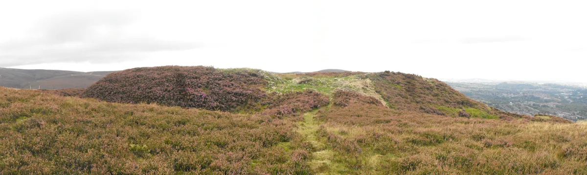
Buckton Castle
Buckton Castle — 12th-century castle in Mossley, Greater Manchester, England, UK.
 📷 3
📷 3Theatres · North West England
Vale Cinema
Vale Cinema in England North West, United Kingdom.
 📷 5
📷 5Castles · North West England
Mossley
Mossley (/ˈmɒzli/) is a town and civil parish in Tameside, Greater Manchester, England, in the upper Tame Valley and the foothills of the Pennines, 3 miles (4.8 km) south-east of Oldham and 9 miles (1
 📷 3
📷 3Memorials & monuments · North West England
War Memorial in Front of Former Town Hall
War Memorial in Front of Former Town Hall — Grade II listed building-listed memorial in england-north-west, United Kingdom.
 📷 3
📷 3Historic bridges · North West England
Huddersfield Narrow Canal Micklehurst Bridge And Lock Number W13
Huddersfield Narrow Canal Micklehurst Bridge And Lock Number W13 — Grade II listed building-listed bridge in england-north-west, United Kingdom.
More castles in this region
 📷 5
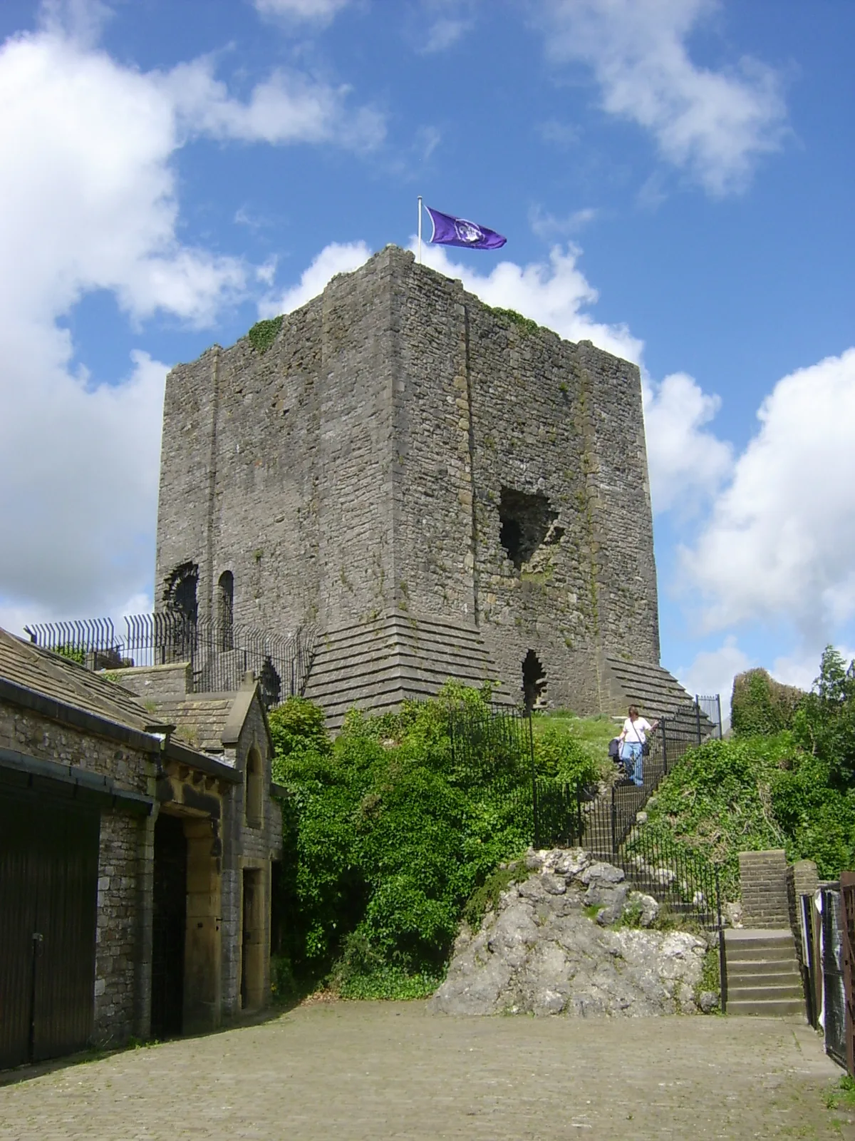
📷 5Castles · North West England
Clitheroe Castle
Clitheroe Castle — castle in Lancashire, England, UK.
 📷 3
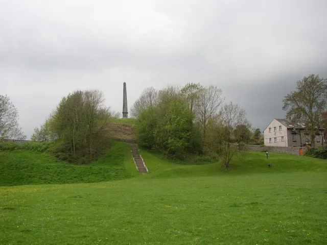
📷 3Castles · North West England
Castle Howe
Castle Howe — Castle in Cumbria, England.
 📷 3
📷 3Castles · North West England
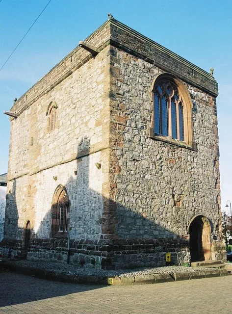
Dalton Castle
Dalton Castle — Grade I listed local museum in Dalton Town with Newton, Westmorland and Furness, Cumbria , England, UK.
 📷 5
📷 5Castles · North West England
Dobroyd Castle
Dobroyd Castle — castle in Todmorden, West Yorkshire, England, UK.
Frequently asked questions
- Where is Carrbrook?
- Carrbrook is in North-West England, United Kingdom (postcode SK15 3PS), in the parish of Tameside, unparished area.
- Does Carrbrook charge admission?
- Carrbrook typically charges admission. Check the official site for current ticket prices and opening hours.
- How do I get to Carrbrook?
- Drivers can navigate to postcode SK15 3PS. It sits within the Stalybridge and Hyde parliamentary constituency.