Mountains & hills · South West England
Carn Kenidjack
Carn Kenidjack — Named summit at 202 m.

Wikimedia Commons contributors — see linked file page for photographer and licence licence
Plan your visit
- Typical visit
- 3 h–8 h
- Best time of year
- Late spring – early autumn (May–Oct)
- Nearest railway station
- Penzance · 9.1 km
- Free entry
- Dog-friendly
About
Carn Kenidjack is a named summit in the United Kingdom. Wikidata describes it as: "Named summit at 202 m.". Coordinates: 50.1391°, -5.6570°.
Photo gallery
Protected designations
- Site of Special Scientific Interest: Aire Point to Carrick Du SSSI
- Site of Special Scientific Interest: West Penwith Moors and Downs SSSI
- Area of Outstanding Natural Beauty: Cornwall
Designations sourced from Natural England open data under OGL v3.
From the Wikipedia article
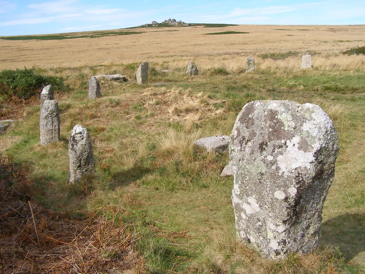
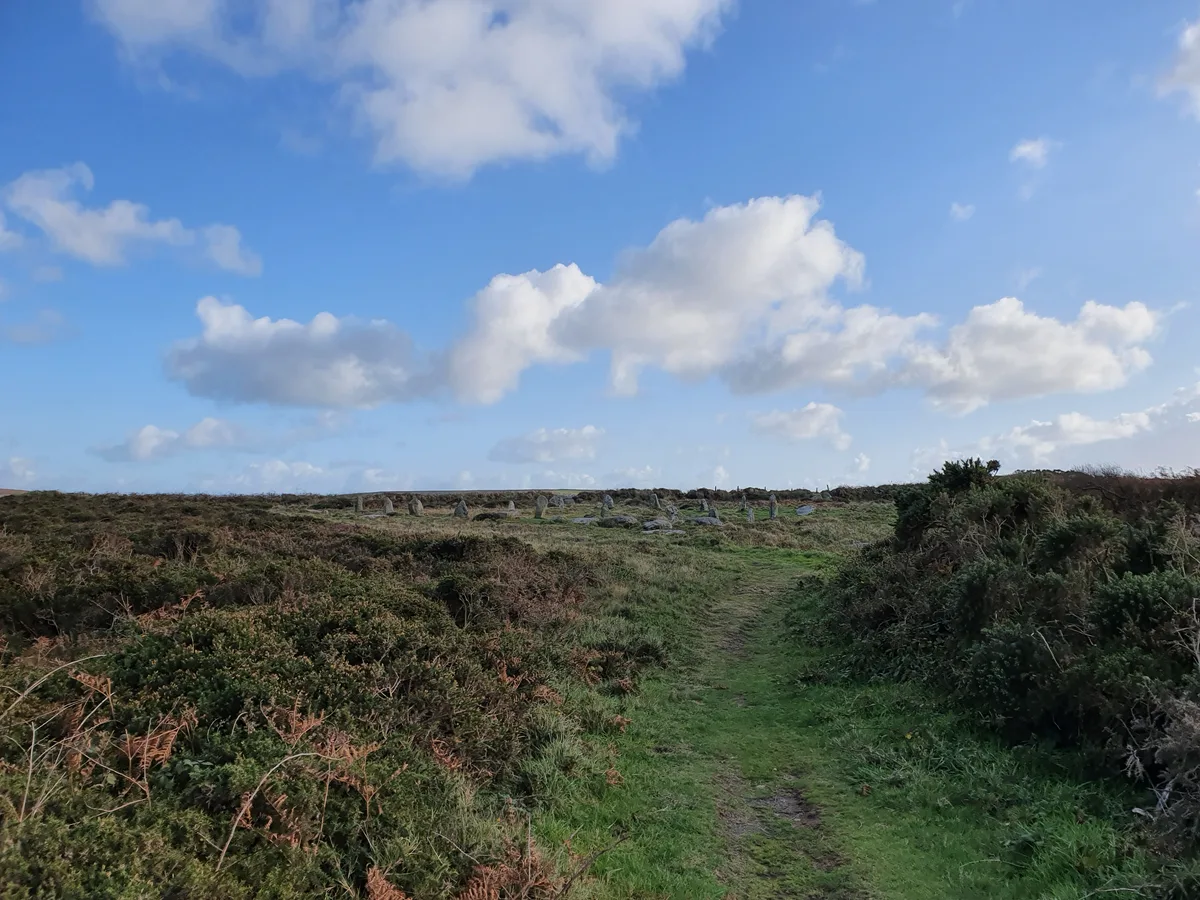
Carn Kenidjack (grid reference SW388329) is a hill in Tregeseal, Cornwall, UK. It is covered in megaliths including Tregeseal East stone circle. A tale is told that two miners returning home one night witnessed a wrestling match near Carn Kenidjack, which was presided over by the Devil. When one of the demon wrestlers was wounded, they whispered a prayer in his ear, and the entire spectacle disappeared.
Excerpt from Wikipedia under CC BY-SA 4.0. See the source article linked in Sources below.
- Coordinates
- 50.1391, -5.6570
- District
- Cornwall
- Parish
- St. Just
- Postcode
- TR20 8PX
- Parliamentary constituency
- St Ives
- Nearest railway station
- Penzance — 9.1 km
Sources
- osm: n2134924418 (ODbL)
- wikipedia: Carn Kenidjack (CC BY-SA 4.0)
- commons: Looking towards Carn Kenidjack from the north - geograph.org.uk - 1572518.jpg (CC BY-SA 4.0)
Other places nearby
Loading nearby places…
Nearby
 📷 5
📷 5Hill forts · South West England
Tregeseal East stone circle
Tregeseal East stone circle — Tregeseal East is a prehistoric stone circle near the town of St Just in Cornwall, UK.
 📷 3
📷 3Archaeological sites · South West England
Two large regular stone circles 290m north east of Hailglower Farm
Two large regular stone circles 290m north east of Hailglower Farm — archaeological site in St Just, Cornwall, England, UK.
 📷 5
📷 5Hill forts · South West England
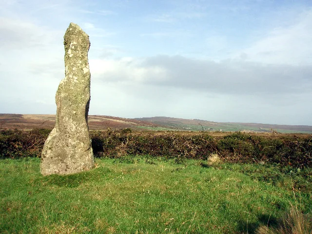
Boswens Menhir
Boswens Menhir — standing stone near St. Just in Penwith, Cornwall, England.
 📷 3
📷 3Memorials & monuments · South West England
Pendeen War Memorial
Pendeen War Memorial — Grade II listed building-listed memorial in england-south-west, United Kingdom.
 📷 5
📷 5Museums · South West England
Trewellard
Trewellard — a museum in england-south-west, United Kingdom.
 📷 5
📷 5Historic churches · South West England
Pendeen
Pendeen (from Cornish: Penn Din meaning "headland fort", previously known as Cornish: Boskaswal Wartha, meaning "Caswal's high dwelling") is a village and ecclesiastical parish on the Penwith peninsul
More mountains in this region
 📷 5
📷 5Mountains & hills · South West England
Alex Tor
Alex Tor — Named summit at 291 m.
 📷 5
📷 5Mountains & hills · South West England
Ash Hole Cavern
Ash Hole Cavern — cave in Brixham, Devon, England, UK.
 📷 5
📷 5Mountains & hills · South West England
Babbacombe Bay
Babbacombe Bay — bay in Devon, England.
 📷 5
📷 5Mountains & hills · South West England
Barley Bay
Barley Bay — bay in the United Kingdom.
Frequently asked questions
- Where is Carn Kenidjack?
- Carn Kenidjack is in South-West England, United Kingdom (postcode TR20 8PX), in the parish of St. Just.
- Is Carn Kenidjack a protected site?
- Yes — Carn Kenidjack is part of the Aire Point to Carrick Du SSSI Site of Special Scientific Interest and the West Penwith Moors and Downs SSSI Site of Special Scientific Interest.
- Is Carn Kenidjack free to visit?
- Yes, Carn Kenidjack is free to enter.
- How do I get to Carn Kenidjack?
- Drivers can navigate to postcode TR20 8PX. It sits within the St Ives parliamentary constituency.