Towns & cities · Central Scotland
Carmunnock
Also known as: Cair Mhanach
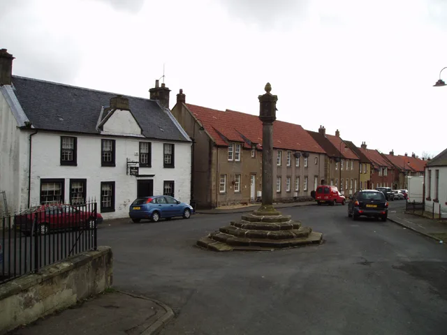
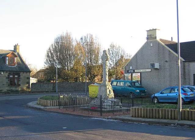
Carmunnock — conservation village at the south-east border of Glasgow.
.jpg?width=1200)
Wikimedia Commons contributors — see linked file page for photographer and licence licence
.jpg)
Plan your visit
- Typical visit
- 3 h–6 h
- Nearest railway station
- Busby · 1.8 km
- Free entry
- Family-friendly
- Dog-friendly
About
Carmunnock is a town, city, village or settlement in the United Kingdom. Recent population estimates put it at around 1,280 people. Address: G76. Wikidata describes it as: "conservation village at the south-east border of Glasgow". Coordinates: 55.7895°, -4.2375°.
Photo gallery
From the Wikipedia article
Carmunnock (; Scottish Gaelic: Cair Mhanach or Corr Mhanach) is a conservation village situated within the Glasgow City council area, lying within three miles (five kilometres) of East Kilbride and Rutherglen in South Lanarkshire and Busby in East Renfrewshire. The nearest other district within Glasgow is Castlemilk.
Excerpt from Wikipedia under CC BY-SA 4.0. See the source article linked in Sources below.
Background
History
This ancient settlement which is associated with the early Christian missionary Saint Cadoc, has a medieval street plan set within the lands of an estate held by variously the Morays of Bothwell, the Earls of Douglas and eventually to the Lords, Marquesses and Dukes of Hamilton until 1700 when it passed to the Stuarts of Castlemilk. There are many cottages in the village that date back to the 1600's, and it is the last remaining village situated within the Glasgow City council area. The World’s Strongest Man competition started life in a garage in the village.
Sourced from Wikipedia under CC BY-SA 4.0.
- Coordinates
- 55.7895, -4.2375
- District
- Glasgow City
- Postcode
- G76
- Parliamentary constituency
- Glasgow South
- Population
- 1,280
- Nearest railway station
- Busby — 1.8 km
Sources
- wikidata: Q1009763 (CC0)
- wikipedia: Carmunnock (CC BY-SA 4.0)
- commons: Carmunnock Parish Church (The Kirk o' the Braes).jpg (CC BY-SA 4.0)
Other places nearby
Loading nearby places…
Nearby
 📷 5
📷 5Historic churches · Central Scotland
Carmunnock Parish Church, Kirk Road, Glasgow
Carmunnock Parish Church, Kirk Road, Glasgow — category B listed building-listed church in scotland-central, United Kingdom.
 📷 5
📷 5Historic bridges · Central Scotland
Kittoch Bridge, Glasgow
Kittoch Bridge, Glasgow — category C listed building-listed bridge in scotland-central, United Kingdom.
 📷 4
📷 4Public art & sculpture · Central Scotland
Southern Gateway
Southern Gateway — a public art in scotland-central, United Kingdom.
Mountain bike trails · Central Scotland
Cathkin Braes MTB Track (Blue)
Cathkin Braes MTB Track (Blue) — a mtb trail in scotland central.
Mountain bike trails · Central Scotland
Cathkin Braes MTB track (Green)
Cathkin Braes MTB track (Green) — a mtb trail in scotland central.
Mountain bike trails · Central Scotland
Cathkin Braes Country Park Green
Cathkin Braes Country Park Green — a mtb trail in scotland central.
More towns in this region
 Flagship📷 3
Towns & cities · Central Scotland
Airth
Airth — village in Falkirk, Scotland, UK.
 Flagship📷 5
Towns & cities · Central Scotland
Avonbridge
Avonbridge — village in Falkirk, Scotland, UK.
 Flagship📷 3
Towns & cities · Central Scotland
Banknock
Banknock — village in Falkirk, Scotland, UK.
 Flagship📷 3
Towns & cities · Central Scotland
Dundee
Dundee — city in Scotland, UK.
Frequently asked questions
- Where is Carmunnock?
- Carmunnock is in central Scotland, United Kingdom (postcode G76).
- Is Carmunnock free to visit?
- Yes, Carmunnock is free to enter.
- How do I get to Carmunnock?
- The nearest railway station is Busby, about 1.8 km away. Drivers can navigate to postcode G76.