Mountains & hills · Central Scotland
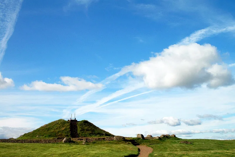
Cairnpapple Hill
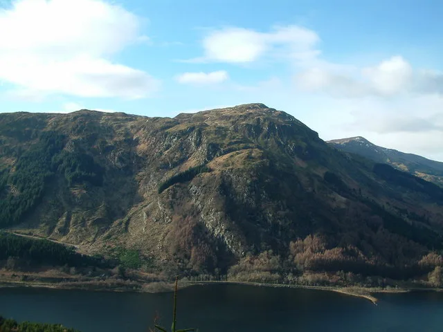
Cairnpapple Hill — Named summit at 312 m.

Wikimedia Commons contributors — see linked file page for photographer and licence licence
Plan your visit
- Typical visit
- 3 h–8 h
- Best time of year
- Late spring – early autumn (May–Oct)
- Nearest railway station
- Bathgate · 3.5 km
- Free entry
- Dog-friendly
About
Cairnpapple Hill is a named summit in the United Kingdom. Wikidata describes it as: "Named summit at 312 m.". Coordinates: 55.9278°, -3.6229°.
Photo gallery
From the Wikipedia article
Cairnpapple Hill is a hill with a dominating position in central lowland Scotland with views from coast to coast. It was used and re-used as a major ritual site for around 4,000 years, and in its day would have been comparable to better known sites like the Standing Stones of Stenness. The summit lies 312 meters above sea level, and is about 2 miles (3 km) north of Bathgate. In the 19th century the site was completely concealed by trees, then in 1947–1948 excavations by Stuart Piggott found a series of ritual monuments from successive prehistoric periods. In 1998, Gordon Barclay re-interpreted the site for Historic Scotland. It is designated a scheduled ancient monument.
Excerpt from Wikipedia under CC BY-SA 4.0. See the source article linked in Sources below.
Background
History
Neolithic rituals began around 3500 BC with signs of small hearths, and precious objects left on the hill, presumably as offerings, including fine pottery bowls and stone axe heads imported from Cumbria and Wales. Probably around 3000 BC a Class II henge was constructed with the hilltop being surrounded by a bank outside a ditch about 12 ft wide cut over 3 ft into the rock, with wide entrances from north and south. Inside this an egg-shaped setting of 24 uprights (thought to have been timber posts, or possibly standing stones) enclosed an inner setting of similar uprights. Some time later a Bronze Age ritual added a small stone and clay cairn just off-centre inside the monument, with a 7 ft…
Visiting
The site is open to the public April to September and has a small visitor centre. The 1940s excavations have been partly covered by a concrete dome replicating the second cairn (although the dome is much higher than the cairn) so that visitors can go inside what was once a solid cairn and see the reconstructed graves, and outside this the surrounding post holes and graves are marked by being filled with colour-coded gravel like an archaeological plan, with the red gravel indicating upright pits, and the white gravel denoting the alleged Christian burials. The current display attempts to show all the main phases of the site at the same time. Cairnpapple Hill is the 445th highest Marilyn (sub…
Sourced from Wikipedia under CC BY-SA 4.0.
- Coordinates
- 55.9278, -3.6229
- District
- West Lothian
- Postcode
- EH48 4NW
- Parliamentary constituency
- Bathgate and Linlithgow
- Nearest railway station
- Bathgate — 3.5 km
- Official site
- www.historicenvironment.scot
Sources
- osm: n257154250 (ODbL)
- wikipedia: Cairnpapple Hill (CC BY-SA 4.0)
- commons: CairnpappleHill.jpg (CC BY-SA 4.0)
Other places nearby
Loading nearby places…
Nearby
 📷 3
📷 3Hill forts · Central Scotland
Cairnpapple Hill
Cairnpapple Hill — Neolithic henge monument.
 📷 3
📷 3Archaeological sites · Central Scotland
Windywa's Silvermine
Windywa's Silvermine — a archaeological in scotland-central, United Kingdom.
 📷 3
📷 3Memorials & monuments · Central Scotland
Scottish Korean War Memorial
Scottish Korean War Memorial — a memorial in scotland-central, United Kingdom.
Vineyards · Central Scotland
Castlethorn
Castlethorn — a UK vineyard in scotland central, producing English or Welsh wine from cool-climate grape varieties.
 📷 3
📷 3Stone circles · Central Scotland
Galabraes Standing Stones
Galabraes Standing Stones — a stone circle in scotland-central, United Kingdom.
 📷 5
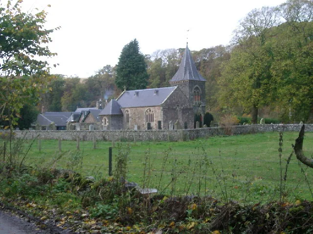
📷 5Historic churches · Central Scotland
Torphichen Kirk
Torphichen Kirk — category B listed building-listed church in scotland-central, United Kingdom.
More mountains in this region
 📷 3
📷 3Mountains & hills · Central Scotland
Abbey Hill
Abbey Hill — Named summit at 278 m.
 📷 3
📷 3Mountains & hills · Central Scotland
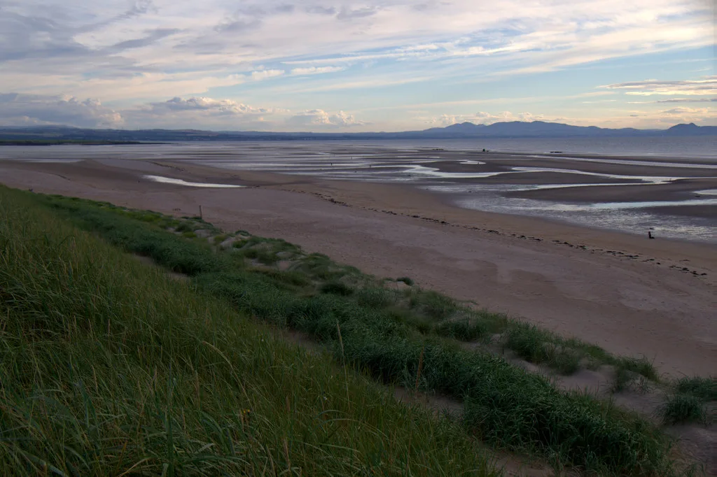
Aberlady Bay
Aberlady Bay — bay on the north coast of East Lothian, Scotland, UK.
 📷 3
📷 3Mountains & hills · Central Scotland
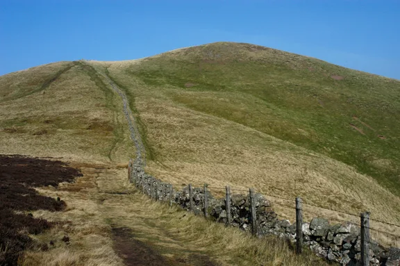
Allermuir Hill
Allermuir Hill — Named summit at 493 m.
 📷 3
📷 3Mountains & hills · Central Scotland
Ardnandave
Ardnandave — Named summit at 715 m.
Frequently asked questions
- Where is Cairnpapple Hill?
- Cairnpapple Hill is in central Scotland, United Kingdom (postcode EH48 4NW).
- Is Cairnpapple Hill free to visit?
- Yes, Cairnpapple Hill is free to enter.
- How do I get to Cairnpapple Hill?
- The nearest railway station is Bathgate, about 3.5 km away. Drivers can navigate to postcode EH48 4NW.