Mountains & hills · South Wales
Cadair Fawr
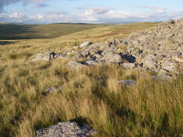
Cadair Fawr — a mountain in wales-south, United Kingdom, 485 m.
Alan Hughes — CC BY-SA 2.0 via Wikimedia Commons licence
Plan your visit
- Typical visit
- 3 h–8 h
- Best time of year
- Late spring – early autumn (May–Oct)
- Free entry
- Dog-friendly
About
Cadair Fawr is a named summit in wales-south, United Kingdom, with an elevation of approximately 485 metres. Listed in the Wikidata register of UK peaks; see the Wikipedia article for further details on the mountain's location, geology and walking routes.
Photo gallery
From the Wikipedia article
Cadair Fawr is a hill in the northern corner of the county borough of Rhondda Cynon Taf, Wales. It lies within the Brecon Beacons National Park and Fforest Fawr Geopark. The 485m high summit at OS grid ref SN 978123 is marked by a trig point. Cadair Fawr is the highest point of a broad ridge known as Cefn Cadlan which forms the northern edge of Cwm Cadlan, a valley which itself runs east-northeastwards from the village of Penderyn. The name Cadair Fawr signifies the 'big chair' whilst Cefn Cadlan signifies the 'ridge of the battlefield'.
Excerpt from Wikipedia under CC BY-SA 4.0. See the source article linked in Sources below.
Background
Visiting
The hill is designated as open country so freely available to walkers. It is readily accessed from the A4059 road which runs along its northern edge between Hirwaun and the A470 road south of Storey Arms.
Sourced from Wikipedia under CC BY-SA 4.0.
- Coordinates
- 51.7999, -3.4836
Sources
- wikidata: Q5016234 (CC0)
- wikipedia: Cadair Fawr (CC BY-SA 4.0)
Other places nearby
Loading nearby places…
Nearby
 📷 5
📷 5Caves · South Wales
Ogof Fechan
Ogof Fechan — a cave broad in wales-south, United Kingdom.
 📷 5
📷 5Historic bridges · South Wales
Bridge over Nant Aber-nant stream
Bridge over Nant Aber-nant stream — Grade II listed building-listed bridge in wales-south, United Kingdom.
Vineyards · South Wales
Pant Sychbant Medieval Hamlet
Pant Sychbant Medieval Hamlet — a UK vineyard in wales south, producing English or Welsh wine from cool-climate grape varieties.
 📷 3
📷 3Caves · South Wales
Ogof Fawr
Ogof Fawr — a cave broad in wales-south, United Kingdom.
 📷 3
📷 3Reservoirs & lochs · South Wales
Llwyn-on Reservoir
Llwyn-on Reservoir — reservoir in Wales, UK.
 📷 3
📷 3Mountains & hills · South Wales
Mynydd-y-glog
Mynydd-y-glog — Named summit at 389 m.
More mountains in this region
 Flagship📷 3
Mountains & hills · South Wales
Milford Haven Waterway
Milford Haven Waterway — ria, or flooded valley, in Pembrokeshire, south-west Wales, UK.
 📷 5
📷 5Mountains & hills · South Wales
Ogof Ffynnon Ddu
Ogof Ffynnon Ddu — cave in the Upper Swansea Valley in South Wales.
 📷 3
📷 3Mountains & hills · South Wales
Abereiddi Bay
Abereiddi Bay — bay in the United Kingdom.
 📷 3
📷 3Mountains & hills · South Wales
Allt Lwyd
Allt Lwyd — Named summit at 653 m.
Frequently asked questions
- Where is Cadair Fawr?
- Cadair Fawr is in South Wales, in the United Kingdom — coordinates 51.7999°, -3.4836°.
- Is Cadair Fawr free to visit?
- Yes — admission to Cadair Fawr is free.