Hill forts · South East England
Bury Camp
Bury Camp — site of an Iron Age multivallate hillfort located in Wiltshire, England, UK.

Wikimedia Commons contributors — see linked file page for photographer and licence licence
Plan your visit
- Typical visit
- 1 h–2 h
- Free entry
- Dog-friendly
About
Bury Camp is a hill fort in the United Kingdom. Heritage designation: scheduled monument. Wikidata describes it as: "site of an Iron Age multivallate hillfort located in Wiltshire, England, UK". Coordinates: 51.4644°, -2.2629°.
Photo gallery
Protected designations
- Area of Outstanding Natural Beauty: Cotswolds
Designations sourced from Natural England open data under OGL v3.
From the Wikipedia article
Bury Camp is the site of an Iron Age multivallate hillfort in north-west Wiltshire, England. It occupies a triangular promontory of Colerne Down, in the north of Colerne parish, at the southern edge of the Cotswold Hills between two spurs of a river valley. The enclosed area of approximately 9.2ha is surrounded by a ditch 4m wide and up to 1m deep, and an outer rampart up to 1.5m high on the east and northwestern sides and up to 2m high on the southwestern side, across the neck of the promontory. The contours of the land provide excellent natural defences to the north and east sides. On the southwestern side, where there are no natural defences, there is a further ditch 4m wide and 1m deep and an outer rampart up to 2m high and 3m wide. These are crossed by many causeways, which could be interpreted as an indication that the construction of the monument was never fully completed. The entrance in the middle of the southwestern side is thought to be of modern origin. At the northeastern corner, the inner bank turns inwards to form a funnel-shaped entrance leading to a hollow way running down the steep scarp into the valley below. Another entrance about a quarter of the way along the northwestern side also consists of inward-turning ramparts forming a funnel-shaped entrance. A small enclosure within the camp is visible on aerial photographs. It is circular, 72m in diameter, with a bank and an outer ditch. The site has been a scheduled monument since 1925. Excavations carried out under Denis Grant King, from 1959 onwards, turned over some good examples of Iron Age drystone walling, and found remains of a much earlier structure that existed at the northeast entrance, indicated by drystone revetments within the northern rampart. In the second stage, the entrance was remodelled and widened. At the northwest entrance, four staggered post holes were uncovered as well as a cylindrical cavity 0.66m deep, interpreted as a gate post hole. The building of the hillfort can be…
Excerpt from Wikipedia under CC BY-SA 4.0. See the source article linked in Sources below.
- Coordinates
- 51.4644, -2.2629
- District
- Wiltshire
- Parish
- North Wraxall
- Postcode
- SN14 8RZ
- Parliamentary constituency
- South Cotswolds
Sources
- wikidata: Q5001075 (CC0)
- wikipedia: Bury Camp (CC BY-SA 4.0)
- commons: Bury Camp Digital Terrain Model.jpg (CC BY-SA 4.0)
Other places nearby
Loading nearby places…
Nearby
 📷 5
📷 5Memorials & monuments · South East England
Elms Monument In Churchyard About 22 Metres South Of South East Angle Of Tower Of Church Of St James
Elms Monument In Churchyard About 22 Metres South Of South East Angle Of Tower Of Church Of St James — Grade II listed building-listed memorial in england-south-east, United Kingdom.
📷 5Memorials & monuments · South East England
R Parker Monument In Churchyard About 16 Metres South Of South East Angle Of Tower Of Church Of St James
R Parker Monument In Churchyard About 16 Metres South Of South East Angle Of Tower Of Church Of St James — Grade II listed building-listed memorial in england-south-east, United Kingdom.
 📷 5
📷 5Memorials & monuments · South East England
Hooper Monument In Churchyard About 19 Metres South Of Tower Of Church Of St James
Hooper Monument In Churchyard About 19 Metres South Of Tower Of Church Of St James — Grade II listed building-listed memorial in england-south-east, United Kingdom.
📷 5Memorials & monuments · South East England
D Parker Monument In Churchyard About 14 Metres South Of South East Angle Of Tower Of Church Of St James
D Parker Monument In Churchyard About 14 Metres South Of South East Angle Of Tower Of Church Of St James — Grade II listed building-listed memorial in england-south-east, United Kingdom.
📷 5Memorials & monuments · South East England
W Holborow Monument In Churchyard About 11 Metres South Of South East Angle Of Tower Of Church Of St James
W Holborow Monument In Churchyard About 11 Metres South Of South East Angle Of Tower Of Church Of St James — Grade II listed building-listed memorial in england-south-east, United Kingdom.
📷 5Memorials & monuments · South East England
Skeate Monument And Railings In Churchyard About 14 Metres South South West Of Tower Of Church Of St James
Skeate Monument And Railings In Churchyard About 14 Metres South South West Of Tower Of Church Of St James — Grade II listed building-listed memorial in england-south-east, United Kingdom.
More places in this region
 Flagship📷 10
Hill forts · South East England
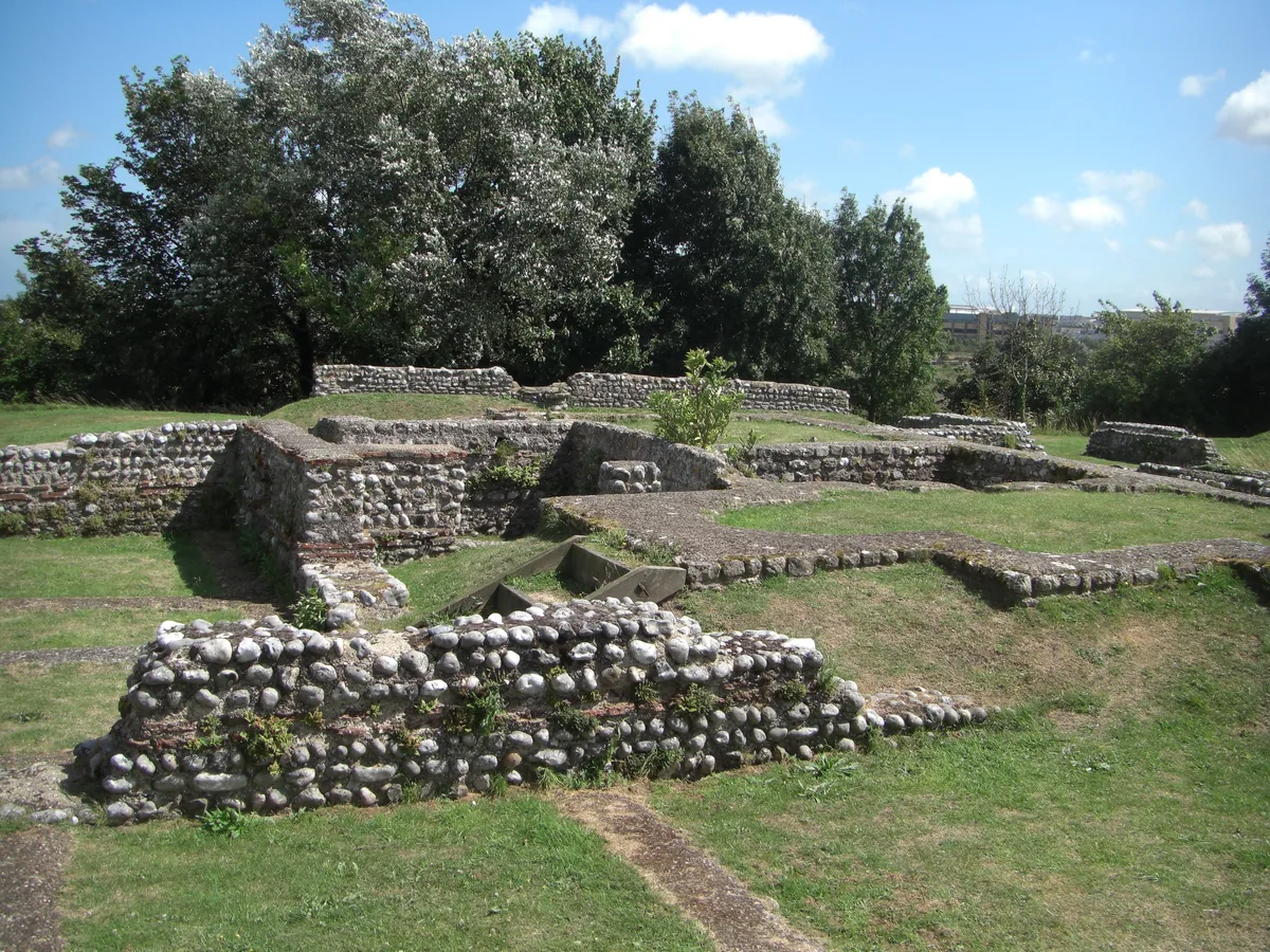
Castrum Anderitum
Castrum Anderitum — 3rd century Roman fort in the province of Britannia.
 Flagship📷 10
Hill forts · South East England
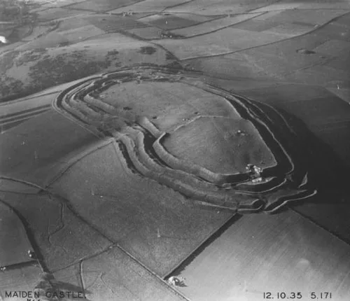
Maiden Castle
Maiden Castle — Iron Age hill fort in Dorset, England, UK.
 Flagship📷 10
Hill forts · South East England
Portus Adurni
Portus Adurni is a hill fort in the United Kingdom.
 Flagship📷 10
Hill forts · South East England
Richborough Roman Fort
Richborough Roman Fort — Roman fort at Richborough, Ash, United Kingdom.
Frequently asked questions
- Where is Bury Camp?
- Bury Camp is in South-East England, United Kingdom (postcode SN14 8RZ), in the parish of North Wraxall.
- Is Bury Camp a listed building?
- Bury Camp is officially recognised as scheduled monument listed.
- Is Bury Camp a protected site?
- Yes — Bury Camp is part of the Cotswolds National Landscape (AONB).
- Is Bury Camp free to visit?
- Yes, Bury Camp is free to enter.
- How do I get to Bury Camp?
- Drivers can navigate to postcode SN14 8RZ. It sits within the South Cotswolds parliamentary constituency.