Islands · South East England
Burntwick Island
Burntwick Island — island in Kent, United Kingdom.

Dan Smith — CC BY-SA 2.0 via Wikimedia Commons licence
Plan your visit
- Typical visit
- 4 h–12 h
- Nearest railway station
- Queenborough · 5.2 km
- Free entry
- Dog-friendly
About
Burntwick Island is a island in the United Kingdom. Wikidata describes it as: "island in Kent, United Kingdom". Coordinates: 51.4210°, 0.6750°.
Photo gallery
Protected designations
- Site of Special Scientific Interest: Medway Estuary and Marshes SSSI
- Ramsar wetland: Medway Estuary & Marshes
Designations sourced from Natural England open data under OGL v3.
From the Wikipedia article
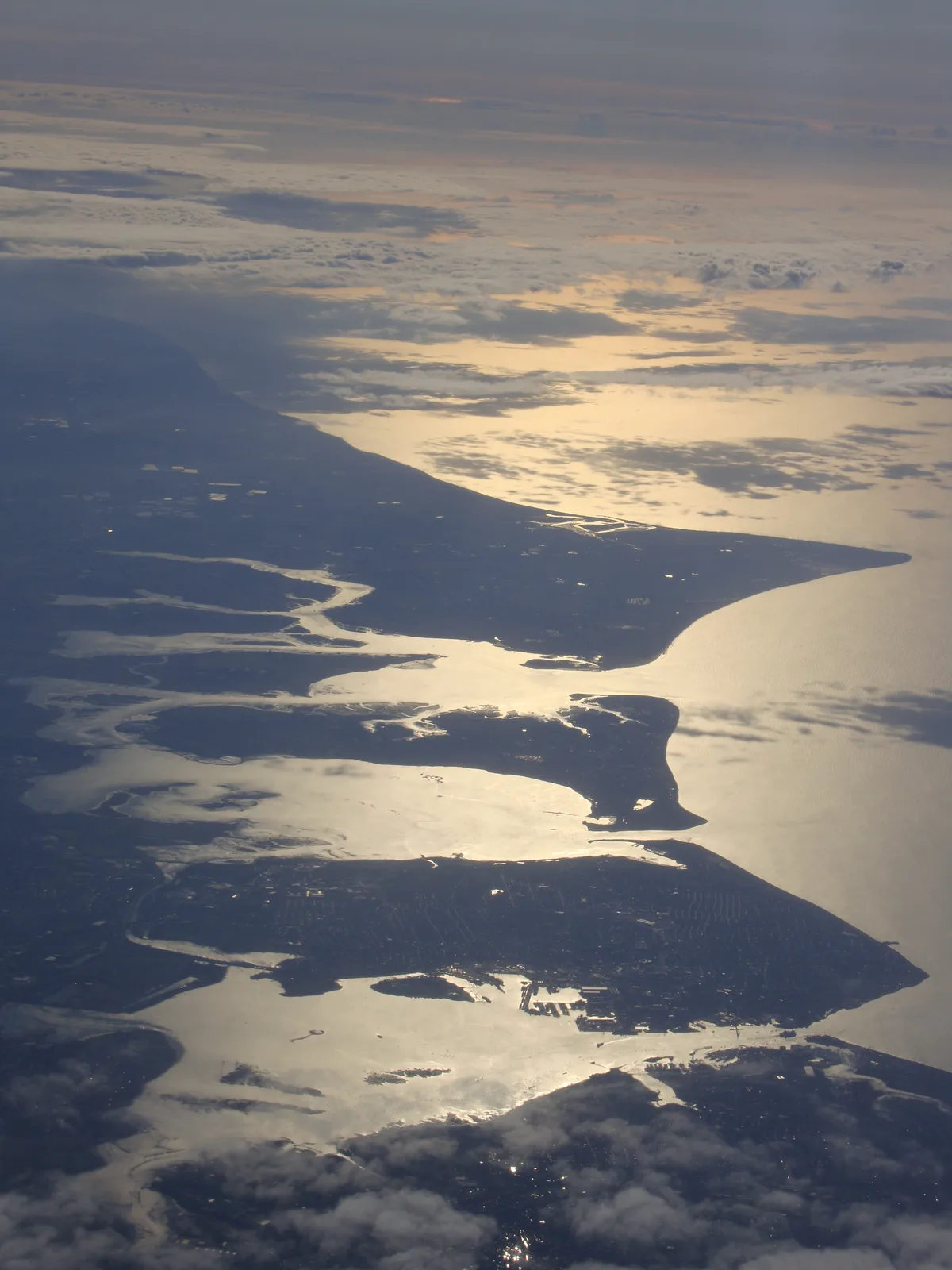
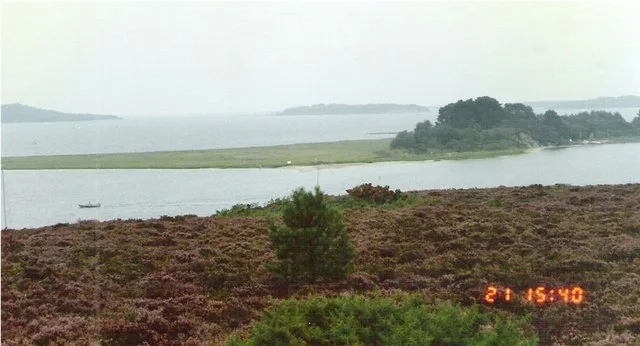
Burntwick Island is an island in the estuary of the River Medway in Kent, United Kingdom. It is a flat, raised area of marshland around 2 kilometres (1.2 mi) long and 1 kilometre (0.62 mi) wide among the tidal sand banks on the southern side of the estuary and separated from the British mainland of Chetney Marshes by a narrow channel known as Stangate Creek. The island is crossed by several narrow tidal channels that mean that at high tide the island is separated into several smaller islands.
Excerpt from Wikipedia under CC BY-SA 4.0. See the source article linked in Sources below.
Background
History
Until the 18th century, the island was part of the mainland and formed the northernmost area of the parish of Upchurch. A track that ran from Shoregate Lane at Ham Green can still be traced. In the late 18th and early 19th centuries it was used as a quarantine base for disease-infected ships, with the bodies of those who died usually buried on Deadman's Island 3 km to the east. The island was also used for smuggling, particularly after rising customs duties in the late 18th century, with tea and spirits the most commonly smuggled items. In the first years of the 19th century, Burntwick became a hideout of the North Kent Gang, a notorious group of smugglers. In 1820 they were confronted by…
Sourced from Wikipedia under CC BY-SA 4.0.
- Coordinates
- 51.4210, 0.6750
- District
- Medway
- Parish
- Isle of Grain
- Postcode
- ME3 0EP
- Parliamentary constituency
- Rochester and Strood
- Nearest railway station
- Queenborough — 5.2 km
Sources
- wikidata: Q38251927 (CC0)
- wikipedia: Burntwick Island (CC BY-SA 4.0)
Other places nearby
Loading nearby places…
Nearby
 📷 5
📷 5Harbours & ports · South East England
London Thamesport
London Thamesport — Container port in England.
 📷 2
📷 2Piers · South East England
Oakham Ness Jetty
Oakham Ness Jetty is a pier in the United Kingdom.
 📷 3
📷 3Museums · South East England
SM UB-122
SM UB-122 — a museum in england-south-east, United Kingdom.
 📷 5
📷 5Islands · South East England
Deadman's Island
Deadman's Island — island in Kent, United Kingdom.
 📷 5
📷 5Beaches · South East England
Cockleshell Hard
Cockleshell Hard is a beach in the United Kingdom.
 📷 5
📷 5Forts · South East England
Dummy Battery
Dummy Battery is a fort in the United Kingdom.
More places in this region
 Flagship📷 10
Islands · South East England
Brownsea Island
Brownsea Island — island in Poole Harbour, Dorset, England, UK.
 Flagship📷 10
Islands · South East England
Hayling Island
Hayling Island — island off the south coast of England.
 Flagship📷 7
Islands · South East England
Isle of Sheppey
Isle of Sheppey — island off the northern coast of Kent, England in the Thames Estuary.
 Flagship📷 10
Islands · South East England
Long Island
Long Island — island in Dorset, England.
Frequently asked questions
- Where is Burntwick Island?
- Burntwick Island is in South-East England, United Kingdom (postcode ME3 0EP), in the parish of Isle of Grain.
- Is Burntwick Island a protected site?
- Yes — Burntwick Island is part of the Medway Estuary and Marshes SSSI Site of Special Scientific Interest and the Medway Estuary & Marshes Ramsar wetland.
- Is Burntwick Island free to visit?
- Yes, Burntwick Island is free to enter.
- How do I get to Burntwick Island?
- The nearest railway station is Queenborough, about 5.2 km away. Drivers can navigate to postcode ME3 0EP.