Mountains & hills · West Midlands
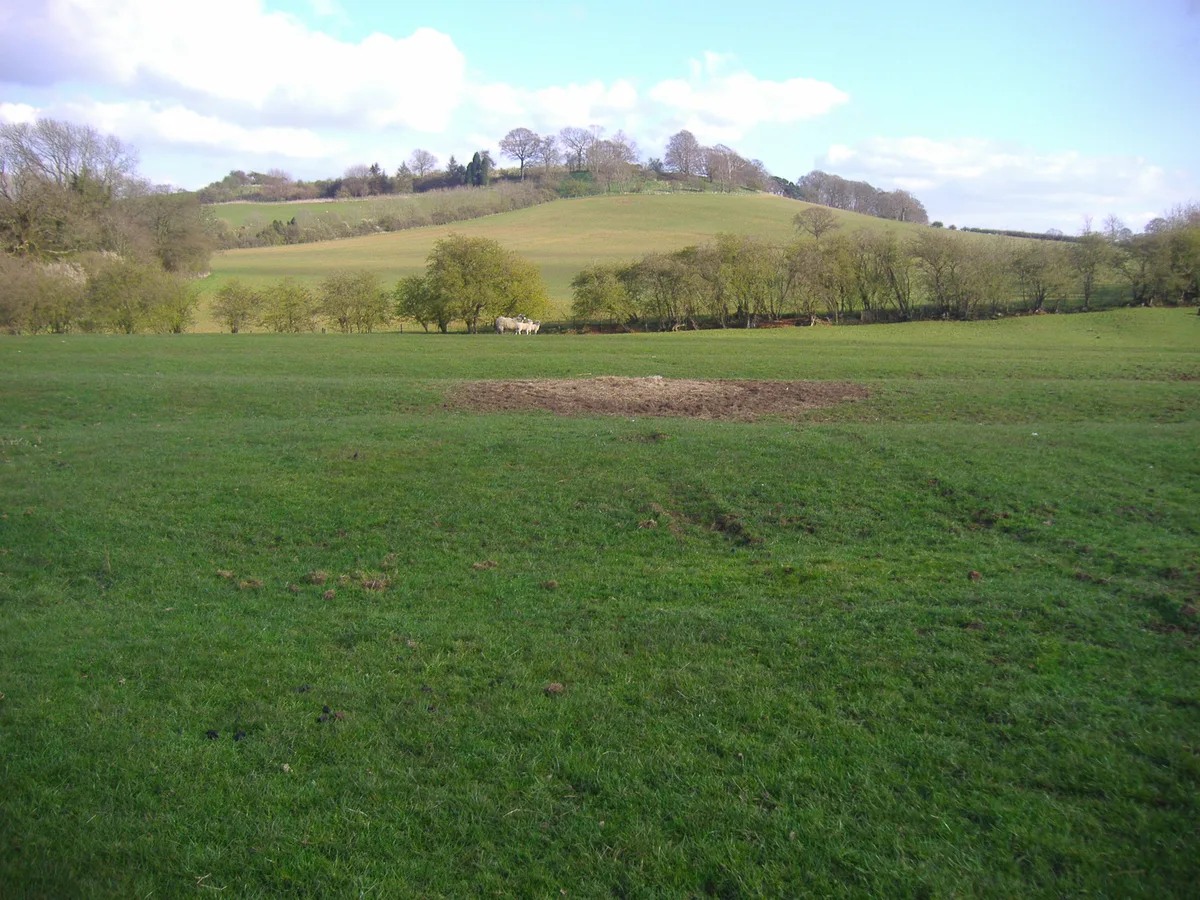
Bredon Hill
Bredon Hill — Named summit at 299 m.

Wikimedia Commons contributors — see linked file page for photographer and licence licence
Plan your visit
- Typical visit
- 3 h–8 h
- Best time of year
- Late spring – early autumn (May–Oct)
- Nearest railway station
- Ashchurch for Tewkesbury · 7.6 km
- Free entry
- Dog-friendly
About
Bredon Hill is a named summit in the United Kingdom. Wikidata describes it as: "Named summit at 299 m.". Coordinates: 52.0611°, -2.0635°.
Photo gallery
Protected designations
- Site of Special Scientific Interest: Bredon Hill SSSI
- Area of Outstanding Natural Beauty: Cotswolds
Designations sourced from Natural England open data under OGL v3.
From the Wikipedia article
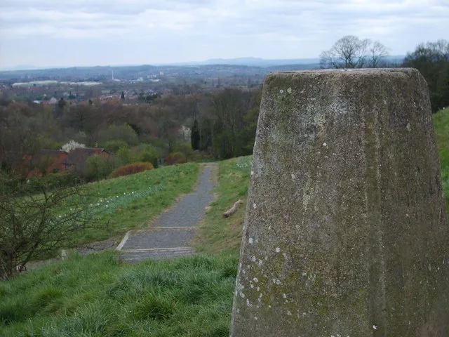
Bredon Hill is a hill located in Worcestershire, England, south-west of Evesham in the Vale of Evesham. The summit of the hill is in the parish of Kemerton, and it extends over parts of eight other parishes (listed below). The hill is geologically part of the Cotswolds and lies within the Cotswolds Area of Outstanding Natural Beauty. However, it now stands isolated in the Vale of Evesham due to natural causes. At the summit (previously located within Gloucestershire), adjacent to Kemerton Camp, is a small stone tower called Parsons Folly which stands at GPS coordinates (52.059963, -2.064606). The tower was built in the mid-18th century for John Parsons, MP (1732–1805), squire of Kemerton Court and intended as a summer house, from which a more extensive view of the surrounding countryside could be seen. The 981-foot (299 m) natural height of the hill contributes to the final height of the tower, whose top now reaches 1,000 feet (305 m). The folly (tower) became a well-known county landmark, and was believed to have inspired the building of Broadway Tower. The current owners, Overbury Estate, lease out the tower as a mobile phone base station, and a number of large aerials have been fitted to its exterior.
Excerpt from Wikipedia under CC BY-SA 4.0. See the source article linked in Sources below.
Background
History
At the summit of the hill, there are the remains of earthworks from an Iron Age hill fort known as Kemerton Camp, which is believed to have been abandoned in the 1st century A.D. after a considerable battle. There are also Roman earthworks and a number of ancient standing stones on the hill. One large stone at the summit is called the Banbury Stone, deriving from 'Baenintesburg', a name for the fort in the 8th century. It is known colloquially as the 'Elephant Stone' because of its resemblance to that animal. Another pair of stones below the summit are known as the King and Queen Stones. Local legend tells that if you pass between them you will be cured of illness. At Elmley Castle, on the…
Sourced from Wikipedia under CC BY-SA 4.0.
- Coordinates
- 52.0611, -2.0635
- County
- Worcestershire
- District
- Wychavon
- Parish
- Overbury
- Postcode
- GL20 7PH
- Parliamentary constituency
- West Worcestershire
- Nearest railway station
- Ashchurch for Tewkesbury — 7.6 km
Sources
- osm: n300924099 (ODbL)
- wikipedia: Bredon Hill (CC BY-SA 4.0)
- commons: Bredon Hill.jpg (CC BY-SA 4.0)
Other places nearby
Loading nearby places…
Nearby
 📷 5
📷 5Viewpoints · West Midlands
Toposcope
Toposcope is a viewpoint in the United Kingdom.
 📷 3
📷 3Natural landmarks · West Midlands
Banbury Stone
Banbury Stone — a other in england-west-midlands, United Kingdom.
Vineyards · West Midlands
Kemerton Camp
Kemerton Camp — a UK vineyard in england west midlands, producing English or Welsh wine from cool-climate grape varieties.
 📷 3
📷 3Follies · West Midlands
Parsons' Folly
Parsons' Folly — Folly or eyecatcher.
 📷 3
📷 3Hill forts · West Midlands
Kemerton Camp Hillfort
Kemerton Camp Hillfort — a hill fort in england-west-midlands, United Kingdom.
📷 3Hill forts · West Midlands
Kemerton Camp Hill Fort
Kemerton Camp Hill Fort — a hill fort in england-west-midlands, United Kingdom.
More mountains in this region
 📷 5
📷 5Mountains & hills · West Midlands
Arbury Hill
Arbury Hill — Named summit at 224.3 m.
Mountains & hills · West Midlands
Barr Beacon
Barr Beacon — Named summit at 227 m.
 📷 3
📷 3Mountains & hills · West Midlands
Barrow Hill
Barrow Hill — Named summit at 179 m.
Mountains & hills · West Midlands
Beacon Hill
Beacon Hill — Named summit at 237 m.
Frequently asked questions
- Where is Bredon Hill?
- Bredon Hill is in Worcestershire, the West Midlands, United Kingdom (postcode GL20 7PH), in the parish of Overbury.
- Is Bredon Hill a protected site?
- Yes — Bredon Hill is part of the Bredon Hill SSSI Site of Special Scientific Interest and the Cotswolds National Landscape (AONB).
- Is Bredon Hill free to visit?
- Yes, Bredon Hill is free to enter.
- How do I get to Bredon Hill?
- The nearest railway station is Ashchurch for Tewkesbury, about 7.6 km away. Drivers can navigate to postcode GL20 7PH.