Towns & cities · Central Scotland
Branxton
Also known as: Branxton, Northumberland
Branxton — village and civil parish in Northumberland, UK.

Wikimedia Commons contributors — see linked file page for photographer and licence licence
Plan your visit
- Typical visit
- 3 h–6 h
- Nearest railway station
- Etal · 3.3 km
- Free entry
- Family-friendly
- Dog-friendly
About
Branxton is a town, city, village or settlement in the United Kingdom. Recent population estimates put it at around 121 people. Wikidata describes it as: "village and civil parish in Northumberland, UK". Coordinates: 55.6309°, -2.1683°.
Photo gallery
Protected designations
- Site of Special Scientific Interest: Tweed Catchment Rivers - England: Till Catchment SSSI
Designations sourced from Natural England open data under OGL v3.
From the Wikipedia article
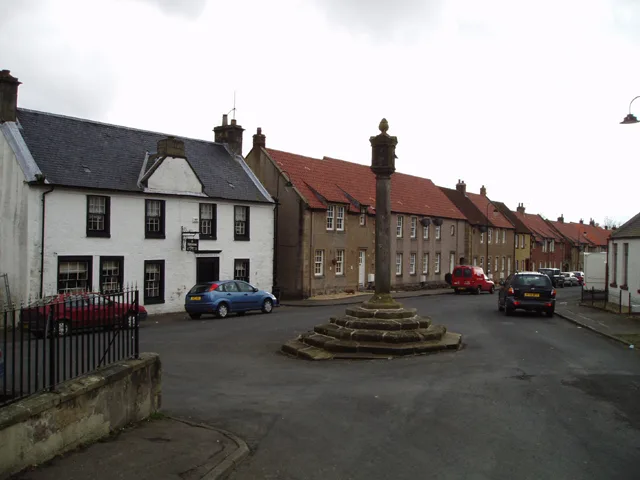
Branxton is a village and civil parish in northern Northumberland, England. It lies about 3 miles (5 km) from the England-Scotland border and about 4 miles (6 km) from the Scottish border town of Coldstream, just off the A697 Newcastle-Edinburgh road. At the 2011 Census, the population of the parish was 123, increasing slightly from 121 at the 2001 Census.
Excerpt from Wikipedia under CC BY-SA 4.0. See the source article linked in Sources below.
- Coordinates
- 55.6309, -2.1683
- District
- Northumberland
- Parish
- Branxton
- Postcode
- TD12 4SP
- Parliamentary constituency
- North Northumberland
- Population
- 121
- Nearest railway station
- Etal — 3.3 km
Sources
- wikidata: Q1863571 (CC0)
- wikipedia: Branxton, Northumberland (CC BY-SA 4.0)
- commons: Branxton Village - geograph.org.uk - 1195491.jpg (CC BY-SA 4.0)
Other places nearby
Loading nearby places…
Nearby
 📷 3
📷 3Forts · Central Scotland
Battle of Flodden Field 1513
Battle of Flodden Field 1513 is a fort in the United Kingdom.
 📷 3
📷 3Battlefields & battle sites · Central Scotland
Battle of Flodden Field Monument
Battle of Flodden Field Monument — a battlefield in scotland-central, United Kingdom.
 📷 3
📷 3Memorials & monuments · Central Scotland
Flodden Monument
Flodden Monument — a memorial in scotland-central, United Kingdom.
📷 3Memorials & monuments · Central Scotland
Flodden Memorial
Flodden Memorial — Grade II listed building-listed memorial in scotland-central, United Kingdom.
Vineyards · Central Scotland
Branxton Hill East
Branxton Hill East — a UK vineyard in scotland central, producing English or Welsh wine from cool-climate grape varieties.
Vineyards · Central Scotland
West Lodge
West Lodge — a UK vineyard in scotland central, producing English or Welsh wine from cool-climate grape varieties.
More towns in this region
 Flagship📷 3
Towns & cities · Central Scotland
Airth
Airth — village in Falkirk, Scotland, UK.
 Flagship📷 5
Towns & cities · Central Scotland
Avonbridge
Avonbridge — village in Falkirk, Scotland, UK.
 Flagship📷 3
Towns & cities · Central Scotland
Banknock
Banknock — village in Falkirk, Scotland, UK.
 Flagship📷 3
Towns & cities · Central Scotland
Dundee
Dundee — city in Scotland, UK.
Frequently asked questions
- Where is Branxton?
- Branxton is in central Scotland, United Kingdom (postcode TD12 4SP), in the parish of Branxton.
- Is Branxton a protected site?
- Yes — Branxton is part of the Tweed Catchment Rivers - England: Till Catchment SSSI Site of Special Scientific Interest.
- Is Branxton free to visit?
- Yes, Branxton is free to enter.
- How do I get to Branxton?
- The nearest railway station is Etal, about 3.3 km away. Drivers can navigate to postcode TD12 4SP.