Mountains & hills · South East England
Bow Hill
Bow Hill — Named summit at 206 m.

Wikimedia Commons contributors — see linked file page for photographer and licence licence
Plan your visit
- Typical visit
- 3 h–8 h
- Best time of year
- Late spring – early autumn (May–Oct)
- Nearest railway station
- Bosham · 6.1 km
- Free entry
- Dog-friendly
About
Bow Hill is a named summit in the United Kingdom. Wikidata describes it as: "Named summit at 206 m.". Coordinates: 50.8964°, -0.8284°.
Photo gallery
Protected designations
- Site of Special Scientific Interest: Kingley Vale SSSI
- National Nature Reserve: KINGLEY VALE
Designations sourced from Natural England open data under OGL v3.
From the Wikipedia article
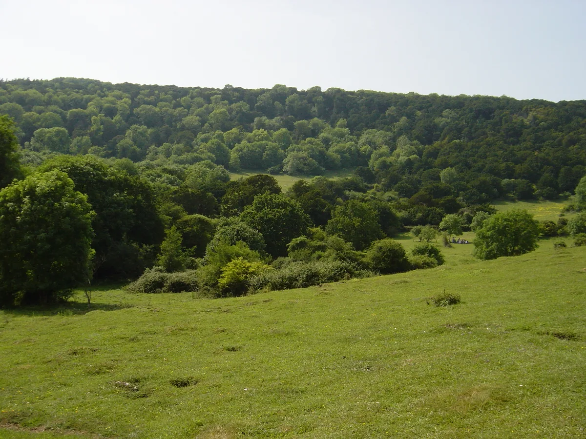
Bow Hill is an elongated hill ridge, 206 metres (676 ft) high, and running roughly from north to south in the South Downs, in the county of West Sussex, England. It has a prominence of 74 metres.
Excerpt from Wikipedia under CC BY-SA 4.0. See the source article linked in Sources below.
Background
Description
Bow Hill is the highest point on a north-to-south running and steep-sided ridge and there is a trig point at the top. Its crest and upper slopes are densely wooded, but the lower slopes are open downland. Various tracks and bridleways run pass close to the summit and there is a ridgeway that divides just northeast of the summit heading to Stoughton in one direction and West Stoke in the other.
Sourced from Wikipedia under CC BY-SA 4.0.
- Coordinates
- 50.8964, -0.8284
- County
- West Sussex
- District
- Chichester
- Parish
- West Dean
- Postcode
- PO18 9HR
- Parliamentary constituency
- Chichester
- Nearest railway station
- Bosham — 6.1 km
Sources
- osm: n29277982 (ODbL)
- wikipedia: Bow Hill, West Sussex (CC BY-SA 4.0)
- commons: The Devil's Humps barrows on Bow Hill - geograph.org.uk - 763644.jpg (CC BY-SA 4.0)
Other places nearby
Loading nearby places…
Nearby
 📷 5
📷 5Follies · South East England
Roman temple at Bow Hill
Roman temple at Bow Hill — a temple folly in england-south-east, United Kingdom.
 📷 5
📷 5Archaeological sites · South East England
Devil’s Humps
Devil’s Humps — a archaeological in england-south-east, United Kingdom.
 📷 5
📷 5Forests & woodlands · South East England
Kingley Vale National Nature Reserve
Kingley Vale National Nature Reserve is a forest or woodland in the United Kingdom.
 📷 5
📷 5Natural landmarks · South East England
Grandfather Yew Tree
Grandfather Yew Tree — a other in england-south-east, United Kingdom.
 📷 5
📷 5Wildlife reserves · South East England
Kingley Vale National Nature Reserve
Kingley Vale National Nature Reserve — nature reserve in the United Kingdom.
 📷 5
📷 5Hill forts · South East England
Goosehill Camp
Goosehill Camp — hillfort in West Sussex, England, UK.
More mountains in this region
 📷 5
📷 5Mountains & hills · South East England
Alum Bay
Alum Bay is a mountain or hill in the United Kingdom.
 📷 5
📷 5Mountains & hills · South East England
Arish Mell
Arish Mell — bay in Dorset, England.
 📷 5
📷 5Mountains & hills · South East England
Balaclava Bay
Balaclava Bay — bay in Dorset, England.
 📷 5
📷 5Mountains & hills · South East England
Balch Cave
Balch Cave — Cave in Somerset, England.
Frequently asked questions
- Where is Bow Hill?
- Bow Hill is in West Sussex, South-East England, United Kingdom (postcode PO18 9HR), in the parish of West Dean.
- Is Bow Hill a protected site?
- Yes — Bow Hill is part of the Kingley Vale SSSI Site of Special Scientific Interest and the KINGLEY VALE National Nature Reserve.
- Is Bow Hill free to visit?
- Yes, Bow Hill is free to enter.
- How do I get to Bow Hill?
- The nearest railway station is Bosham, about 6.1 km away. Drivers can navigate to postcode PO18 9HR.