Mountains & hills · North West England
Blackstone Edge
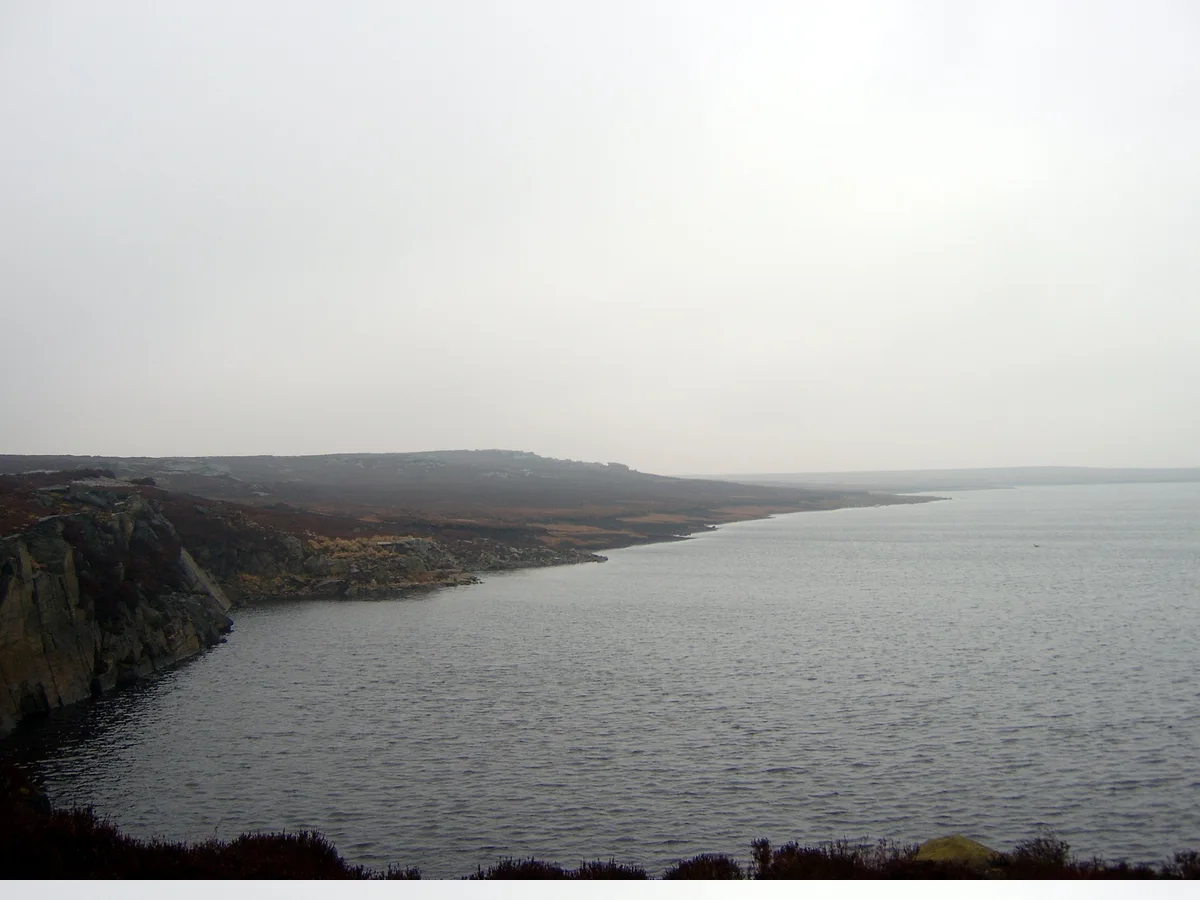
Blackstone Edge — Named summit at 473 m.

Wikimedia Commons contributors — see linked file page for photographer and licence licence
Plan your visit
- Typical visit
- 3 h–8 h
- Best time of year
- Late spring – early autumn (May–Oct)
- Nearest railway station
- Littleborough · 3.4 km
- Free entry
- Dog-friendly
About
Blackstone Edge is a named summit in the United Kingdom. Wikidata describes it as: "Named summit at 473 m.". Coordinates: 53.6438°, -2.0437°.
Photo gallery
Protected designations
- Site of Special Scientific Interest: South Pennine Moors SSSI
Designations sourced from Natural England open data under OGL v3.
From the Wikipedia article
Blackstone Edge ( BLAK-stən) is a gritstone escarpment at 472 metres (1,549 ft) above sea level in the Pennine hills surrounded by moorland on the boundary between Greater Manchester and West Yorkshire in England.
Excerpt from Wikipedia under CC BY-SA 4.0. See the source article linked in Sources below.
Background
History
Crossing the escarpment is Blackstone Edge Long Causeway, also known as Blackstone Edge Roman Road, a partially paved road on the Greater Manchester side, becoming a holloway through peat as it runs into Yorkshire. The Blackstone Edge Long Causeway was originally thought to be of Roman origin until investigations by James Maxim, who proposed the theory that it was actually a 1735 turnpike or packhorse route. This theory was widely accepted until 2012 when investigations by Archaeological Services WYAS led them to conclude that "The archaeological surface evidence...suggests that the route of the road is unlikely to have originated as part of a turnpike scheme as probable medieval and…
Sourced from Wikipedia under CC BY-SA 4.0.
- Coordinates
- 53.6438, -2.0437
- District
- Rochdale
- Parish
- Rochdale, unparished area
- Postcode
- OL15 0LG
- Parliamentary constituency
- Rochdale
- Nearest railway station
- Littleborough — 3.4 km
Sources
- osm: n29884402 (ODbL)
- wikipedia: Blackstone Edge (CC BY-SA 4.0)
- commons: Blackstone Edge - geograph.org.uk - 468.jpg (CC BY-SA 4.0)
Other places nearby
Loading nearby places…
Nearby
 📷 5
📷 5Reservoirs & lochs · North West England
Blackstone Edge Reservoir
Blackstone Edge Reservoir — reservoir in Greater Manchester, England, UK.
 📷 3
📷 3Natural landmarks · North West England
Windy Hill
Windy Hill — mountain in United Kingdom.
 📷 3
📷 3Archaeological sites · North West England
Cat Stones
Cat Stones — a archaeological in england-north-west, United Kingdom.
 📷 3
📷 3Historic bridges · North West England
Rochdale Canal Lock No. 45 And Pikehouse Bridge
Rochdale Canal Lock No. 45 And Pikehouse Bridge — Grade II listed building-listed bridge in england-north-west, United Kingdom.
 📷 3
📷 3Historic houses · North West England
Windy Bank
Windy Bank — house in Littleborough, Rochdale, Greater Manchester, England, UK.
 📷 3
📷 3Historic bridges · North West England
Rochdale Canal Benthouse Bridge
Rochdale Canal Benthouse Bridge — Grade II listed building-listed bridge in england-north-west, United Kingdom.
More mountains in this region
 📷 3
📷 3Mountains & hills · North West England
Allen Crags
Allen Crags — Named summit at 785 m.
 📷 3
📷 3Mountains & hills · North West England
Alum Pot
Alum Pot — Open shaft pothole in North Yorkshire.
 📷 3
📷 3Mountains & hills · North West England
Arnside Knott
Arnside Knott — Named summit at 159 m.
 📷 3
📷 3Mountains & hills · North West England
Aye Gill Pike
Aye Gill Pike — Named summit at 556.3 m.
Frequently asked questions
- Where is Blackstone Edge?
- Blackstone Edge is in North-West England, United Kingdom (postcode OL15 0LG), in the parish of Rochdale, unparished area.
- Is Blackstone Edge a protected site?
- Yes — Blackstone Edge is part of the South Pennine Moors SSSI Site of Special Scientific Interest.
- Is Blackstone Edge free to visit?
- Yes, Blackstone Edge is free to enter.
- How do I get to Blackstone Edge?
- The nearest railway station is Littleborough, about 3.4 km away. Drivers can navigate to postcode OL15 0LG.