Mountains & hills · Central Scotland
Blackhope Scar
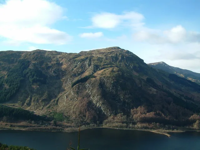
Blackhope Scar — Named summit at 651 m.

Wikimedia Commons contributors — see linked file page for photographer and licence licence
Plan your visit
- Typical visit
- 3 h–8 h
- Best time of year
- Late spring – early autumn (May–Oct)
- Free entry
- Dog-friendly
About
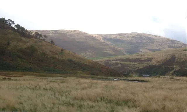
Blackhope Scar is a named summit in the United Kingdom. Wikidata describes it as: "Named summit at 651 m.". Coordinates: 55.7236°, -3.0917°.
Photo gallery
From the Wikipedia article
Blackhope Scar is a hill in the Moorfoot Hills range, part of the Southern Uplands of Scotland. It lies to the northeast of the town of Peebles and is the second highest of the Moorfoot Hills after Windlestraw Law. A rough, boggy moorland hill, it is usually climbed from the Gladhouse Reservoir and offers fine views from its summit.
Excerpt from Wikipedia under CC BY-SA 4.0. See the source article linked in Sources below.
- Coordinates
- 55.7236, -3.0917
- Address
- Scottish Borders, Midlothian, Scotland
- Official site
- www.hill-bagging.co.uk
Sources
- osm: n1364897870 (ODbL)
- wikipedia: Blackhope Scar (CC BY-SA 4.0)
- commons: BlackhopeScar.jpg (CC BY-SA 4.0)
Other places nearby
Loading nearby places…
Nearby
 📷 3
📷 3Castles · Central Scotland
Hirendean Castle
Hirendean Castle — a castle in scotland-central, United Kingdom.
 📷 3
📷 3Historic houses · Central Scotland
Woodlandslee Tower
Woodlandslee Tower — a historic house in scotland-central, United Kingdom.
 📷 3
📷 3Natural landmarks · Central Scotland
Peatrig Hill
Peatrig Hill — mountain in Scottish Borders, Scotland, UK.
 📷 2
📷 2Mountains & hills · Central Scotland
Peatrig Hill
Peatrig Hill — Named summit at 454 m.
 📷 3
📷 3Mountains & hills · Central Scotland
Makeness Kipps
Makeness Kipps — a mountain in scotland-central, United Kingdom.
 📷 5
📷 5Reservoirs & lochs · Central Scotland
Gladhouse Reservoir
Gladhouse Reservoir — reservoir in Midlothian, Scotland, UK, on the River South Esk.
More mountains in this region
 📷 3
📷 3Mountains & hills · Central Scotland
Abbey Hill
Abbey Hill — Named summit at 278 m.
 📷 3
📷 3Mountains & hills · Central Scotland
Aberlady Bay
Aberlady Bay — bay on the north coast of East Lothian, Scotland, UK.
 📷 3
📷 3Mountains & hills · Central Scotland
Allermuir Hill
Allermuir Hill — Named summit at 493 m.
 📷 3
📷 3Mountains & hills · Central Scotland
Ardnandave
Ardnandave — Named summit at 715 m.
Frequently asked questions
- Where is Blackhope Scar?
- Blackhope Scar is in Central Scotland, in the United Kingdom — coordinates 55.7236°, -3.0917°.
- Is Blackhope Scar free to visit?
- Yes — admission to Blackhope Scar is free.