Mountains & hills · Yorkshire & the Humber
Black Hill
Also known as: Soldiers' Lump
Black Hill — Named summit at 582 m.

Wikimedia Commons contributors — see linked file page for photographer and licence licence
.jpg)
Plan your visit
- Typical visit
- 3 h–8 h
- Best time of year
- Late spring – early autumn (May–Oct)
- Nearest railway station
- Marsden · 7.8 km
- Free entry
- Dog-friendly
About
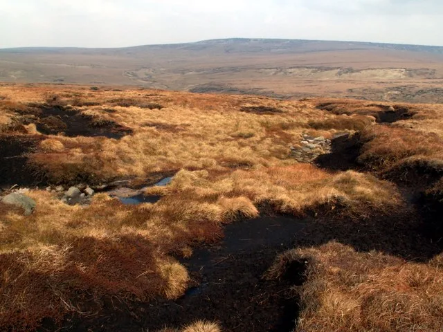
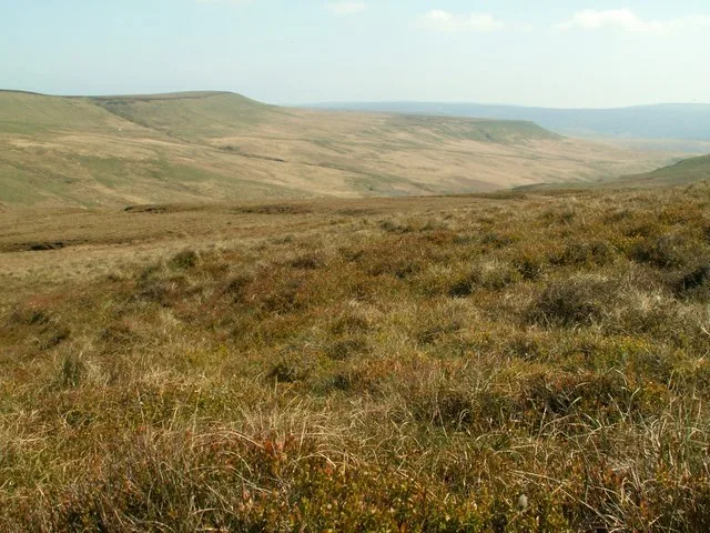
Black Hill is a named summit in the United Kingdom. Also known as: Soldiers' Lump. Wikidata describes it as: "Named summit at 582 m.". Coordinates: 53.5388°, -1.8835°.
Photo gallery
Protected designations
- Site of Special Scientific Interest: Dark Peak SSSI
Designations sourced from Natural England open data under OGL v3.
From the Wikipedia article
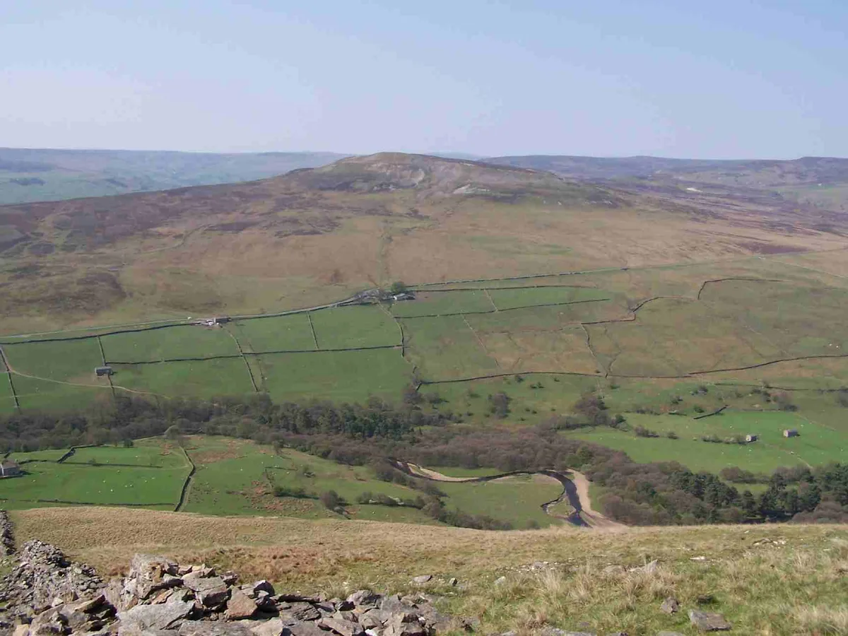
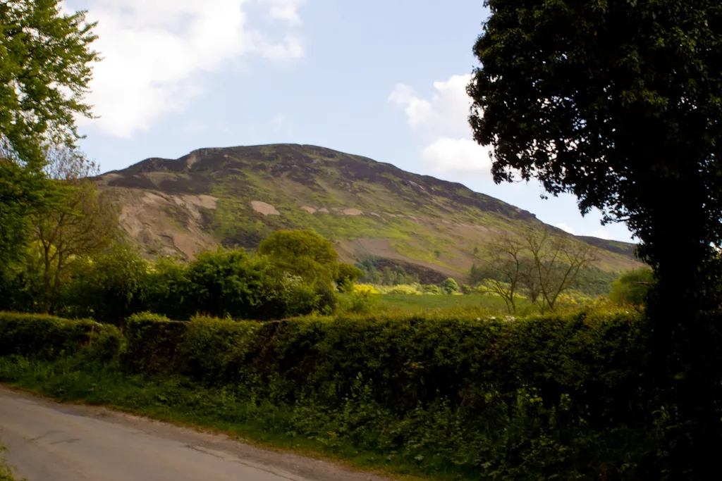
Black Hill, in the Peak District, is the highest hill in West Yorkshire, England. Its summit rises to an elevation of 582 m (1,909 ft) above sea level. It is surpassed in height by only two other major summits in the Peak District (Kinder Scout and Bleaklow). Black Hill is a typical Pennine moorland mountain, with a very flat and extensive plateau (but steeper sides). The top is peaty, poorly drained, and thus very boggy after rain. The area surrounding the summit itself had virtually no vegetation and was very dark, giving the hill an appropriate name. However, recent restoration work has eliminated much of the exposed peat. Black Hill is crossed by the Pennine Way whose now-paved surface allows walkers to reach the top dry-shod even in the wettest of weather. Black Hill was the highest point (county top) of the historic county of Cheshire, lying at the tip of what was once known as the Cheshire Panhandle, a long projection of the county which lay to the north of the reservoir filled valley of Longdendale. Under the local government reforms which were enacted in 1974, Black Hill was placed for administrative purposes on the border between the boroughs of Kirklees in West Yorkshire and High Peak in Derbyshire. It is also the highest point within a metropolitan county in the United Kingdom.
Excerpt from Wikipedia under CC BY-SA 4.0. See the source article linked in Sources below.
- Coordinates
- 53.5388, -1.8835
- Address
- Chichester |publisher= Summersdale |isbn= 978-1-84-953239-6 |pages= 208–217}}</ref>
- Nearest railway station
- Marsden — 7.8 km
Sources
- osm: n266946605 (ODbL)
- wikipedia: Black Hill (Peak District) (CC BY-SA 4.0)
- commons: Black Hill (Peak District).jpg (CC BY-SA 4.0)
Other places nearby
Loading nearby places…
Nearby
 📷 3
📷 3Public art & sculpture · Yorkshire & the Humber
Framing The Landscape
Framing The Landscape — a public art in england-yorkshire, United Kingdom.
 📷 3
📷 3Mountains & hills · Yorkshire & the Humber
Black Chew Head
Black Chew Head — Named summit at 542 m.
 📷 3
📷 3Mountains & hills · Yorkshire & the Humber
Britland Edge Hill
Britland Edge Hill — Named summit at 523 m.
 📷 3
📷 3Natural landmarks · Yorkshire & the Humber
Black Chew Head
Black Chew Head — Hill in the United Kingdom.
 📷 3
📷 3Historic houses · Yorkshire & the Humber
Rimmon Cottage
Rimmon Cottage — a historic house in england-yorkshire, United Kingdom.
 📷 3
📷 3Reservoirs & lochs · Yorkshire & the Humber
Digley Reservoir
Digley Reservoir — reservoir in West Yorkshire, England, UK.
More mountains in this region
📷 3Mountains & hills · Yorkshire & the Humber
Black Chew Head
Black Chew Head — Named summit at 542 m.
📷 3Mountains & hills · Yorkshire & the Humber
Britland Edge Hill
Britland Edge Hill — Named summit at 523 m.
 📷 3
📷 3Mountains & hills · Yorkshire & the Humber
Calver Hill
Calver Hill — Named summit at 493 m.
 📷 5
📷 5Mountains & hills · Yorkshire & the Humber
Carlton Bank
Carlton Bank — Named summit at 408 m.
Frequently asked questions
- Where is Black Hill?
- Black Hill is in Yorkshire, United Kingdom.
- Is Black Hill a protected site?
- Yes — Black Hill is part of the Dark Peak SSSI Site of Special Scientific Interest.
- Is Black Hill free to visit?
- Yes, Black Hill is free to enter.
- How do I get to Black Hill?
- The nearest railway station is Marsden, about 7.8 km away.