Mountains & hills · Scottish Highlands
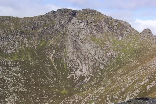
Beinn Tarsuinn
Beinn Tarsuinn — Named summit at 826 m.

Wikimedia Commons contributors — see linked file page for photographer and licence licence
Plan your visit
- Typical visit
- 3 h–8 h
- Best time of year
- Late spring – early autumn (May–Oct)
- Free entry
- Dog-friendly
About
Beinn Tarsuinn is a named summit in the United Kingdom. Wikidata describes it as: "Named summit at 826 m.". Coordinates: 55.6222°, -5.2413°.
Photo gallery
From the Wikipedia article
Beinn Tarsuinn is a mountain on the Isle of Arran, Scotland. It is the southernmost of the four Corbetts on the island, lying between Glen Rosa to the east and Glen Iorsa to the west. Beinn Tarsuinn is often climbed in conjunction with the neighbouring peak of Cìr Mhòr, to which it is linked by a rocky ridge forming the subsidiary top of A' Chìr. The crossing of A' Chìr involves scrambling, however the two peaks can be linked without crossing A' Chìr by means of a path that traverse the ridge's western side. The simplest and shortest route up Beinn Tarsuinn is via one of the two ridges on either side of the Coire a' Bhradain; both ridges drop down into Glen Rosa, the usual access for most walkers to this group of hills.
Excerpt from Wikipedia under CC BY-SA 4.0. See the source article linked in Sources below.
- Coordinates
- 55.6222, -5.2413
- Address
- Isle of Arran, North Ayrshire, Scotland
Sources
- osm: n300806330 (ODbL)
- wikipedia: Beinn Tarsuinn (Corbett) (CC BY-SA 4.0)
- commons: Beinn Tarsuinn.jpg (CC BY-SA 4.0)
Other places nearby
Loading nearby places…
Nearby
 📷 3
📷 3Natural landmarks · Scottish Highlands
Beinn Tarsuinn
Beinn Tarsuinn — mountain in North Ayrshire, Scotland, UK.
 📷 3
📷 3Mountains & hills · Scottish Highlands
A'Chir
A'Chir — a mountain in scotland-highlands, United Kingdom.
 📷 3
📷 3Mountains & hills · Scottish Highlands
Beinn a' Chliabhain
Beinn a' Chliabhain — a mountain in scotland-highlands, United Kingdom.
 📷 3
📷 3Mountains & hills · Scottish Highlands
Beinn Nuis
Beinn Nuis — a mountain in scotland-highlands, United Kingdom.
 📷 3
📷 3Mountains & hills · Scottish Highlands
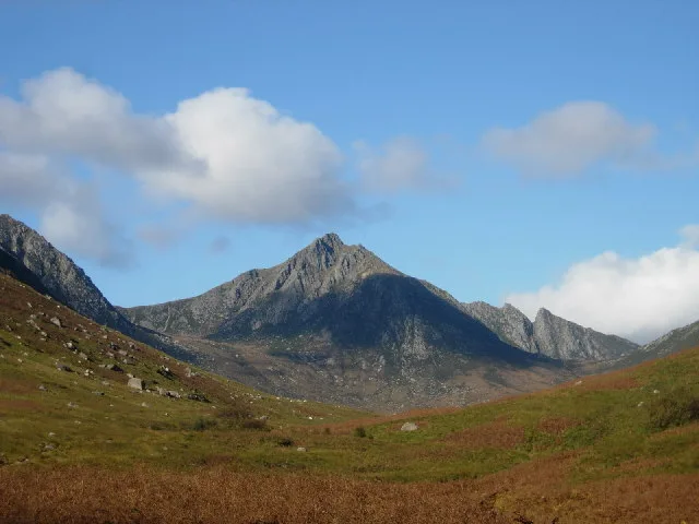
Cìr Mhòr
Cìr Mhòr — Named summit at 799 m.
 📷 3
📷 3Natural landmarks · Scottish Highlands
Cìr Mhòr
Cìr Mhòr — mountain in North Ayrshire, Scotland, UK.
More mountains in this region
 📷 3
📷 3Mountains & hills · Scottish Highlands
A' Bhuidheanach Bheag
A' Bhuidheanach Bheag — Named summit at 936 m.
 📷 3
📷 3Mountains & hills · Scottish Highlands
A' Chailleach
A' Chailleach — Named summit at 997 m.
 📷 3
📷 3Mountains & hills · Scottish Highlands
A' Chailleach
A' Chailleach — Named summit at 930 m.
 📷 3
📷 3Mountains & hills · Scottish Highlands
A' Chaoirnich
A' Chaoirnich — Named summit at 875 m.
Frequently asked questions
- Where is Beinn Tarsuinn?
- Beinn Tarsuinn is in Scottish Highlands, in the United Kingdom — coordinates 55.6222°, -5.2413°.
- Is Beinn Tarsuinn free to visit?
- Yes — admission to Beinn Tarsuinn is free.