Mountains & hills · Scottish Highlands
Beinn Talaidh
Beinn Talaidh — Named summit at 761 m.

Wikimedia Commons contributors — see linked file page for photographer and licence licence
Plan your visit
- Typical visit
- 3 h–8 h
- Best time of year
- Late spring – early autumn (May–Oct)
- Free entry
- Dog-friendly
About
Beinn Talaidh is a named summit in the United Kingdom. Wikidata describes it as: "Named summit at 761 m.". Coordinates: 56.4443°, -5.8554°.
Photo gallery
From the Wikipedia article
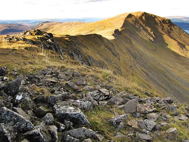
Beinn Talaidh (762 m) is a peak on the Isle of Mull, Scotland, located in the mountainous centre of the Island. The mountain is shaped like a symmetrical cone and can be climbed from the steep facing south side, or more gentle northern side along Glen Forsa. Beinn Talaidh was for many years classed as a Corbett before a resurvey found it to be slightly lower than expected, and it was thus demoted to Graham status; however it is the highest of the 219 Grahams in Scotland.
Excerpt from Wikipedia under CC BY-SA 4.0. See the source article linked in Sources below.
- Coordinates
- 56.4443, -5.8554
- Address
- Isle of Mull, Scotland
- Official site
- www.hill-bagging.co.uk
Sources
- osm: n1745289652 (ODbL)
- wikipedia: Beinn Talaidh (CC BY-SA 4.0)
- commons: Glen Forsa - geograph.org.uk - 1362516.jpg (CC BY-SA 4.0)
Other places nearby
Loading nearby places…
Nearby
 📷 5
📷 5Islands · Scottish Islands
Torosay
Torosay in Scotland Islands, United Kingdom.
 📷 3
📷 3Memorials & monuments · Scottish Highlands
Dakota Mark IV KK194 Crash Memorial
Dakota Mark IV KK194 Crash Memorial — a memorial in scotland-highlands, United Kingdom.
 📷 3
📷 3Mountains & hills · Scottish Highlands
Beinn Thunicaraidh
Beinn Thunicaraidh — a mountain in scotland-highlands, United Kingdom.
 📷 2
📷 2Mountains & hills · Scottish Highlands
Beinn Mheadhon
Beinn Mheadhon — a mountain in scotland-highlands, United Kingdom.
 📷 3
📷 3Natural landmarks · Scottish Highlands
Dùn da Ghaoithe
Dùn da Ghaoithe — 766m high mountain in Argyll and Bute, Scotland, UK.
 📷 3
📷 3Mountains & hills · Scottish Highlands
Dùn da Ghaoithe
Dùn da Ghaoithe — Named summit at 766 m.
More mountains in this region
 📷 3
📷 3Mountains & hills · Scottish Highlands
A' Bhuidheanach Bheag
A' Bhuidheanach Bheag — Named summit at 936 m.
 📷 3
📷 3Mountains & hills · Scottish Highlands
A' Chailleach
A' Chailleach — Named summit at 997 m.
 📷 3
📷 3Mountains & hills · Scottish Highlands
A' Chailleach
A' Chailleach — Named summit at 930 m.
 📷 3
📷 3Mountains & hills · Scottish Highlands
A' Chaoirnich
A' Chaoirnich — Named summit at 875 m.
Frequently asked questions
- Where is Beinn Talaidh?
- Beinn Talaidh is in Scottish Highlands, in the United Kingdom — coordinates 56.4443°, -5.8554°.
- Is Beinn Talaidh free to visit?
- Yes — admission to Beinn Talaidh is free.